Near Williamsburg in James City County, Virginia — The American South (Mid-Atlantic)
Barracks
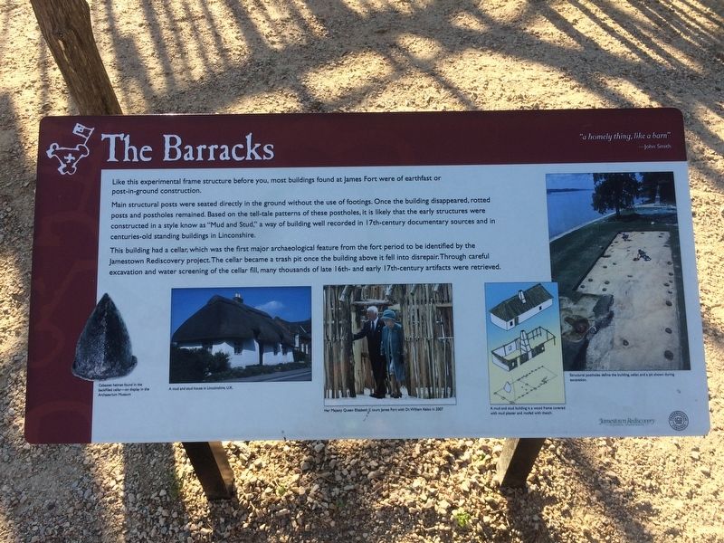
"a homely thing, like a barn" - John Smith
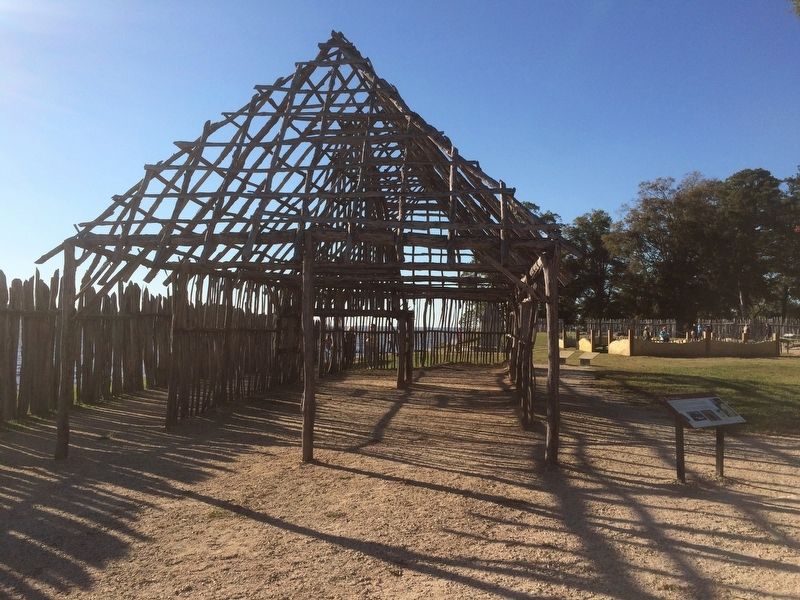
Like this experimental frame structure before you, most buildings found at James Fort were of earthfast or post-in-ground construction.
Main structural posts were seated directly in the ground without the use of footings. Once the building disappeared, rotted posts and postholes remained. Based on the tell-tale patterns of these postholes, it is likely that the early structures were constructed in a style know as “Mud and Stud,” a way of building well recorded in 17th-century documentary sources and in centuries-old standing buildings in Lincolnshire.
This building had a cellar, which was the first major archaeological feature from the fort period to be identified by the Jamestown Rediscovery project. The cellar became a trash pit once the building above it fell into disrepair. Through careful excavation and water screening of the cellar fill, many thousands of late 16th- and early 17th-century artifacts were retrieved.
Captions:
Cabasset helmet found in the backfilled cellar – on display in the Archaearium Museum.
A mud and stud house in Lincolnshire, U.K.
A mud and stud building is a wood frame covered with mud plaster and roofed with thatch.
Structural postholes define the building, cellar, and a pit shown during excavation.
Erected by Jamestown Rediscovery Project.
Topics. This historical marker is listed in these topic lists: Colonial Era • Settlements & Settlers.
Location. 37° 12.491′ N, 76° 46.7′ W. Marker is near Williamsburg, Virginia, in James City County. Marker can be reached from Colonial Parkway. The marker is at the Jamestown National Historic Site, just north of the reconstructed frame of the barracks at the Jamestown Fort. Touch for map. Marker is in this post office area: Jamestown VA 23081, United States of America. Touch for directions.
Other nearby markers. At least 8 other markers are within walking distance of this marker. The First General Assembly of Virginia (here, next to this marker); a different marker also named The Barracks (here, next to this marker); East Bulwark (a few steps from this marker); The Tombs of James and Sarah Blair (within shouting distance of this marker); Church Tower (within shouting distance of this marker); The Tombstones (within shouting distance of this marker); Palisades (within shouting distance of this marker); 1608 Church (within shouting distance of this marker). Touch for a list and map of all markers in Williamsburg.
Credits. This page was last revised on November 30, 2016. It was originally submitted on November 30, 2016, by J. Makali Bruton of Accra, Ghana. This page has been viewed 453 times since then and 16 times this year. Photos: 1, 2. submitted on November 30, 2016, by J. Makali Bruton of Accra, Ghana.

