Near Livingston in Polk County, Texas — The American South (West South Central)
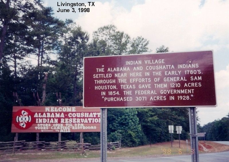
Indian Village
Topics. This historical marker is listed in this topic list: Native Americans. A significant historical year for this entry is 1780.
Location. 30° 43.176′ N, 94° 40.214′ W. Marker is near Livingston, Texas, in Polk County. Marker is at the intersection of U.S. 190 and State Park Road 56, on the left when traveling west on U.S. 190. Touch for map. Marker is in this post office area: Livingston TX 77351, United States of America. Touch for directions.
Other nearby markers. At least 8 other markers are within 17 miles of this marker, measured as the crow flies. Village of the Alabama and Coushatti Indians (a few steps from this marker); Confederate Service of Alabama and Coushatta Indians (approx. 0.4 miles away); Midway Cemetery (approx. 2.4 miles away); Whitehead Home (approx. 12.6 miles away); E.C. Matthews Home (approx. 16.6 miles away); Moscow Male and Female Academy (approx. 16.6 miles away); Texas Statesman William Pettus Hobby (approx. 16.6 miles away); Moscow (approx. 16.7 miles away). Touch for a list and map of all markers in Livingston.
Credits. This page was last revised on December 9, 2016. It was originally submitted on July 5, 2016, by Don Morfe of Baltimore, Maryland. This page has been viewed 804 times since then and 52 times this year. Last updated on December 8, 2016, by Jim Evans of Houston, Texas. Photos: 1, 2. submitted on July 5, 2016, by Don Morfe of Baltimore, Maryland. • Bernard Fisher was the editor who published this page.

