Santiago de Querétaro in Querétaro, Mexico — The Central Highlands (North America)
Temple and former Convent of San Antonio
Inscription.
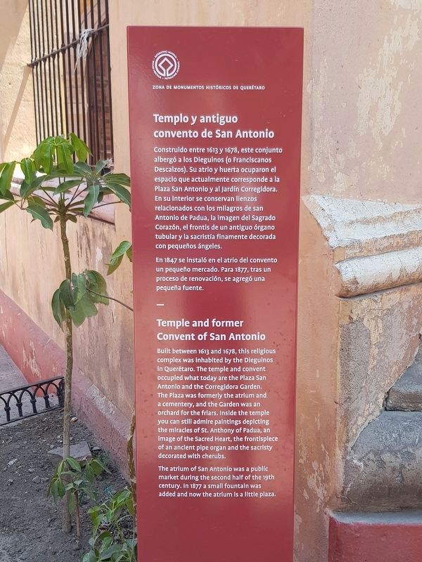
Templo y antiguo convent de San Antonio
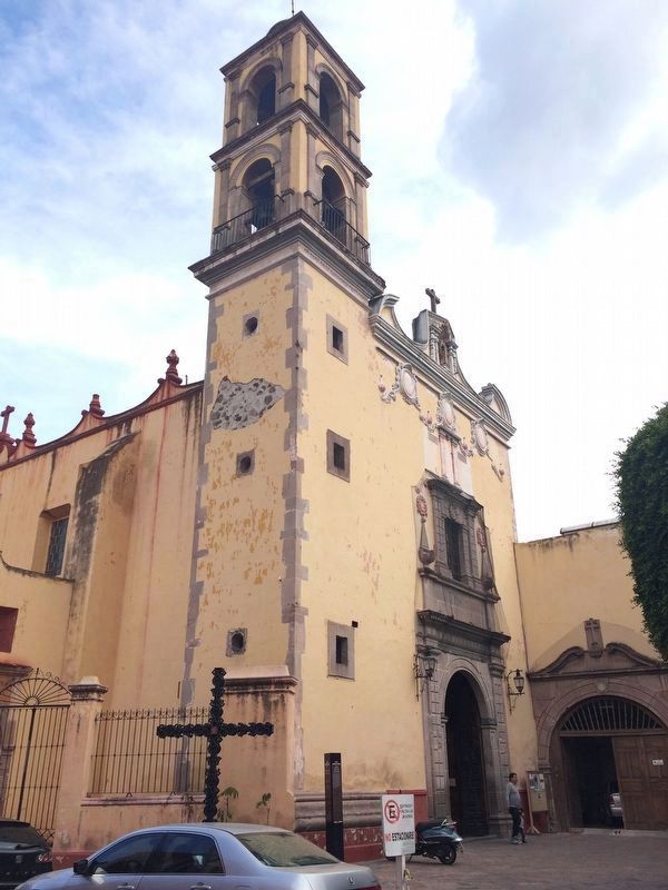
Construido entre 1613 y 1678, este conjunto albergó a los Dieguinos (o Franciscanos Descalzos). Su atrio y huerta ocuparon el espacio que actualmente corresponde a la Plaza San Antonio y al Jardín Corregidora. En su interior se conservan lienzos relacionados con los milagros de san Antonio de Padua, la imagen del Sagrado Corazón, el frontis de un antiguo órgano tubular y la sacristía finamente decorada con pequeños ángeles.
En 1847 se instaló en el atrio del convento un pequeño mercado. Para 1877, tras un proceso de renovación, se agregó una pequeña fuente.
Temple and former Convent of San Antonio
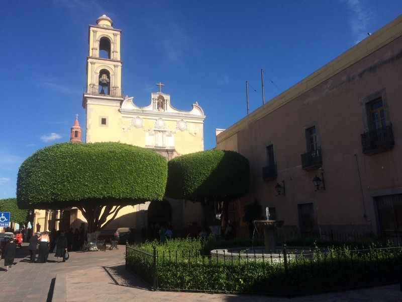
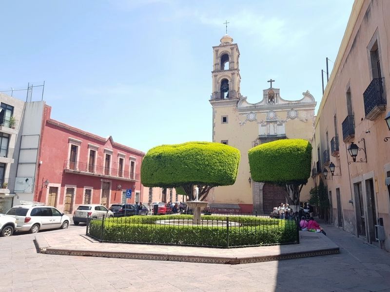
Built between 1613 and 1678, this religious complex was inhabited by the Dieguinos in Querétaro. The temple and convent occupied what today are the Plaza San Antonio and the Corregidora Garden. The Plaza was formerly the atrium and a cementery, and the Garden was an orchard for the friars. Inside the temple you can still admire paintings depicting the miracles of St. Anthony of Padua, an image of the Sacred Heart, the frontispiece of an ancient pipe organ and the sacristy decorated with cherubs.
The atrium of San Antonio was a public market during the second half of the 19th century. In 1877 a small fountain was added and now the atrium is a little plaza.
Erected 2018 by Municipalidad de Querétaro.
Topics. This historical marker is listed in these topic lists: Churches & Religion • Colonial Era • Man-Made Features. A significant historical year for this entry is 1613.
Location. 20° 35.677′ N, 100° 23.507′ W. Marker is in Santiago de Querétaro, Querétaro. Marker is on Calle Angela Peralta just east of Calle Corregidora, on the right when traveling east. Touch for map. Marker is in this post office area: Santiago de Querétaro QUE 76000, Mexico. Touch for directions.
Other nearby markers. At least 8 other markers are within walking distance of this marker. Monument to Josefa Ortiz de Domínguez (within shouting distance of this marker); House of Mariano Lara (about 90 meters away, measured in a direct line); Teatro de la República (about 120 meters away); Cantina "El Puerto de Mazatlán" (about 150 meters away); Church and Former Convent of San Francisco (about 180 meters away); Residence of Epigmenio and Emeterio González (about 180 meters away); Temple of the Congregation (about 180 meters away); Temple and Convent of Our Lady of Mount Carmel (about 180 meters away). Touch for a list and map of all markers in Santiago de Querétaro.
Photographed By J. Makali Bruton, December 10, 2016
2. The previous Temple and Convent of San Antonio Marker
This previous marker was replaced in 2018. Its text read:
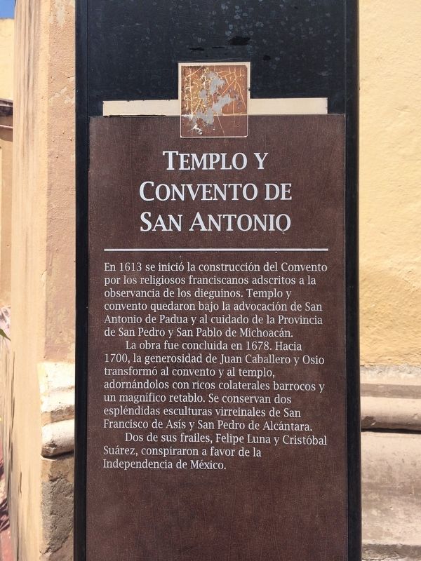
Templo y Convento de San Antonio En 1613 se inició la construcción del Convento por los religiosos franciscanos adscritos a la observancia de los dieguinos. Templo y convento quedaron bajo la advocación de San Antonio de Padua y al cuidado de la Provincia de San Pedro y San Pablo de Michoacán.
La obra fue concluida en 1678. Hacia 1700, la generosidad de Juan Caballero y Osio transformó al convento y al templo, adornándolos con ricos colaterales barrocos y un magnífico retablo. Se conservan dos espléndidas esculturas virreinales de San Francisco de Asís y San Pedro de Alcántara.
Dos de sus frailes, Felipe Luna y Cristóbal Suárez, conspiraron a favor de la Independencia de México.
More about this marker. The marker was replaced in 2018 with updated text but in the same location as a marker with the same name. The marker also mentions that the area is part of the Zone of Historical Monuments of Querétaro (Zona de Monumentos Históricos de Querétaro) as part of its designation as a UNESCO World Heritage Site.
Photographed By J. Makali Bruton, December 10, 2016
3. The previous Temple and Convent of San Antonio Marker
This previous marker was replaced in 2018. Its English text read:
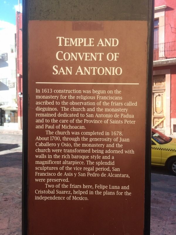
Temple and Convent of San Antonio In 1613 construction was begun on the monastery for the religious Franciscans ascribed to the observation of the friars called dieguinos. The church and the monastery remained dedicated to San Antonio de Padua and to the care of the Province of Saints Peter and Paula of Michoacan.
The church was completed in 1678. About 1700, through the generosity of Juan Caballero y Osio, the monastery and the church were transformed being adorned with walls in the rich baroque style and a magnificent altarpiece. The splendid sculptures of the vice regal period, San Francisco de Asis y San Pedro de Alcantara, were preserved.
Two of the friars here, Felipe Luna and Cristobal Suarez, helped in the plans for the Independence of Mexico.
Credits. This page was last revised on May 8, 2018. It was originally submitted on January 6, 2017, by J. Makali Bruton of Accra, Ghana. This page has been viewed 324 times since then and 9 times this year. Photos: 1. submitted on May 8, 2018, by J. Makali Bruton of Accra, Ghana. 2, 3, 4. submitted on January 6, 2017, by J. Makali Bruton of Accra, Ghana. 5. submitted on July 15, 2017, by J. Makali Bruton of Accra, Ghana. 6. submitted on May 8, 2018, by J. Makali Bruton of Accra, Ghana.
