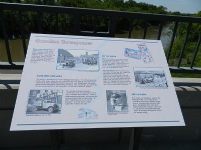
Gasoline Horsepower
When autos appeared in the 1890s, only the wealthy could afford to buy them. But by the 1920s assembly lines made cars affordable for the middle class, and sales soared. At the end of the decade there were 25 million cars on the road and U.S. factories were building 5.3 million new cars each year.
Sweeping Changes
The American workplace was transformed by gasoline engines. By 1920 motorized fire trucks, snow plows, police cars and construction rigs were replacing their horse-drawn counterparts. Fargo-Moorhead and other commercial hubs shipped goods with greater speed and flexibility as long-haul trucking developed. Each year brought innovations like the rear-view mirror (1911), the forklift truck (1918) and air-filled tires (1922).
The everyday landscape changed to accommodate cars. Garages replaced horse barns and traffic lights appeared. "Drive-in" banks and shopping centers with parking lots drew customers away from downtown. In 1937 Fargo-Moorhead lost its electric streetcars - an urban transit system superseded by buses and cars.
On The Move
Americans loved their new mobility and took to the roads with enthusiasm. Gas stations, "drive-ins" and motor hotels - later shortened to "motels" - sprang up across the country. Meanwhile, railroad ridership decreased as travelers chose the freedom of cars
Most early highways were rough dirt tracks more suited to horse than cars. Slogans like "Get Farmers Out of the Mud!" led a nationwide call for better roads. Around 1920, newly-created highway departments began the immense job of grading, graveling, bridging and paving thousands of miles of road. U.S. Highway 52, which crossed the Main Avenue bridge beginning in 1934, was one of the new generation of highways.
On The Farm
Rural people, not city dwellers, were the first Americans to buy cars in large numbers. Automobiles reduced rural isolation and gas-powered equipment made farm work much easier. Compared to other states North Dakota ranked high in cars per capital, with 87 percent of its farmers owning cars by 1930. Minnesota's numbers were smaller but growing rapidly.
Erected 2004 by MnDOT.
Topics. This historical marker is listed in these topic lists: Industry & Commerce • Roads & Vehicles. A significant historical year for this entry is 1920.
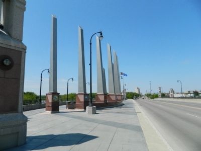
Location. 46° 52.421′ N, 96° 46.649′ W. Marker is in Fargo, North Dakota, in Cass County. It is in Downtown. Marker is on U.S. 10. Marker is on Veterans Memorial Bridge between Moorhead and Fargo. Touch for map. Marker is in this post office area: Fargo ND 58103, United States of America. Touch for directions.
Other nearby markers. At least 8 other markers are within walking distance of this marker. 'The Next Great City' (within shouting distance of this marker);
More about this marker. Marker was created by Gemini Research for MnDOT; erected when the bridge was built.
Credits. This page was last revised on February 16, 2023. It was originally submitted on June 27, 2011, by Bill Pfingsten of Bel Air, Maryland. This page has been viewed 930 times since then and 20 times this year. Last updated on January 14, 2017. Photos: 1, 2. submitted on June 27, 2011, by Bill Pfingsten of Bel Air, Maryland.

