Near Stephenson in Frederick County, Virginia — The American South (Mid-Atlantic)
Third Battle of Winchester
"One Moving Mass of Glittering Sabers"
— 1864 Valley Campaigns —
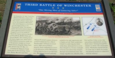
Crossing the Opequon Creek fords early in the morning, Union Gen. Wesley Merritt’s and Gen. William W. Averell’s cavalry divisions probed Confederate Gen. John C. Breckinridge’s defenses at several points. After several Federal assaults, Early readjusted his forces in the afternoon north of Winchester, folding back his line on an east-west axis. Merritt and Averell patiently waited for the right opportunity, and it finally arrived. Their cavalrymen, formed in a mile-long line three ranks deep, advanced first at a trot then charged in a furious onslaught of horses and sabers that smashed through the Confederate lines. The charge engulfed two redoubts, Star Fort and Fort Collier, as the tidal wave of blue rolled forward, sending Early’s force “whirling through Winchester” in retreat. One veteran later wrote, “Winchester was the first battle in the war in which the cavalry was properly handled in cooperations with the infantry.”
Erected by Virginia Civil War Commission.
Topics and series. This historical marker is listed in this topic list: War, US Civil. In addition, it is included in the Virginia Civil War Trails series list. A significant historical month for this entry is September 1863.
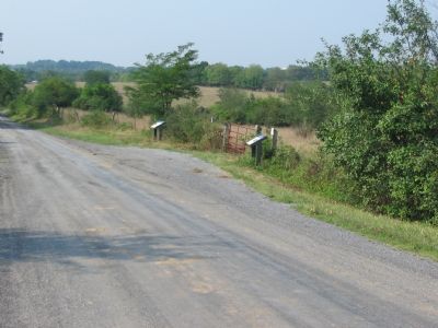
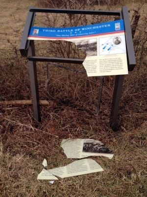
Location. Marker has been reported missing. It was located near 39° 13.802′ N, 78° 6.589′ W. Marker was near Stephenson, Virginia, in Frederick County. Marker was at the intersection of Milburn Road (County Route 662) and Old Charlestown Road (County Route 761), on the right when traveling south on Milburn Road. Touch for map. Marker was in this post office area: Stephenson VA 22656, United States of America. Touch for directions.
Other nearby markers. At least 8 other markers are within 2 miles of this location, measured as the crow flies. Stephenson Depot (within shouting distance of this marker); Roots Of Methodism In Frederick County Milburn Chapel (approx. 0.4 miles away); a different marker also named Roots Of Methodism In Frederick County Milburn Chapel (approx. 0.4 miles away); Action at Stephenson’s Depot (approx. 0.6 miles away); 1st Maryland Battery (CSA) Memorial (approx. 0.6 miles away); John Rutherford's Farm (approx. 1.3 miles away); Rutherford's Farm (approx. 1.3 miles away); Battle of Rutherford's Farm (approx. 1.3 miles away). Touch for a list and map of all markers in Stephenson.
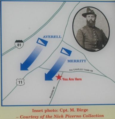
More about this marker. A painting of “U.S. Cavalry over-running an artillery redoubt near Fort Collier (Stine Field)” is on the upper center section of the marker. A map showing the location of the charge is on the right side, with a portrait of Captain M. Birge.
Also see . . .
1. Opequon or Third Winchester. National Park Service narrative of the battle. The action discussed on the marker is summarized as phase nine of this rather complex battle. (Submitted on September 7, 2007, by Craig Swain of Leesburg, Virginia.)
2. General Wesley Merritt. While somewhat overshadowed by the other big names, such as Sheridan and Custer, Merritt had a distinguished career in his own right, including service in the Civil War, Indian Wars, and eventually the Spanish-American War. (Submitted on September 7, 2007, by Craig Swain of Leesburg, Virginia.)
Photographed By Craig Swain, August 26, 2007
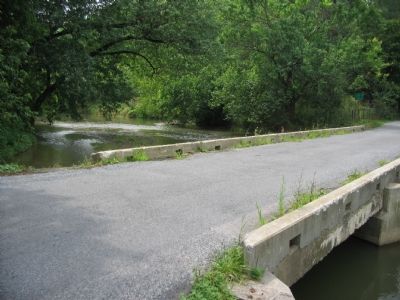
4. Cavalry Fords of the Opequon
Merritt's Division forded the Opequon where present day Old Charlestown Road (Route 761) crosses the creek. From this point, the Federals advanced down the road towards Stephenson. Their advance was countered by Confederate cavalry under Gen. John McCausland. Eventually Merritt's men formed on line near where Stephenson Road intersects the Martinsburg Pike (U.S. 11). (Close to the monument for the June 1863 Battle of Second Winchester.)
Credits. This page was last revised on January 22, 2017. It was originally submitted on September 7, 2007, by Craig Swain of Leesburg, Virginia. This page has been viewed 2,490 times since then and 26 times this year. Last updated on January 21, 2017, by Pete Skillman of Townsend, Delaware. Photos: 1, 2, 3, 4. submitted on September 7, 2007, by Craig Swain of Leesburg, Virginia. 5. submitted on January 18, 2015. • Bernard Fisher was the editor who published this page.
