Near Richmond in Chesterfield County, Virginia — The American South (Mid-Atlantic)
Falling Creek Stone Bridge
1826-1828
— Falling Creek Ironworks Park —
Old Stone Bridge History
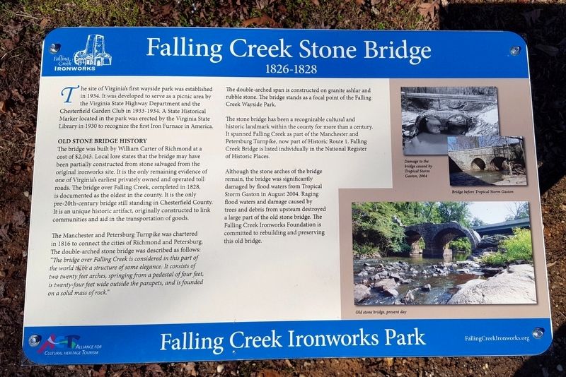
The bridge was built by William Carter of Richmond at a cost of $2,043. Local lore states that the bridge may have been partially constructed from stone salvaged from the original ironworks site. It is the only remaining evidence of one of Virginia’s earliest privately owned and operated toll roads. The bridge over Falling Creek, completed in 1828, is documented as the oldest in the county. It is the only pre-20th-century bridge still standing in Chesterfield County. It is an unique historic artifact, originally constructed to link communities and aid in the transportation of goods.
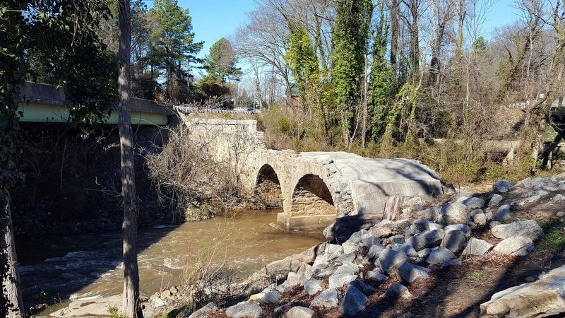
The Manchester and Petersburg Turnpike was chartered in 1816 to connect the cities of Richmond and Petersburg. The double-arched stone bridge was described as follows: The bridge over Falling Creek is considered in this part of the world to be a structure of some elegance. It consists of two twenty feet arches, springing from a pedestal of four feet, is twenty-four feet wide outside the parapets, and is founded on a solid mass of rock.
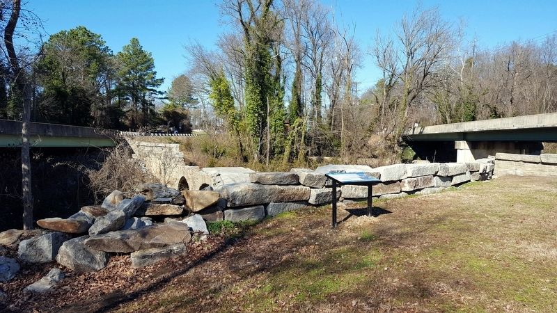
The double-arched span is constructed on granite ashlar and rubble stone. The bridge stands as a focal point of the Falling Creek Wayside Park.
The stone bridge has been a recognizable cultural and historic landmark within the county for more than a century. It spanned Falling Creek as part of the Manchester and Petersburg Turnpike, now part of Historic Route 1. Falling Creek Bridge is listed individually in the National Register of Historic Places.
Although the stone arches of the bridge remain, the bridge was significantly damaged by flood waters from Tropical Storm Gaston in August 2004. Raging flood waters and damage caused by trees and debris from upstream destroyed a large part of the old stone bridge. The Falling Creek Ironworks Foundation is committed to rebuilding and preserving this old bridge.
(captions)
Damage to the bridge caused by Tropical Storm Gaston, 2004
Bridge before Tropical Storm Gaston
Old stone bridge, present day
Erected 2016 by Falling Creek Ironworks Foundation, Chesterfield Heritage Alliance.
Topics. This historical marker is listed in these topic lists: Bridges & Viaducts • Roads & Vehicles. A significant historical year for this entry is 1828.
Location. 37° 26.365′ N, 77° 26.338′ W. Marker is near Richmond, Virginia, in Chesterfield County. Marker is on Jefferson Davis Highway (U.S. 1) 0.3 miles south of Chippenham Parkway (Virginia Route 150), in the median. The marker and bridge are located at the Falling Creek Wayside. Touch for map. Marker is in this post office area: Richmond VA 23234, United States of America. Touch for directions.
Other nearby markers. At least 8 other markers are within walking distance of this marker. Jefferson Davis Highway (within shouting distance of this marker); Site of First Iron Foundry in America (within shouting distance of this marker); Warwick (about 500 feet away, measured in a direct line); Falling Creek Ironworks (about 500 feet away); Natural History (about 600 feet away); a different marker also named Natural History (about 600 feet away); Iron Furnace Overlook (about 600 feet away); Cary’s Mill Overlook (about 600 feet away). Touch for a list and map of all markers in Richmond.
Also see . . . Falling Creek Ironworks Foundation. (Submitted on January 26, 2017.)
Credits. This page was last revised on January 26, 2017. It was originally submitted on January 26, 2017, by Bernard Fisher of Richmond, Virginia. This page has been viewed 419 times since then and 28 times this year. Photos: 1, 2, 3. submitted on January 26, 2017, by Bernard Fisher of Richmond, Virginia.


