Zona Centro in San Francisco de Campeche in Campeche, Mexico — The Southeast (Yucatan Peninsula)
"La Española" Chapel
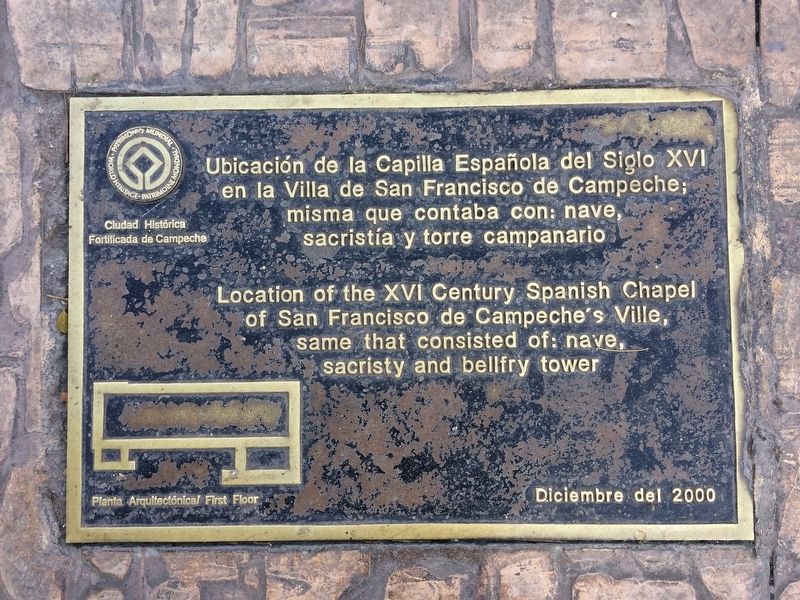
en la Villa de San Francisco de Campeche;
misma que contaba con: nave,
sacristía y torre campanario
Diciembre de 2000
Sello del UNESCO Patrimonio Mundial, Ciudad Histórica Fortificada de Campeche
Pie de dibujo: Planta Arquitectónica/First Floor
of San Francisco de Campeche’s Ville,
same that consisted of: nave,
sacristy and bellfry tower
December, 2000
Seal of UNESCO World Heritage, Historic Fortified City of Campeche
Caption: Architectural layout/First Floor
Erected 2000.
Topics and series. This historical marker is listed in these topic lists: Charity & Public Work • Churches & Religion • Colonial Era • Man-Made Features. In addition, it is included in the UNESCO World Heritage Sites series list. A significant historical month for this entry is December 2000.
Location. 19° 50.773′ N, 90° 32.215′ W. Marker is in San Francisco de Campeche, Campeche. It is in Zona Centro. Marker can be reached from Calle 8, on the right when traveling east. The markers are on the northeast corner of the Campeche central square (Plaza de Indepencia). Touch for map. Marker is at or near this postal address: 177 Calle 8, San Francisco de Campeche CAMP 24000, Mexico. Touch for directions.
Other nearby markers. At least 8 other markers are within walking distance of this marker. Campeche Library (within shouting distance of this marker); The Birthplace of Justo Sierra Méndez (within shouting distance of this marker); "The Palace" Cultural Center (within shouting distance of this marker); Independence Square (within shouting distance of this marker); Bastion of Our Lady of Solitude (about 90 meters away, measured in a direct line); Pedro Sainz de Baranda y Borreyro (about 90 meters away); Gate to the Sea (about 150 meters away); Temple of the Sweet Name of Jesus (about 180 meters away). Touch for a list and map of all markers in San Francisco de Campeche.
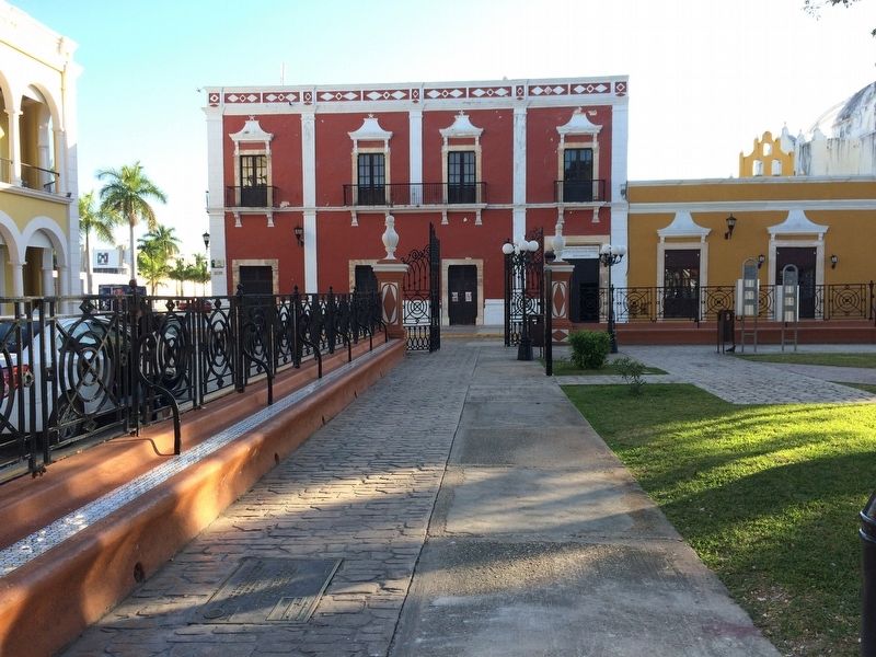
More about this marker. There are three almost identical bronze markers set into the park's walkways, marking the historical corners of the "La Española" Chapel.

Photographed By J. Makali Bruton, January 10, 2017
2. "La Española" Chapel Marker
The featured marker is to the middle-right in this view, mounted in the walkway seen below the left-most window of the yellow building. An additional marker can be seen to the left in the foreground. The third similar marker is to the far left, outside of the park's fence in this view. In the distance is the colorful headquarters of the National Technical Institute (Instituto Politécnico Nacional de Campeche).
Credits. This page was last revised on March 20, 2024. It was originally submitted on January 28, 2017, by J. Makali Bruton of Accra, Ghana. This page has been viewed 222 times since then and 15 times this year. Photos: 1, 2. submitted on January 28, 2017, by J. Makali Bruton of Accra, Ghana.
