Valladolid, Yucatán, Mexico — The Southeast (Yucatan Peninsula)
Sisal Neighborhood
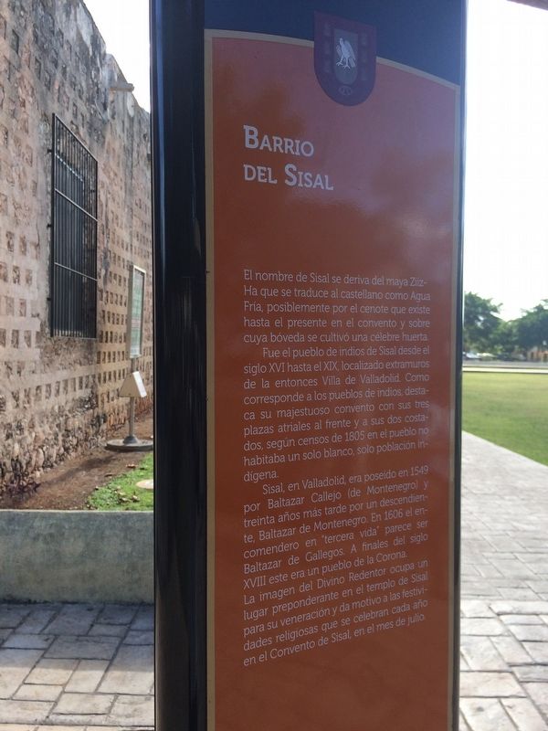
Barrio del Sisal
El nombre de Sisal se deriva del maya Ziiz-Ha que se traduce al castellano como Agua Fría, posiblemente por el cenote que existe hasta el presente en el convento y sobre cuya bóveda se cultivó una célebre huerta.
Fue el pueblo de indios de Sisal desde el siglo XVI hasta el XIX, localizado extramuros de la entonces Villa de Valladolida. Como corresponde a los pueblos de los indios, destaca su majestuoso convento con sus tres plazas atriales al frente y a sus dos costados, según censos de 1805 en el pueblo no habitaba un solo blanco, solo población indígena.
Sisal, en Valladolid, era poseído en 1549 por Baltazar Callejo (de Montenegro) y treinta años más tarde por un descendiente, Baltazar de Montenegro. En 1606 el encomendero en “tercera vida” parece ser Baltazar de Gallegos. A finales del siglo XVIII este era un pueblo de la Corona.
La imagen del Divino Redentor ocupa un lugar preponderante en el templo de Sisal para su veneración y da motivo a las festividades religiosas que se celebran cada año en el Convento de Sisal, en el mes de julio.
English:
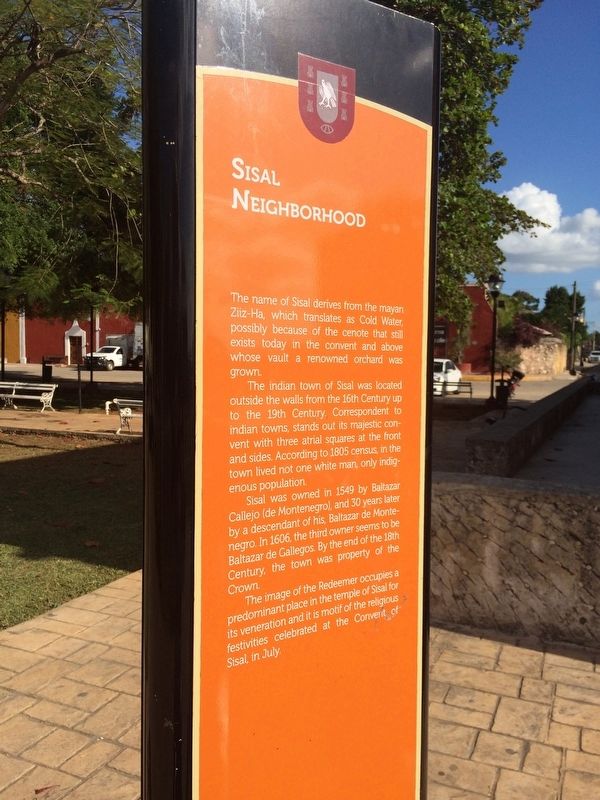
Sisal Neighborhood
The name of Sisal derives from the mayan Ziiz-Ha, which translates as Cold Water, possibly because of the cenote that still exists today in the convent and above whose vault a renowned orchard was grown.
The indian town of Sisal was located outside the walls from the 16th Century up to the 19th Century. Correspondent to indian towns, stands out its majestic convent with three atrial squares at the front and sides. According to 1805 census, in the town lived not one white man, only indigenous population.
Sisal was owned in 1549 by Baltazar Callejo (de Montenegro), and 30 years later by a descendant of his, Baltazar de Montenegro. In 1606, the third owner seems to be Baltazar de Gallegos. By the end of the 18th Century, the town was property of the Crown.
The image of the Redeemer occupies a predominant place in the temple of Sisal for its veneration and it is motif of the religious festivities celebrated at the Convent of Sisal, in July.
Topics. This historical marker is listed in these topic lists: Colonial Era • Man-Made Features • Native Americans. A significant historical year for this entry is 1805.
Location. 20° 41.182′ N, 88° 12.586′ W. Marker is in Valladolid, Yucatán. Marker is on Calle 49. Touch for map. Marker is at or near this postal address: 238A Calle 49, Valladolid YU 97780, Mexico. Touch for directions.
Other nearby markers. At least 8 other markers are within walking distance of this marker. Convent of San Bernardino de Siena (Saint Berardine of Siena) (within shouting distance of this marker); Cenote “Sis-Há” (within shouting distance of this marker); The Waterwheel (within shouting distance of this marker); Mayan House (about 150 meters away, measured in a direct line); Road of the Friars (approx. 0.6 kilometers away); The Valladolid Artisans' Market (approx. 0.8 kilometers away); House of Governor Francisco Canton Rosado (approx. 0.9 kilometers away); The Crime of the Mayors (approx. 0.9 kilometers away). Touch for a list and map of all markers in Valladolid.
Credits. This page was last revised on March 4, 2017. It was originally submitted on March 4, 2017, by J. Makali Bruton of Accra, Ghana. This page has been viewed 285 times since then and 17 times this year. Photos: 1, 2, 3. submitted on March 4, 2017, by J. Makali Bruton of Accra, Ghana.


