Shippensburg in Cumberland County, Pennsylvania — The American Northeast (Mid-Atlantic)
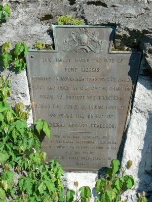
This Tablet Marks the Site of Fort Morris
Erected in November 1755 by Col. James Burd and used as one of the chain of forts to protect the frontiers during the period of Indian hostility following the defeat of General Edward Braddock.
Erected 1921 by Pennsylvania Historical Commission and the Civic Club of Shippensburg.
Topics and series. This historical marker is listed in these topic lists: Colonial Era • Forts and Castles • War, French and Indian. In addition, it is included in the Pennsylvania Historical and Museum Commission series list. A significant historical month for this entry is November 1755.
Location. 40° 2.877′ N, 77° 31.599′ W. Marker is in Shippensburg, Pennsylvania, in Cumberland County. Marker is on West King Street (Route 11) near Morris Street. Touch for map. Marker is at or near this postal address: 212 W King St, Shippensburg PA 17257, United States of America. Touch for directions.
Other nearby markers. At least 5 other markers are within walking distance of this marker. Braddock Expedition (here, next to this marker); Veterans Memorial (about 300 feet away, measured in a direct line); Galen J. Karper (about 500 feet away); William C. Ashwell (approx. 0.2 miles away); Mc Lean House (approx. 0.2 miles away). Touch for a list and map of all markers in Shippensburg.
Also see . . . Finding Fort Morris. by Paul Marr, Department of Geography and Earth Science, Shippensburg University. Published in 2004 in the Middle States Geographer. (Submitted on May 16, 2007.)
Credits. This page was last revised on March 2, 2022. It was originally submitted on May 16, 2007, by Peter Linehan of Shippensburg, Pennsylvania. This page has been viewed 2,131 times since then and 25 times this year. Photos: 1, 2. submitted on May 16, 2007, by Peter Linehan of Shippensburg, Pennsylvania. • J. J. Prats was the editor who published this page.

