Near Page in Coconino County, Arizona — The American Mountains (Southwest)
Glen Canyon Bridge / Cableways
Reclamation: Managing Water in the West
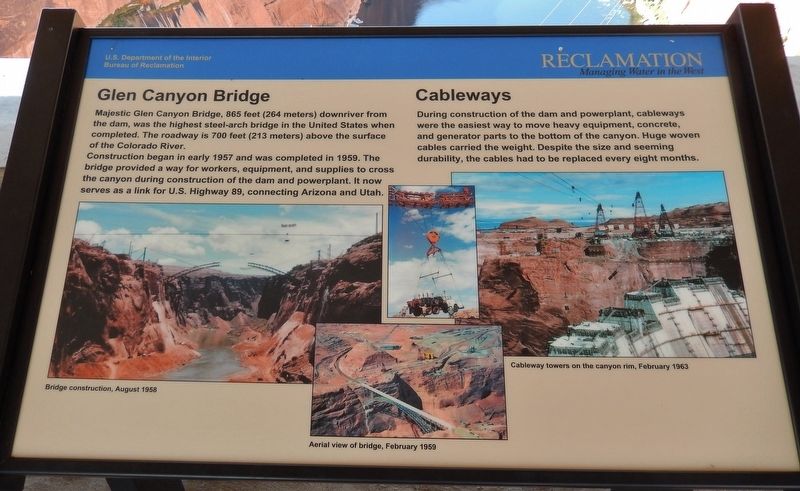
Glen Canyon Bridge
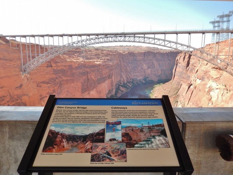
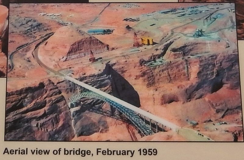
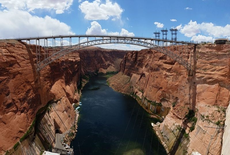
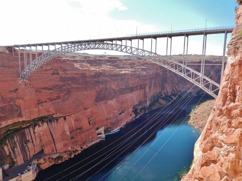
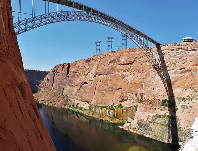
Majestic Glen Canyon Bridge, 865 feet (264 meters) downriver from the dam, was the highest steel-arch bridge in the United States when completed. The roadway is 700 feet (213 meters) above the surface of the Colorado River.
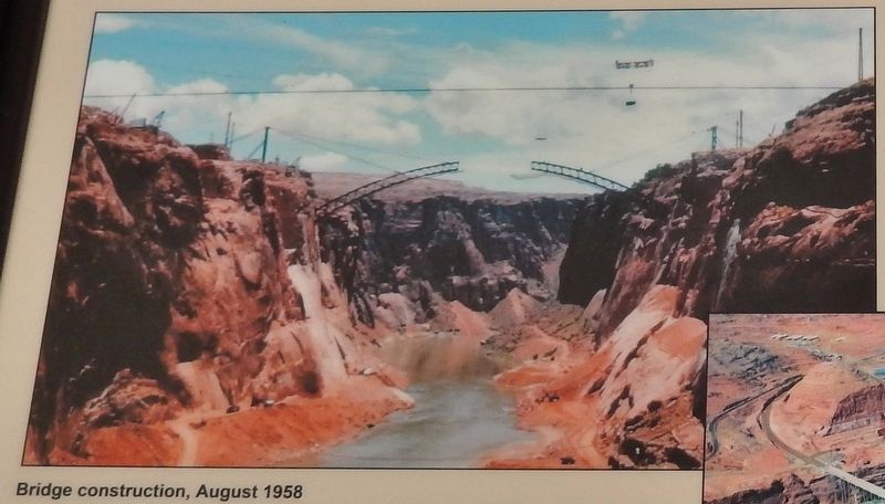
Construction began in early 1957 and was completed in 1959. The bridge provided a way for workers, equipment, and supplies to cross the canyon during construction of the dam and powerplant. It now serves as a link for U.S. Highway 89, connecting Arizona and Utah.
Cableways
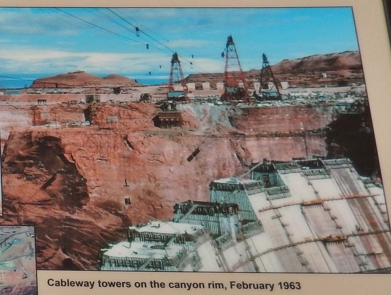
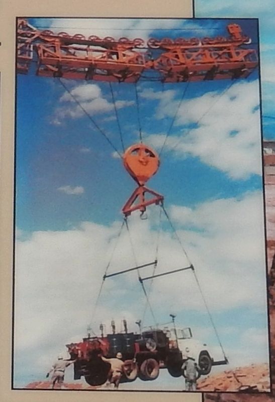
During construction of the dam and powerplant, cableways were the easiest way to move heavy equipment, concrete and generator parts to the bottom of the canyon. Huge woven cables carried the weight. Despite the size and seeming durability, the cables had to be replaced every eight months.
Erected by Bureau of Reclamation, U.S. Department of the Interior.
Topics. This historical marker is listed in this topic list: Bridges & Viaducts. A significant historical year for this entry is 1957.
Location. 36° 56.241′ N, 111° 29.09′ W. Marker is near Page, Arizona, in Coconino County. Marker can be reached from U.S. 89. Marker is located on top of Glen Canyon Dam, near the center, on the south side, under an awning, overlooking the Glen Canyon Bridge. Touch for map. Marker is in this post office area: Page AZ 86040, United States of America. Touch for directions.
Other nearby markers. At least 8 other markers are within walking distance of this marker. Colorado River Storage Project / Glen Canyon Dam (within shouting distance of this marker); Intake Structures (within shouting distance of this marker); Glen Canyon Dam (about 300 feet away, measured in a direct line); Hydroelectric Power - A Green and Renewable Energy Source (about 400 feet away); Rock Bolts / High Scaling (about 500 feet away); Wicket Gates (about 500 feet away); Concrete Bucket / Concrete Core Sample (about 600 feet away); Major John Wesley Powell (about 600 feet away). Touch for a list and map of all markers in Page.
Credits. This page was last revised on September 10, 2020. It was originally submitted on March 11, 2017, by Cosmos Mariner of Cape Canaveral, Florida. This page has been viewed 456 times since then and 34 times this year. Photos: 1, 2, 3, 4, 5, 6. submitted on March 11, 2017, by Cosmos Mariner of Cape Canaveral, Florida. 7, 8, 9. submitted on March 18, 2017, by Cosmos Mariner of Cape Canaveral, Florida. 10. submitted on March 22, 2017, by Cosmos Mariner of Cape Canaveral, Florida. • Bill Pfingsten was the editor who published this page.
