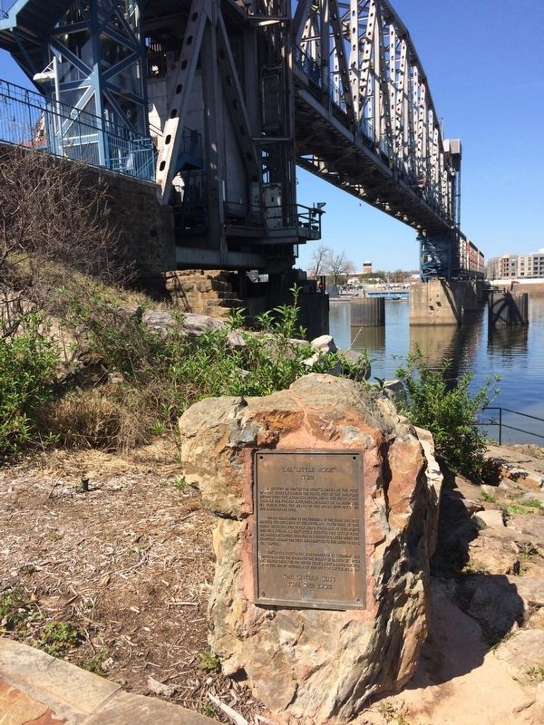
Downtown in Little Rock in Pulaski County, Arkansas — The American South (West South Central)
The "Little Rock"
1722
For 100 years prior to the founding of the town this rock marked the crossing of the north and south trail of the early settlers, the river being fordable at this point, and was known as the "Little Rock." In 1821 Little Rock was made the capital of Arkansas territory, later when the territory became a state and admitted to the Union in 1836, the capital.
The "Little Rock" is the N.W. Corner of the Quapaw Line surveyed after the signing of the treaty of cession between the Quapaw tribe and the United States June 24, 1818. Erected with the aid of officials of the city of Little Rock by
Erected 1932 by The Civitan Club.
Topics. This historical marker is listed in these topic lists: Bridges & Viaducts • Exploration • Settlements & Settlers • Waterways & Vessels. A significant historical year for this entry is 1722.
Location. 34° 44.943′ N, 92° 15.995′ W. Marker is in Little Rock, Arkansas, in Pulaski County. It is in Downtown. Marker can be reached from Ottenheimer Plaza. Marker is located on the Arkansas Trail, just to the East of the Junction Bridge, just North of Ottenheimer Plaza. Touch for map. Marker is in this post office area: Little Rock AR 72201, United States of America. Touch for directions.
Other nearby markers. At least 8 other markers are within walking distance of this marker. Witness to Removal (a few steps from this marker); One Old Rock (a few steps from this marker); The Big Rock and the Little Rock (a few steps from this marker); Smaller Rock, Big Bridge (a few steps from this marker); A Piece of the Rock, a Piece of History (a few steps from this marker); It is River City (within shouting distance of this marker); Arkansas in the Civil War (within shouting distance of this marker); The Point of Rocks (within shouting distance of this marker). Touch for a list and map of all markers in Little Rock.
Also see . . . Jean-Baptiste Bénard de la Harpe. (Submitted on March 22, 2017, by Steve Masler of Memphis, Tennessee.)
Credits. This page was last revised on December 20, 2023. It was originally submitted on March 22, 2017, by Steve Masler of Memphis, Tennessee. This page has been viewed 3,901 times since then and 416 times this year. Photos: 1, 2. submitted on March 22, 2017, by Steve Masler of Memphis, Tennessee. • Bill Pfingsten was the editor who published this page.

