Near Appomattox in Appomattox County, Virginia — The American South (Mid-Atlantic)
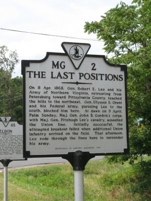
The Last Positions
Erected 1997 by Department of Historic Resources. (Marker Number MG-2.)
Topics and series. This historical marker is listed in this topic list: War, US Civil. In addition, it is included in the Virginia Department of Historic Resources (DHR) series list. A significant historical date for this entry is April 8, 1865.
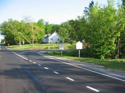
Location. 37° 22.074′ N, 78° 50.355′ W. Marker is near Appomattox, Virginia, in Appomattox County. Marker is at the intersection of Virginia Route 26 and County Route 677, on the right when traveling south on State Route 26. Touch for map. Marker is in this post office area: Appomattox VA 24522, United States of America. Touch for directions.
Other nearby markers. At least 8 other markers are within walking distance of this marker. Eldon (a few steps from this marker); Robertson House Fight (approx. ¼ mile away); a different marker also named Robertson House Fight (approx. ¼ mile away); Custer's Third Brigade (approx. 0.7 miles away); Walker's Last Stand (approx. 0.7 miles away); Confederate Artillery Position (approx. 0.7 miles away); Carver-Price School (approx. ¾ mile away); Winonah Camp / Mozella Price Home (approx. ¾ mile away). Touch for a list and map of all markers in Appomattox.
Also see . . . Lee's Retreat. Map and tour guide to key locations along the retreat route. (Submitted on August 14, 2008, by Craig Swain of Leesburg, Virginia.)
Credits. This page was last revised on June 16, 2016. It was originally submitted on August 14, 2008, by Laura Troy of Burke, Virginia. This page has been viewed 1,453 times since then and 11 times this year. Photos: 1. submitted on August 14, 2008, by Laura Troy of Burke, Virginia. 2. submitted on April 20, 2010, by Craig Swain of Leesburg, Virginia. • Craig Swain was the editor who published this page.

