Fort Kent in Aroostook County, Maine — The American Northeast (New England)
The Aroostook War
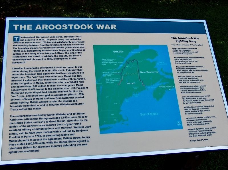
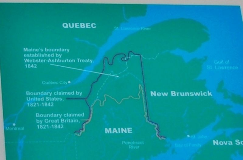
The Aroostook War was an undeclared, bloodless “war” that occurred in 1839. The peace treaty that ended the American Revolution in 1783 had not satisfactorily determined the boundary between New Brunswick and what is now Maine. The boundary dispute worsened after Maine gained statehood (1820) and, disregarding British claims, began granting land to settlers in the valley of the Aroostook River. The king of the Netherlands was asked to arbitrate the dispute, but the U.S. Senate rejected his award in 1832, although the British accepted it.
Canadian lumberjacks entered the Aroostook region to cut timber during the winter of 1838-1839, and in February they seized the American land agent who had been dispatched to expel them. The “war” was now under way. Maine and New Brunswick called out their militiamen, and the U.S. Congress, at the instigation of Maine, authorized a force of 50,000 men and appropriated $10 million to meet the emergency. Maine actually sent 10,000 troops to the disputed area. U.S. President Martin Van Buren dispatched General Winfield Scott to the “war” zone, and Scott arranged an agreement (March 1839) between officials of Maine and New Brunswick that averted actual fighting. Britain agreed to refer the dispute to a boundary commission, and in 1842 the Webster-Asburton Treaty settled the matter.
The compromise reached by Daniel Webster and 1st Baron Ashburton (Alexander Baring) awarded 7,015 square miles to the United States and 5,012 to Great Britain. Retention by the British of the northern area assured them of year-round overland military communications with Montreal. Webster used a map, said to have been marked with a red line by Benjamin Franklin at Paris in 1782, in persuading Maine and Massachusetts to accept the agreement. Britain agreed to pay these states $150,000 each, while the United States agreed to reimburse Britain for expenses incurred defending the area against encroachment.
The Aroostook War Fighting Song
Sung in Maine to the tune of “Auld Lang Syne”
We are marching on to Madawask,
To fight the trespassers;
We’ll teach the British how to walk
And come off conquerors.
We’ll have our land, right good and clear,
For all the English say;
They shall not cut another log,
Nor stay another day.
They need not think to have our land,
We Yankees can fight well;
We’ve whipped them twice most manfully,
As every child can tell.
And if the tyrants say one word,
A third time we will show,
How high the Yankee spirit runs,
And what our guns can do.
They better much all stay at home,
And mind their business there;
The way we treated them before,
Made all the nations stare.
Come on! Brace fellows, one and all!
The Red-Coats ne’er shall say,
We Yankees, feared to meet them armed,
So gave our land away.
We’ll feed them well with ball and shot.
We’ll cut these red-coats down,
Before we yield to them an inch
Or title of our ground.
Ye husbands, fathers, brothers, sons,
From every quarter come!
March, to the bugle and the fife!
March, to the beating drum!
Onward! My lands so brave and true
Our country’s right demands
With justice, and with glory fight,
For these Aroostook lands!
Bangor, Feb 21, 1839
Topics and series. This historical marker is listed in these topic lists: Settlements & Settlers • Wars, Non-US. In addition, it is included in the Former U.S. Presidents: #08 Martin Van Buren series list. A significant historical year for this entry is 1839.
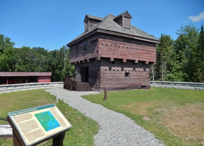
Location. 47° 15.157′ N, 68° 35.708′ W. Marker is in Fort Kent, Maine, in Aroostook County. Marker is at the intersection of Blockhouse Road and Island Road, on the right when traveling west on Blockhouse Road. Marker is at the Fort Kent State Historical Site, beside the walkway leading to the blockhouse. Marker is on the left-hand side of the walkway
as you face the blockhouse. Touch for map. Marker is in this post office area: Fort Kent ME 04743, United States of America. Touch for directions.
Other nearby markers. At least 7 other markers are within 9 miles of this marker, measured as the crow flies. Fort Kent (a few steps from this marker); Allagash and St. John Rivers (approx. 0.2 miles away); When "going across" Was Like Crossing the Street (approx. 0.3 miles away); America's First Mile (approx. 0.4 miles away); One People in Two Countries / Une Vallée sans frontière (approx. 0.4 miles away); Rail Fuels Growth, Cultural Change (approx. 0.4 miles away); La paroisse de Ste. Luce 150e anniversaire (approx. 8.1 miles away).
Also see . . .
1. Aroostook War.
The nation’s only war declared by a state and the nation’s only bloodless war. Its roots were planted in the Treaty of Paris of 1783 ending the Revolutionary War. With inaccurate maps and uncertainty about with local river was the French named St. Croix River, the treaty language left the British termed “Disputed Territory” of about 12,000 square miles vulnerable to conflict in what was known as the Northeast Boundary Dispute. (Submitted on April 3, 2017, by Cosmos Mariner of Cape Canaveral, Florida.)
2. Aroostook War - Lincoln, Maine.
The dispute lasted from 1838 to 1839. This was the time span when both countries’ militias started forming and getting restless over the ever-growing conflict. The entire “war” took place in what is now Aroostook county and New Brunswick. When the Governor called upon the state to organize its local militias, Lincoln soldiers became ready. Many of the town's male residents prepared for war. The Military Road through Lincoln was the main avenue of transportation for most of the troops, so it must have excited lots of the townspeople. (Submitted on April 3, 2017, by Cosmos Mariner of Cape Canaveral, Florida.)
3. How the Maine-New Brunswick border was finalized.
In 1841, new governments in the United States and Great Britain came to power which desired to resolve the dispute by diplomacy. In the US, Daniel Webster was appointed Secretary of State after a failed presidential bid. One of his goals was to settle the disputed border. The British appointed Lord Ashburton, a personal friend of Webster, to be their negotiator on this issue. The negotiations opened in the spring of 1842. (Submitted on April 3, 2017, by Cosmos Mariner of Cape Canaveral, Florida.)
4. Fort Kent.
A boundary dispute arose from the carrying on of lumbering operations by parties from Maine and New Brunswick, and the location at the junction of the Fish and St.John's rivers was a focal point of the trouble. In April 1839 the first armed forces appeared. In 1840 the blockhouse was completed and was named Fort Kent, in honor of Governor Edward Kent who was that year elected as Governor of Maine. (Submitted on April 3, 2017, by Cosmos Mariner of Cape Canaveral, Florida.)
Credits. This page was last revised on April 18, 2020. It was originally submitted on April 3, 2017, by Cosmos Mariner of Cape Canaveral, Florida. This page has been viewed 660 times since then and 28 times this year. Photos: 1, 2. submitted on April 3, 2017, by Cosmos Mariner of Cape Canaveral, Florida. 3. submitted on April 18, 2020, by Cosmos Mariner of Cape Canaveral, Florida. • Bill Pfingsten was the editor who published this page.


