Macon in Bibb County, Georgia — The American South (South Atlantic)
Fort Hawkins
The Battle for Macon
— Georgia Civil War Heritage Trails —
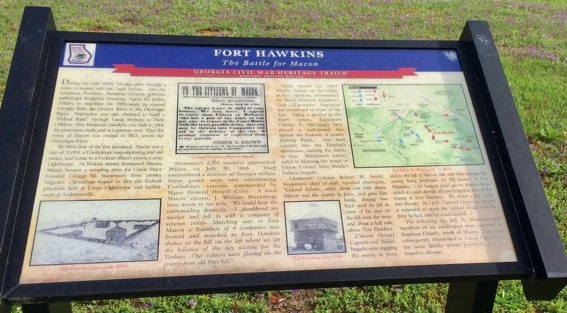
By 1864, little of the fort remained. Macon was a city of 10,000, a Confederate manufacturing and rail center, and home to a Federal officer's prison, Camp Oglethorpe. As Federal armies threatened Atlanta, Macon became a tempting prize for Union Major General George M. Stoneman's three cavalry brigades, Stoneman hoped to free the Federal prisoners held at Camp Oglethorpe and further south at Andersonville.
Stoneman's 2,100 troopers approached Macon on July 30, 1864. They encountered a mixture of Georgia militia, home guard units and convalescing Confederate veterans commanded by Major General Howell Cobb. A local Macon citizen, J. William Blackshear, later wrote to his wife, "We could hear the cannonading distinctly, I.. shouldered my musket and fell in with a company of veteran troops...Marching over to East Macon a Battalion of 4 companies was formed and marched to Fort Hawkins thence to the hill on the left where we lay the balance of the day waiting for the Yankees...Our cannon were playing on the enemy from old Fort hill."
Cobb placed his chief artillery battery on at Fort Hawkins, commanded by Major Edward Taliaferro. One 12-pounder Napoleon was positioned in front of the fort. Using a spotter in the fort's tower, Lieutenant Charles A. McClung's crew placed a well-aimed fire against the Federals at nearby Dunlap Farm. One shell crashed into the Dunlap's farmhouse, causing the family to flea. Taliaferro's battery aided in blunting the attack of Union Colonel Silas Biddle's Indiana brigade.
Lieutenant Colonel Robert W. Smith, Stoneman's chief of staff, reported afterwards, "Colonel Adams...when about one mile above Macon met the enemy in force, and gave him battle, driving him back until he fell in cover of his own on the hill near the river and about a half mile above Fort Hawkins....[Colonel Horace) Capron's and Biddle's brigades were engaging the enemy in front, and to the left of Macon, but with little success, the enemy being protected...by the battery in Fort Hawkins, Oho battery could get no position from which it could operate effectively against that of the enemy in Fort Hawkins. We threw a few shells
into the city. At 3 pm, General Stoneman, finding it impossible to reach the railroad bridge with the force he had, ordered a withdrawal...
The following day, July 31, Stoneman and hundreds of his cavalrymen were captured at Sunshine Church, north of Macon. They were subsequently imprisoned in Camp Oglethorpe, the same facility whose prisoners they had hoped to liberate.
Photo captions:
Bottom left: Fort Hawkins, circa early 1800s
Middle newspaper notice: Georgia Governor Brown's Appeal
Bottom right: Fort Hawkins, circa 1870s
Top right map: The Battle for Macon, 1864
Erected 2011 by Georgia Civil War Heritage Trails, Inc.
Topics and series. This historical marker is listed in these topic lists: Forts and Castles • War, US Civil • Waterways & Vessels. In addition, it is included in the Georgia Civil War Trails series list. A significant historical year for this entry is 1805.
Location. 32° 50.972′ N, 83° 36.71′ W. Marker is in Macon, Georgia, in Bibb County. Marker is on Woolfolk Street east of Womack Street, on the right when traveling east. Touch for map. Marker is at or near this postal address: 736 Emery Highway, Macon GA 31217, United States of America. Touch for directions.
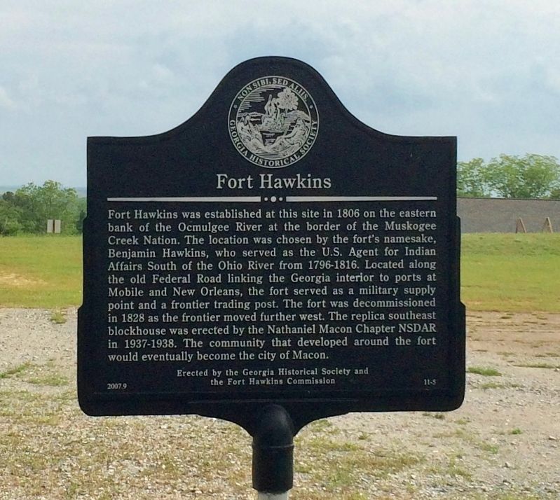
Other nearby markers. At least 8 other markers are within walking distance of this marker. Gen. James Edward Oglethorpe (a few steps from this marker); a different marker also named Fort Hawkins (within shouting distance of this marker); War of 1812 Bicentennial Celebration (within shouting distance of this marker); The Dunlap House (approx. 0.7 miles away); Paleo Indian Period 15000 B.C.E. - 8000 B.C.E. (approx. 0.7 miles away); Battles of Dunlap Farm (approx. 0.7 miles away); Yaupon Holly (approx. 0.7 miles away); The Civilian Conservation Corps (CCC) 1933-1942 (approx. 0.7 miles away). Touch for a list and map of all markers in Macon.
More about this marker. Part of the Jefferson Davis Heritage Trail.
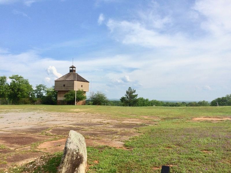
Regarding Fort Hawkins. The fort is completely fenced off and is currently only open Saturdays and Sundays from
12 noon to 4:00 p.m. Group visits by appointment. A new visitors center and parking is on the opposite side of the historical markers.
Also see . . .
1. Historic Fort Hawkins website. (Submitted on May 4, 2017, by Mark Hilton of Montgomery, Alabama.)
2. Wikipedia article on Fort Hawkins. (Submitted on May 4, 2017, by Mark Hilton of Montgomery, Alabama.)
Credits. This page was last revised on November 24, 2019. It was originally submitted on May 4, 2017, by Mark Hilton of Montgomery, Alabama. This page has been viewed 901 times since then and 23 times this year. Photos: 1, 2, 3, 4. submitted on May 4, 2017, by Mark Hilton of Montgomery, Alabama.


