Decatur in Morgan County, Alabama — The American South (East South Central)
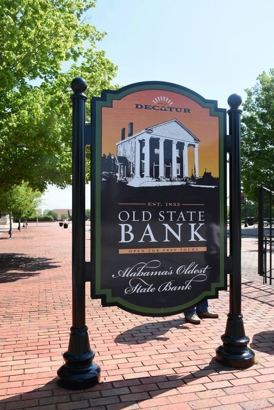
Old Decatur Historic District / Old State Bank
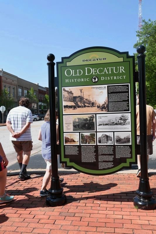
With a bank, railroad, and rive as drivers, Decatur began growing between 1830 and 1860. The Civil War, however, drastically changed the landscape of this community. Those strategic assets made the city prime real estate for Union and Confederate armies, resulting in three years of near constant occupation. It has been estimated that the town changed hands eight times. IN 1862, while under Union control the railroad bridge was burned (who burned is is still a hotly disputed topic!). Tow years later the town was systematically torn down and its building materials used to build Union fortifications with some buildings also being burned.
It took years for Decatur to recover following the War Between the States, as it is know in the South. One of the most important developments in the community's resurgence was the purchase by Louisville & Nashville Railroad Company of track extending from Montgomery to Nashville by way of Decatur in 1871. By 8886, 640 railroad cars passed through L&N's Decatur rail every day. Just as the government and economy began to rebound, yellow fever hit the area in 1878. The disease killed 51 people, but hundreds more - including the mayor - let town to avoid infection. Many never returned. A second outbreak in 1888 killed 35, including five heroic doctors who refused to leave but stayed to treat the sick.
Historic Bank Street has been a center of commerce for Decatur for many years. With the old State Bank at your back, the first block of buildings on the east side of Bank Street dates to the reconstruction following the Civil War in the late 1870's and 80's. The remaining Bank Street buildings are newer due to various fires that destroyed the downtown. As you look down the bloc, notice the remnants of bricks and rails down the center of the street where trolleys once connected the downtown of Old Decatur and Albany.
"Street Scene, The Decaturs, Ala." No, that is not a typo on the post card photo you see form circa 1905. At the time this depot was being built, there were, in fact, two cities adjacent to one another that were at odds for years. The original Decatur (where you are now standing)became known as Old Decatur after a group of investors from Albany, New York, purchased vast amounts of land in 1887 and positioned their real estate as "New Decatur." The southern residents did not warm up to the concept of the "carpetbaggers" and an imaginary dividing line seemed to form between Bank Street and New Decatur's 2nd Avenue. This animosity lessened when the new city changed its name to Albany in 1916. The driving force to join the two towns came from the need for a bridge, instead of a ferry, across the Tennessee River. In 1927, the two cities merged to form one City of Decatur. The Decatur Kiwanis Club was formed with an equal number of member from each town to organize efforts to get the state to build the bridge which opened in 1928.
The Old State Bank was built in 1833 at a cost of $9,482. It opened that same year as a branch of the State Bank of Alabama and was profitable until 1837. After the bank accumulated outstanding debts of over $1 million, its franchise was revoked and it closed in 1842. The failure was lamed on "political shenanigans," poor lending practices and an economic depression. After its closure it has served as a private residence, American Legion Post 15, a social center, The First National Bank of Decatur and other uses.
The Old State Bank played a significant role in the influence and development of architectural style in Alabama until the Civil War by combining elements of the Federal style with Greek-Revival. It is the oldest standing bank building in Alabama and because the Union Army used the bank for a hospital, it is one of only four buildings in Decatur that survived the war.
In 1939, it was renovated for use as a museum and civic hall. The City of Decatur purchased the property in 1982. The massive limestone columns - which likely were quarried at a plantation in Trinity, Al and transported by ox carts - still carry scars from rifle balls fired during Civil War skirmishes. In 1972, the Old State Bank was named to the National Register of Historic Places.
The Trolley System By November 1903 electric street cars replaced mule- and horse-drawn trollies which were put into service around 1887. The mule barn located at the intersection of Grant Street and Somerville Road was replaced by an electric car barn at the head of Second Avenue. Four street car routes served the town. Route 1 connected the two downtown with Old Town (NW), Danville Road, Moulton Street, Gordon Drive and Fourth Avenue. Route 2 ran through Grant Street (some tracks are still visible). Route 3 (Southtown) connected Prospect Drive to Fourth Avenue and the area of the old L&N Railroad shops. Route 4 connected the two downtowns (with some tracks still visible on Bank and Church Streets).
(captions)
A View Facing North 1908
Note the Old State Bank is seen in the background at the end of the street on the left.
A rare photo taken during the Civil War of a Union Party building their fort upon this location. Handwritten on the back of this photo:
Scene in Decatur Ala
May 1864
party at work
(1) Fort No 2
(2) Old Building of Decatur Bank
(3)Fort No 3 in Main St
(4)Provost Marshall's office
A View Facing North in 1864
The Indian Cavalry posses on Bank Street with a battery of artillery in 1864 in this view looking north with the Tennessee River behind. The 10th Indiana fought against General John Bell Hood's Confederate Army during the October 26-29 1864, Battle of Decatur.
Erected by City of Decatur.
Topics and series. This memorial is listed in these topic lists: Architecture • Disasters • Industry & Commerce • War, US Civil. In addition, it is included in the Former U.S. Presidents: #05 James Monroe series list.
Location. 34° 36.819′ N, 86° 59.039′ W. Marker is in Decatur, Alabama, in Morgan County. Memorial is at the intersection of Bank Street NE and Church Street NE on Bank Street NE. Touch for map. Marker is at or near this postal address: 925 Bank St NE, Decatur AL 35601, United States of America. Touch for directions.
Other nearby markers. At least 8 other markers are within walking distance of this marker. To Commemorate the Passage of The Olympic Torch (here, next to this marker); Historic Downtown/Founders Park (a few steps from this marker); Rising Sun Lodge No. 29 (within shouting distance of this marker); Battle of Decatur (within shouting distance of this marker); Old State Bank Building (within shouting distance of this marker); Decatur and The Civil War in North Alabama (within shouting distance of this marker); Hood’s Middle Tennessee Campaign and The Battle for Decatur (about 300 feet away, measured in a direct line); Gold Star Families Memorial Monument (about 400 feet away). Touch for a list and map of all markers in Decatur.
Credits. This page was last revised on July 20, 2022. It was originally submitted on May 5, 2017, by Sandra Hughes Tidwell of Killen, Alabama, USA. This page has been viewed 547 times since then and 35 times this year. Photos: 1, 2. submitted on May 5, 2017, by Sandra Hughes Tidwell of Killen, Alabama, USA. • Bernard Fisher was the editor who published this page.

