Lee Hall in Newport News, Virginia — The American South (Mid-Atlantic)
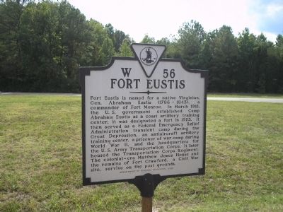
Fort Eustis
Erected 2001 by Department of Historical Resources. (Marker Number W-56.)
Topics and series. This historical marker is listed in these topic lists: Colonial Era • Forts and Castles • War, US Civil • War, World II. In addition, it is included in the Virginia Department of Historic Resources (DHR) series list. A significant historical month for this entry is March 1918.
Location. 37° 10.526′ N, 76° 34.178′ W. Marker is in Newport News, Virginia. It is in Lee Hall. Marker is at the intersection of Warwick Blvd (U.S. 60) and Dozier Road, on the right when traveling south on Warwick Blvd. Touch for map. Marker is in this post office area: Newport News VA 23603, United States of America. Touch for directions.
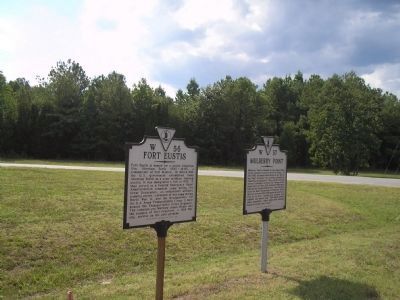
Other nearby markers. At least 8 other markers are within walking distance of this marker. Mulberry Point (here, next to this marker); Skiffes Creek (approx. 0.4 miles away); Balthrope (approx. 0.4 miles away); Stanley Hundred (approx. 0.4 miles away); General Abraham Eustis (approx. 0.4 miles away); a different marker also named Fort Eustis (approx. 0.4 miles away); Lee’s Mill Earthworks (approx. half a mile away); 0-6-0T Side-Tank Switcher (approx. 0.6 miles away). Touch for a list and map of all markers in Newport News.
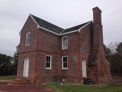
Related markers. Click here for a list of markers that are related to this marker. Links to Matthew Jones House historical markers.
Also see . . . Fort Eustis. Official website of Fort Eustis. (Submitted on August 16, 2008, by Bill Coughlin of Woodland Park, New Jersey.)
Credits. This page was last revised on February 1, 2023. It was originally submitted on August 16, 2008, by Bill Coughlin of Woodland Park, New Jersey. This page has been viewed 1,374 times since then and 21 times this year. Photos: 1, 2. submitted on August 16, 2008, by Bill Coughlin of Woodland Park, New Jersey. 3. submitted on January 23, 2016, by Kevin W. of Stafford, Virginia.
Editor’s want-list for this marker. Pictures of the remains of Fort Crawford. • Can you help?


