Franklin in Williamson County, Tennessee — The American South (East South Central)
Battle of Franklin
The Landscape Shapes the Battle
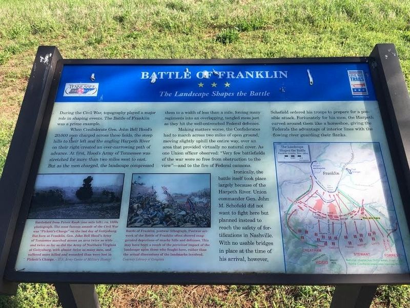
During the Civil War, topography played a major role in shaping events. The Battle of Franklin was a prime example.
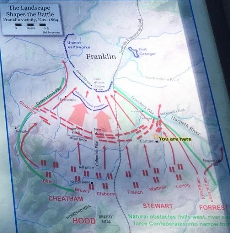
When Confederate Gen. John Bell Hood’s 20,000 men charged across these fields, the steep hills to their left and the angling Harpeth River on their right created an ever-narrowing path of advance. At first, Hood’s Army of Tennessee was stretched for more than two miles west to east. But as the men charged, the landscape compressed them to a width of less than a mile, forcing many regiments into an overlapping, tangled mess just as they hit the well-entrenched Federal defenses.
Making matters worse, the Confederates had to march across two miles of open ground, moving slightly uphill the entire way, over an area that provided virtually no natural cover. As one Union officer observed: “Very few battlefields of the war were so free from obstruction to the view”—and to the fire of Federal cannons.
Ironically, the battle itself took place largely because of the Harpeth River. Union commander Gen. John M. Schofield did not want to fight here but planned instead to reach the safety of fortifications in Nashville. With no usable bridges in place at the time of his arrival, however, Schofield ordered his troops to prepare for a possible attack. Fortunately for his men, the Harpeth curved around them like a horseshoe, giving the Federals the advantage of interior lines with the flowing river guarding their flanks.
Erected by Tennessee Civil War Trails.
Topics and series. This historical marker is listed in this topic list: War, US Civil. In addition, it is included in the Tennessee Civil War Trails series list. A significant historical date for this entry is November 30, 1864.
Location. 35° 54.343′ N, 86° 51.529′ W. Marker is in Franklin, Tennessee, in Williamson County. Marker can be reached from Eastern Flank Circle, 0.4 miles south of Lewsiburg Pike (Business U.S. 431), on the right when traveling west. Located in Eastern Flank Battlefield Park. Touch for map. Marker is at or near this postal address: 1368 Eastern Flank Cir, Franklin TN 37064, United States of America. Touch for directions.
Other nearby markers. At least 8 other markers are within walking distance of this marker. Battle of Franklin, Eastern Flank (within shouting distance of this marker); a different marker also named Battle of Franklin (within shouting distance of this marker); a different marker also named Battle of Franklin, Eastern Flank (within shouting distance of this marker); a different marker also named Battle of Franklin, Eastern Flank (within shouting distance of this marker); a different marker also named Battle of Franklin, Eastern Flank (within shouting distance of this marker); a different marker also named Battle of Franklin, Eastern Flank (about 300 feet away, measured in a direct line); Becoming the Front Line 1862 (about 300 feet away); A Crucial War Zone 1863 (about 300 feet away). Touch for a list and map of all markers in Franklin.
Also see . . . Eastern Flank Battlefield Park. City of Franklin website entry (Submitted on April 14, 2021, by Larry Gertner of New York, New York.)
Photographed By US Army Center of Military History
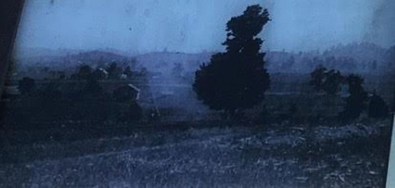
3. Battlefield from Privet Knob
Battlefield from Privet Knob (one mile left), ca. 1880s photograph. The most famous assault of the Civil War was “Pickett’s Charge” on the last day of Gettysburg. But here at Franklin, Gen. John Bell Hood’s Army of Tennessee marched across an area twice as wide and twice as far as did the Army of Northern Virginia at Gettysburg, with almost twice as many men, and suffered more killed and wounded than were lost in Pickett’s Charge.
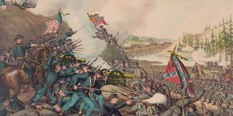
Library of Congress
5. Battle of Franklin lithograph
Battle of Franklin, postwar lithograph. Postwar artwork of the Battle of Franklin often showed exaggerated depictions of nearby hills and defenses. This may have been a result of the perceived impact of the landscape upon those who fought here, rather than the actual dimensions of the landmarks involved.
Credits. This page was last revised on April 15, 2021. It was originally submitted on May 25, 2017, by Brandon Stahl of Fairfax, Virginia. This page has been viewed 455 times since then and 31 times this year. Photos: 1, 2, 3, 4, 5. submitted on May 25, 2017, by Brandon Stahl of Fairfax, Virginia. • Bernard Fisher was the editor who published this page.
