Marker Logo HMdb.org THE HISTORICAL
MARKER DATABASE
“Bite-Size Bits of Local, National, and Global History”
Westminster in Carroll County, Maryland — The American Northeast (Mid-Atlantic)
 

Westminster MD Town Survey


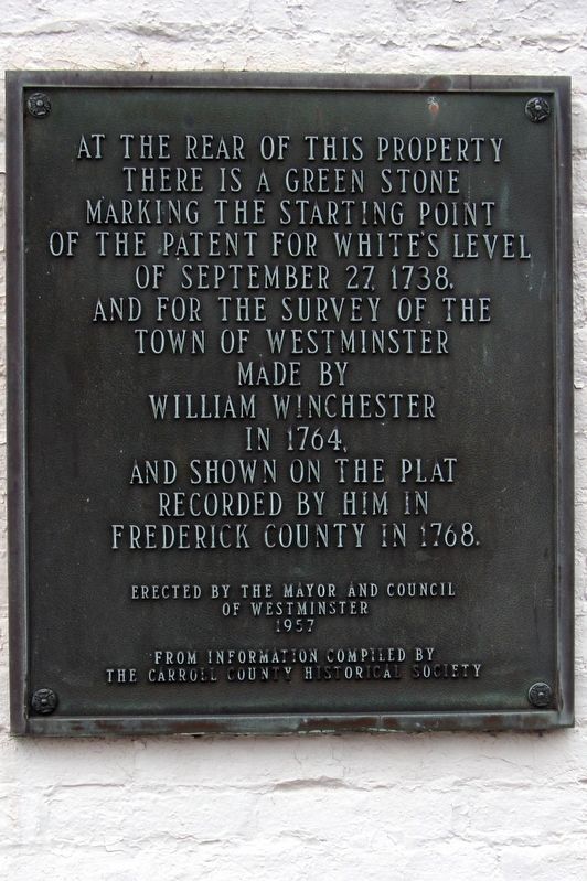
Westminster MD Town Survey Marker image. Click for full size.
Photographed By Larry Gertner, May 11, 2015
1. Westminster MD Town Survey Marker
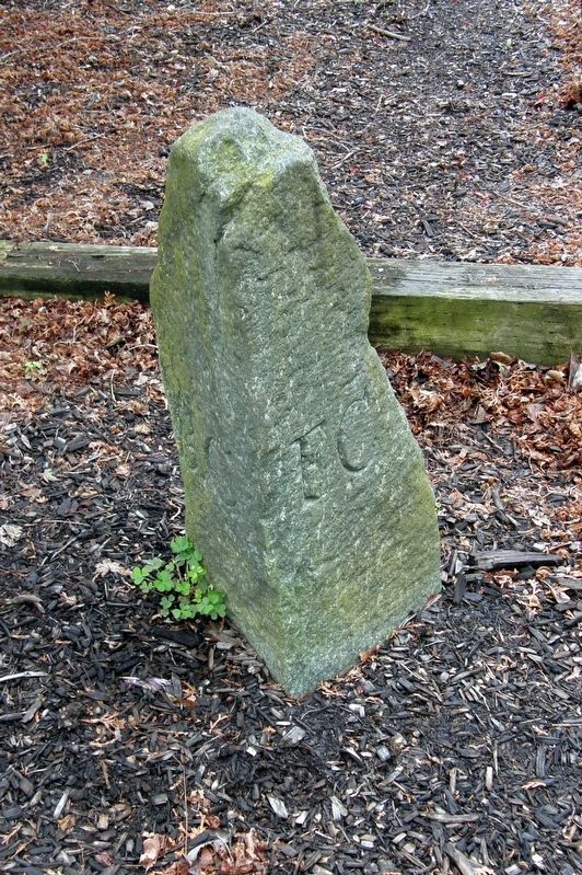
Inscription. At the rear of this property there is a green stone marking the starting point for the patent of White's Level of September 27, 1738, and for the survey of the town of Westminster made by William Winchester in 1764, and shown on the plat recorded by him in Frederick County in 1768.

Erected by the Mayor and Council of Westminster 1957 from information compiled by the Carroll County Historical Society
 
Erected by the Mayor and Council of Westminster.
 
Topics. This historical marker is listed in these topic lists: Colonial EraSettlements & Settlers. A significant historical date for this entry is September 27, 1738.
 
Location. 39° 34′ N, 76° 59.233′ W. Marker is in Westminster, Maryland, in Carroll County. Marker is at the intersection of E. Main Street and Manchester Avenue, on the right when traveling west on E. Main Street. Touch for map. Marker is in this post office area: Westminster MD 21157, United States of America. Touch for directions.
 
Other nearby markers. At least 8 other markers are within walking distance of this marker. The Trumbo-Chrest House (here, next to this marker); Corbit’s Charge (within shouting distance of this marker); 12 N Church Street (about 800 feet away, measured in a direct line); American Legion Square (approx. ¼ mile away); The Loom House (approx. ¼ mile away); Gettysburg Campaign

Paid Advertisement
Click on the ad for more information.
Please report objectionable advertising to the Editor.
Click or scan to see
this page online
(approx. ¼ mile away); a different marker also named Corbit's Charge (approx. ¼ mile away); Votes for Women (approx. ¼ mile away). Touch for a list and map of all markers in Westminster.
 
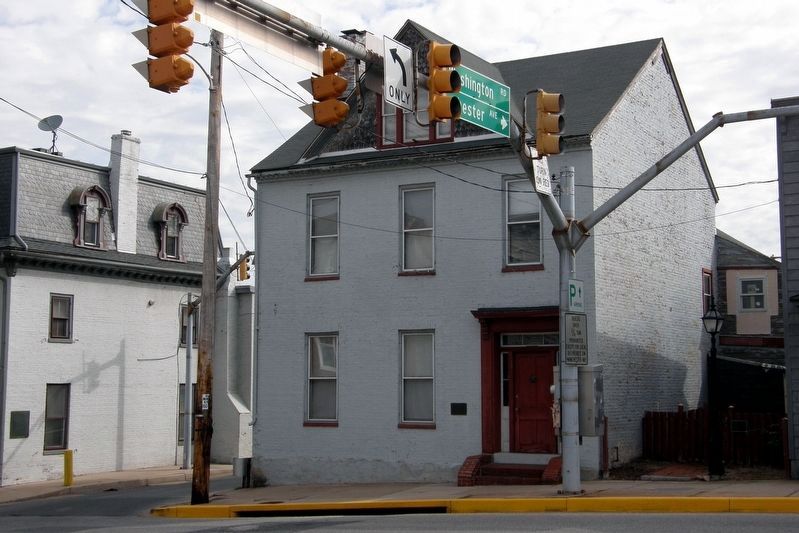
The marker is visible on the wall facing Manchester Avenue on the building to the left. image. Click for full size.
Photographed By Larry Gertner, May 11, 2015
2. The marker is visible on the wall facing Manchester Avenue on the building to the left.
The "green stone" referred to in the marker. image. Click for full size.
Photographed By Larry Gertner, May 11, 2015
3. The "green stone" referred to in the marker.
 
 
Credits. This page was last revised on April 17, 2020. It was originally submitted on May 26, 2017, by Larry Gertner of New York, New York. This page has been viewed 262 times since then and 18 times this year. Last updated on April 17, 2020, by Larry Gertner of New York, New York. Photos:   1, 2, 3. submitted on May 26, 2017, by Larry Gertner of New York, New York. • Bill Pfingsten was the editor who published this page.
Share this page.  
Share on Tumblr
m=148316

CeraNet Cloud Computing sponsors the Historical Marker Database.
This website earns income from purchases you make after using our links to Amazon.com. We appreciate your support.
Paid Advertisement
Apr. 18, 2024