From Mine to Market
Lackawanna Valley Industrial Highway
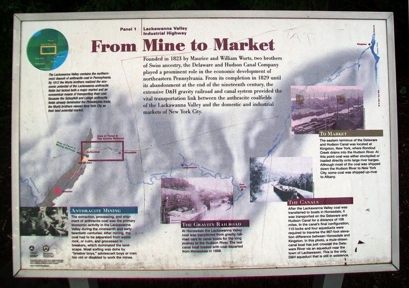
Founded in 1823 by Maurice and William Wurts, two brothers of Swiss ancestry, the Delaware and Hudson Canal Company played a prominent role in the economic development of northeastern Pennsylvania. From its completion in 1829 until its abandonment at the end of the nineteenth century, the extensive D&H gravity railroad and canal system provided the vital transportation link between the anthracite coalfields of the Lackawanna Valley and the domestic and industrial markets of New York City.
The Lackawanna Valley contains the northernmost deposit of anthracite coal in Pennsylvania. By 1812 the Wurts brothers realized the economic potential of the Lackawanna anthracite fields but lacked both a major market and an economical means of transporting their coal. Because the Schuylkill and Lehigh anthracite fields already dominated the Philadelphia trade, the Wurts brothers viewed New York City as their best potential market.
Anthracite Mining
The extraction, processing, and shipment of anthracite coal was the primary economic activity in the Lackawanna Valley during the nineteenth and early twentieth centuries. After mining, the coal had to be separated from waste rock, or culm, and processed in breakers, which dominated the landscape. Most sorting was done by "breaker boys," adolescent boys or men too old or disabled
The Gravity Railroad
At Honesdale the Lackawanna Valley coal was transferred from gravity railroad cars to canal boats for the long journey to the Hudson River. The last canal boat loaded with coal departed from Honesdale in 1898.
The Canals
After the Lackawanna Valley coal was transferred to boats in Honesdale, it was transported on the Delaware and Hudson Canal for a distance of 108 miles. In the canal's final configuration, 110 locks and four aqueducts were required to traverse the 967-foot elevation difference between Honesdale and Kingston. In this photo, a mule-drawn canal boat has just crossed the Delaware River via an aqueduct near the town of Lackawaxen. This is the only D&H aqueduct that is still in existence.
To Market
The eastern terminus of the Delaware and Hudson Canal was located at Kingston, New York, where Rondout Creek drains into the Hudson River. At this point coal was either stockpiled or loaded directly onto large river barges. Although most of the coal was shipped down the Hudson River to New York City, some coal was shipped up-river to Albany.
[Background map showing the route of the D&H Canal]
Erected by Pennsylvania Dept of Transportation and the Federal Highway Commission. (Marker Number 1.)
Topics. This historical marker is listed
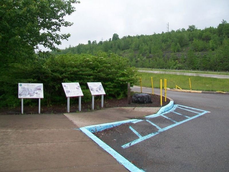
Location. 41° 33.198′ N, 75° 29.695′ W. Marker is near Carbondale, Pennsylvania, in Lackawanna County. It is in Carbondale Township. Marker is on Casey Highway (U.S. 6), on the right when traveling south. Marker is at the Carbondale Scenic Overlook, accessed from the southbound lanes of US Hwy 6, AKA the Casey Highway. Touch for map. Marker is in this post office area: Carbondale PA 18407, United States of America. Touch for directions.
Other nearby markers. At least 8 other markers are within 2 miles of this marker, measured as the crow flies. The Gravity Railroad (here, next to this marker); Mining Methods (here, next to this marker); McCawley Park: Carbondale's UFO (approx. 1.2 miles away); Carbondale (approx. 1.2 miles away); The First Underground Anthracite Mine (approx. 1.4 miles away); Site of the First Deep Underground Anthracite Mine in America (approx. 1.4 miles away); America's First Underground Anthracite Mine (approx. 1.4 miles away); Church Street: Five of Carbondale’s many historic Churches (approx. 1.4 miles away). Touch for a list and map of all markers in Carbondale.
Also see . . .
2. Brief History of the D&H Canal. (Submitted on June 6, 2017, by William Fischer, Jr. of Scranton, Pennsylvania.)
Credits. This page was last revised on February 7, 2023. It was originally submitted on June 5, 2017, by William Fischer, Jr. of Scranton, Pennsylvania. This page has been viewed 173 times since then and 13 times this year. Photos: 1, 2, 3. submitted on June 6, 2017, by William Fischer, Jr. of Scranton, Pennsylvania.


