The Gravity Railroad
Lackawanna Valley Industrial Highway
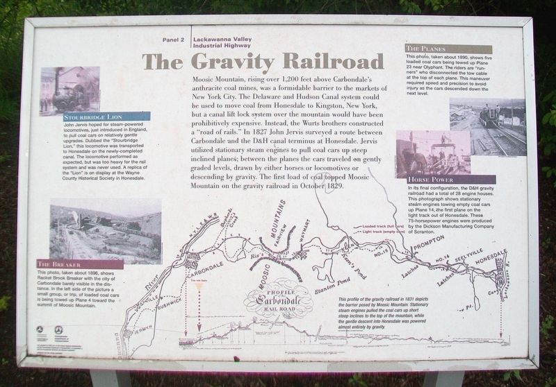
Moosic Mountain, rising over 1,200 feet above Carbondale's anthracite coal mines, was a formidable barrier to the markets of New York City. The Delaware and Hudson Canal system could be used to move coal from Honesdale to Kingston, New York, but a canal lift lock system over the mountain would have been prohibitively expensive. Instead, the Wurts brothers constructed a "road of rails." In 1827 John Jervis surveyed a route between Carbondale and the D&H canal terminus at Honesdale. Jervis utilized stationary steam engines to pull coal cars up steep inclined planes; between the planes the cars traveled on gently graded levels, drawn by either horses or locomotives or descending by gravity. The first load of coal topped Moosic Mountain on the gravity railroad in October 1829.
Stourbridge Lion
John Jervis hoped for steam-powered locomotives, just introduced in England, to pull coal cars on relatively gentle upgrades. Dubbed the "Stourbridge Lion," this locomotive was transported to Honesdale on the newly-completed canal. The locomotive performed as expected, but was too heavy for the rail system and was never used. A replica of the "Lion" is on display at the Wayne County Historical Society in Honesdale.
The Breaker
This photo, taken about 1896, shows Racket Brook Breaker with the city of Carbondale barely
Profile of the Carbondale Rail Road
This profile of the gravity railroad in 1831 depicts the barrier posed by Moosic Mountain. Stationary steam engines pulled the coal cars up short steep inclines to the top of the mountain, while the gentle descent into Honesdale was powered almost entirely by gravity.
Horse Power
In its final configuration, the D&H gravity railroad had a total of 28 engine houses. This photograph shows stationary steam engines towing empty coal cars up Plane 14, the first plane on the light track out of Honesdale. These 75-horsepower engines were produced by the Dickson Manufacturing Company of Scranton.
The Planes
This photo, taken about 1890, shows five loaded coal cars being towed up Plane 23 near Olyphant. The riders are "runners" who disconnected the tow cable at the top of each plane. This maneuver required speed and precision to avoid injury as the cars descended down the next level.
Erected by Pennsylvania Dept of Transportation and the Federal Highway Commission. (Marker Number 2.)
Topics. This historical marker is listed in these topic lists: Industry & Commerce
Location. 41° 33.198′ N, 75° 29.695′ W. Marker is near Carbondale, Pennsylvania, in Lackawanna County. It is in Carbondale Township. Marker is on U.S. 6, on the right when traveling south. Marker is at the Carbondale Scenic Overlook, accessed from the southbound lanes of US Hwy 6, AKA the Casey Highway. Touch for map. Marker is in this post office area: Carbondale PA 18407, United States of America. Touch for directions.
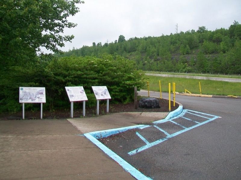
Other nearby markers. At least 8 other markers are within 2 miles of this marker, measured as the crow flies. From Mine to Market (here, next to this marker); Mining Methods (here, next to this marker); McCawley Park: Carbondale's UFO (approx. 1.2 miles away); Carbondale (approx. 1.2 miles away); The First Underground Anthracite Mine (approx. 1.4 miles away); Site of the First Deep Underground Anthracite Mine in America (approx. 1.4 miles away); America's First Underground Anthracite Mine (approx. 1.4 miles away); Church Street: Five of Carbondale’s many historic Churches (approx. 1.4 miles away). Touch for a list and map of all markers in Carbondale.
Also see . . .
1. D&H Canal and Gravity Railroad History. (Submitted on June 6, 2017, by William Fischer, Jr. of Scranton, Pennsylvania.)
2. The Delaware and Hudson Railway, The Bridge Line
Credits. This page was last revised on February 7, 2023. It was originally submitted on June 6, 2017, by William Fischer, Jr. of Scranton, Pennsylvania. This page has been viewed 517 times since then and 81 times this year. Photos: 1, 2, 3. submitted on June 6, 2017, by William Fischer, Jr. of Scranton, Pennsylvania.


