Aurora in Erie County, New York — The American Northeast (Mid-Atlantic)
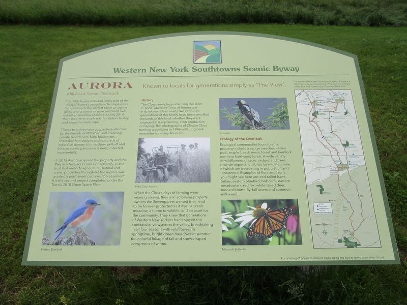
Aurora
Western New York Southtowns Scenic Byway
— Mill Road Scenic Overlook —
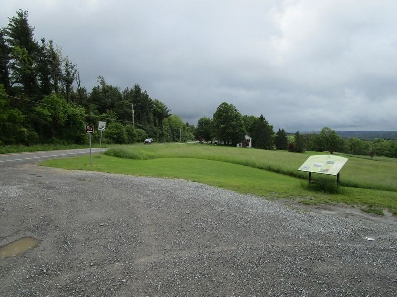
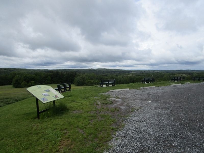
This 180-degree vista and iconic part of the Town of Aurora's agricultural heritage gives the community the perfect place to catch a glimpse of a sunset or gaze westward over unbroken meadow and forest. Until 2014 there was never a safe way for visitors to stop and enjoy this landscape.
Thanks to a three-year cooperative effort led by the Friends of Mill Road and involving private landowners, local businesses, charitable foundations and hundreds of individual donors, this roadside pull-off and 60-acre scenic panorama is now protected in perpetuity.
In 2013 Aurora acquired the property and the Western New York Land Conservancy, a land trust that protects agricultural, natural and scenic properties throughout the region, was granted a permanent conservation easement. It is the second project completed under the Town's 2010 Open Space Plan.
Eastern Bluebird.
History. The Closs family began farming this land in 1828, when the Town of Aurora was in its infancy. Over nearly two centuries, generations of this family have been stewards of this land, whether they were engaged in dairy farming, crop production or haying. The photographs of Clinton Closs running a combine in 1946 will bring back memories for many Aurorans.
1946 Closs Family.
When the Closs's days of farming were nearing an end, they and adjoining property owners the Sievenpipers wanted their land to be forever protected as it was: a scenic meadow, a home to wildlife, and an asset for the community. They knew that generations of Western New Yorkers had enjoyed the spectacular view across the valley, breathtaking in all four seasons with wildflowers in springtime, bright green meadows in summer, the colorful foliage of fall and snow-draped evergreens of winter.
Bobolink.
Ecology of the Overlook. Ecological communities found on the property include a sedge meadow, vernal pool, maple-beech mesic forest and hemlock northern hardwood forest. A wide variety of wildflowers, grasses, sedges and trees provide important habitat for wildlife, some of which are decreasing in population and threatened. Examples of flora, and fauna you might see here are: red-tailed hawk, turkey, eastern bluebird, bobolink, eastern meadowlark, red fox, white-tailed deer, monarch butterfly, fall asters and common milkweed.
Monarch Butterfly.
The Western New York Southtowns Scenic Byway is a 108 mile route encompassing 7 towns and 4 villages within Erie and Cattaraugus Counties, New York. For a listing of points of interest signs along the byway go to www.wnyssb.org .
Erected by Western New York Southtowns Scenic Byway.
Topics. This historical marker is listed in these topic lists: Agriculture • Environment. A significant historical year for this entry is 2014.
Location. 42° 43.896′ N, 78° 38.726′ W. Marker is in Aurora, New York, in Erie County. Marker is on Mill Road (County Route 47) 0.6 miles south of Sweet Road, on the right when traveling south. Touch for map. Marker is at or near this postal address: 1245 Mill Road, East Aurora NY 14052, United States of America. Touch for directions.
Other nearby markers. At least 8 other markers are within 3 miles of this marker, measured as the crow flies. W. Aurora Church (approx. 1.2 miles away); Griffins Mills (approx. 1.3 miles away); UH-1 Helicopter (approx. 2.1 miles away); Dedicated to Those Who Served (approx. 2.1 miles away); Republic F-84 (approx. 2.1 miles away); a different marker also named Dedicated to Those Who Served (approx. 2.1 miles away); The Middle Road (approx. 2.8 miles away); a different marker also named Dedicated to Those Who Served (approx. 2.8 miles away). Touch for a list and map of all markers in Aurora.
Also see . . . Western New York Southtowns Scenic Byway. (Submitted on June 7, 2017, by Anton Schwarzmueller of Wilson, New York.)
Credits. This page was last revised on June 7, 2017. It was originally submitted on June 7, 2017, by Anton Schwarzmueller of Wilson, New York. This page has been viewed 236 times since then and 8 times this year. Photos: 1, 2, 3. submitted on June 7, 2017, by Anton Schwarzmueller of Wilson, New York.


