Simpson in Lackawanna County, Pennsylvania — The American Northeast (Mid-Atlantic)
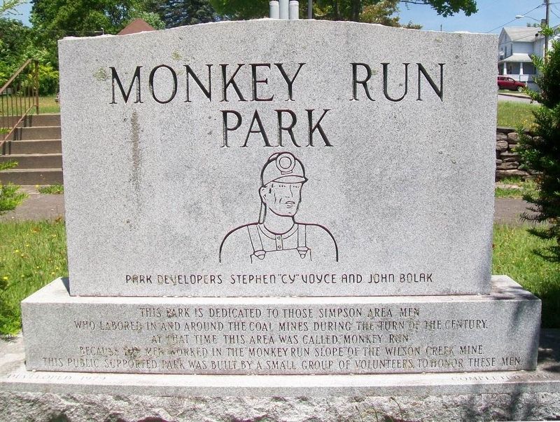
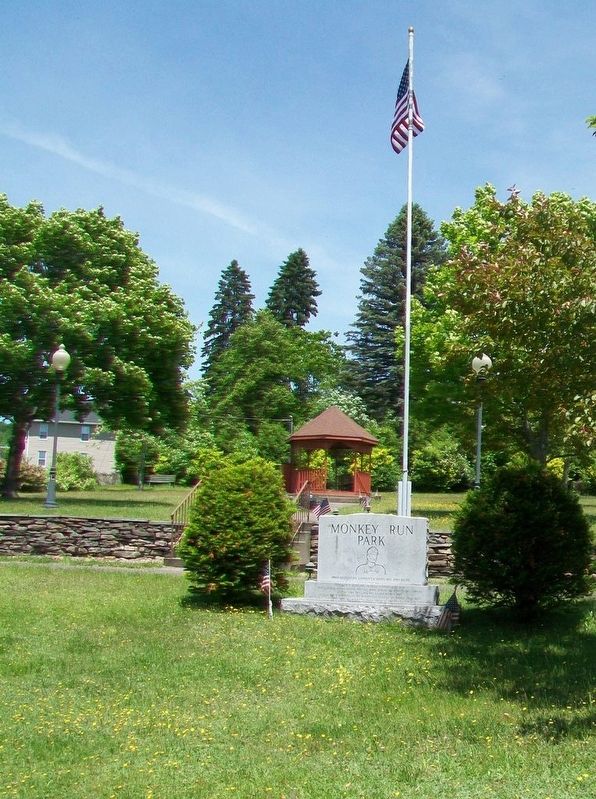
Monkey Run Park
Developed 1979 • Completed 1986
— Park Developers Stephen "Cy" Voyce and John Bolak —
This public supported park was built by a small group of volunteers to honor these men.
Topics. This historical marker is listed in these topic lists: Charity & Public Work • Environment • Industry & Commerce.
Location. 41° 35.788′ N, 75° 29.063′ W. Marker is in Simpson, Pennsylvania, in Lackawanna County. Marker is at the intersection of Main Street (Pennsylvania Route 171) and Froble Street, on the right when traveling north on Main Street. Touch for map. Marker is at or near this postal address: Monkey Run Park, Carbondale PA 18407, United States of America. Touch for directions.
Other nearby markers. At least 8 other markers are within 2 miles of this marker, measured as the crow flies. Simpson, Lackawanna County, Pa. (approx. 0.2 miles away); Veterans Memorial (approx. 0.2 miles away); Fell Township War Memorial (approx. half a mile away); Birthplace of Lt. Joseph R. Sarnoski (approx. 0.7 miles away); Gravity Railroad (approx. 1.6 miles away); Gravity Railroad Monument (approx. 1.6 miles away); Gravity Park and the Gravity Railroad Historic Site (approx. 1.6 miles away); Gravity Park (approx. 1.6 miles away). Touch for a list and map of all markers in Simpson.
Also see . . . Wilson Creek (Lackawanna County). (Submitted on June 12, 2017, by William Fischer, Jr. of Scranton, Pennsylvania.)
Credits. This page was last revised on June 12, 2017. It was originally submitted on June 12, 2017, by William Fischer, Jr. of Scranton, Pennsylvania. This page has been viewed 465 times since then and 34 times this year. Photos: 1, 2, 3. submitted on June 12, 2017, by William Fischer, Jr. of Scranton, Pennsylvania.


