Pittston in Luzerne County, Pennsylvania — The American Northeast (Mid-Atlantic)
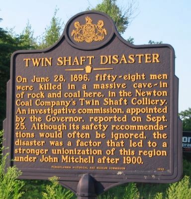
Twin Shaft Disaster
Erected 1992 by Pennsylvania Historical and Museum Commission.
Topics and series. This historical marker is listed in these topic lists: Industry & Commerce • Labor Unions. In addition, it is included in the Pennsylvania Historical and Museum Commission series list. A significant historical date for this entry is June 28, 1896.
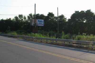
Location. 41° 20.493′ N, 75° 47.156′ W. Marker is in Pittston, Pennsylvania, in Luzerne County. Marker is at the intersection of North Main Street and Union Street, on the right when traveling north on North Main Street. Touch for map. Marker is in this post office area: Pittston PA 18640, United States of America. Touch for directions.
Other nearby markers. At least 8 other markers are within 2 miles of this marker, measured as the crow flies. Pittston Fort (approx. 0.8 miles away); a different marker also named Pittston Fort (approx. 0.8 miles away); Erie Railroad Co. v. Tompkins (approx. one mile away); Jenkins Fort (approx. one mile away); a different marker also named Jenkins' Fort (approx. one mile away); Sam Miceli Veterans' Memorial Park (approx. 1.1 miles away); The Greater Pittston Coal Miner (approx. 1.1 miles away); World War Memorial (approx. 1.2 miles away). Touch for a list and map of all markers in Pittston.
Also see . . .
1. Twin Shaft Disaster. A compilation of newspaper accounts of the disaster. (Submitted on August 19, 2008, by Craig Swain of Leesburg, Virginia.)
2. Twin Shaft Disaster - Behind the Marker. ExplorePAHistory.com (Submitted on July 20, 2011, by Mike Wintermantel of Pittsburgh, Pennsylvania.)
Credits. This page was last revised on June 16, 2016. It was originally submitted on August 19, 2008, by Craig Swain of Leesburg, Virginia. This page has been viewed 8,036 times since then and 99 times this year. Photos: 1, 2. submitted on August 19, 2008, by Craig Swain of Leesburg, Virginia.

