Guanajuato, Mexico — The Central Highlands (North America)
Miguel Hidalgo and the Owl's Hill
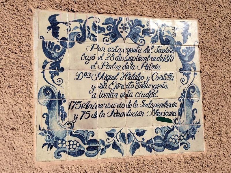
Miguel Hidalgo y la Cuesta del Tecolote
bajó el 28 de Septiembre de 1810
el Padre de la Patria
Don Miguel Hidalgo y Costilla
y su Ejército Insurgente,
a tomar esta ciudad.
175 Aniversario de la Independencia
y 75 de la Revolución Mexicana.
175th Anniversary of Mexican Independence
and 75th Anniversary of the Mexican Revolution
Topics. This historical marker is listed in these topic lists: Roads & Vehicles • Wars, Non-US. A significant historical date for this entry is September 28, 1810.
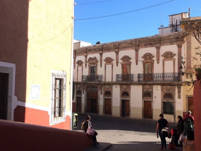
Location. 21° 0.837′ N, 101° 15.079′ W. Marker is in Guanajuato. Marker is on Calle del Campanero, on the right when traveling north. Touch for map. Marker is in this post office area: Guanajuato 36000, Mexico. Touch for directions.
Other nearby markers. At least 8 other markers are within walking distance of this marker. Euquerio Guerrero López (within shouting distance of this marker); House of Juan Antonio de Riano y Bárcenas (within shouting distance of this marker); El Puente de Nava (within shouting distance of this marker); The Temple of San Juan Bautista (within shouting distance of this marker); The Church of San Francisco (within shouting distance of this marker); House of Manuel Doblado (about 90 meters away, measured in a direct line); Vallejo Metals Processing Plant (about 90 meters away); The Route of Hidalgo (about 120 meters away). Touch for a list and map of all markers in Guanajuato.
Photographed By J. Makali Bruton, April 3, 2017
3. Miguel Hidalgo and the Owl's Hill Marker
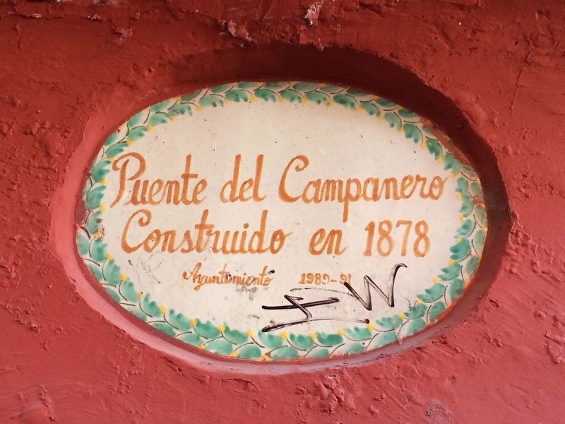
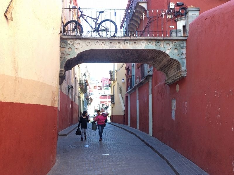
This view of the road is towards the south, up the hill. The bridge, known as the Bridge of the Bellringer (Puente del Campanero), was built in 1878 and would not have been present during the Mexican Independence Battle of Guanajuato in 1810.
Photographed By J. Makali Bruton, April 2, 2017
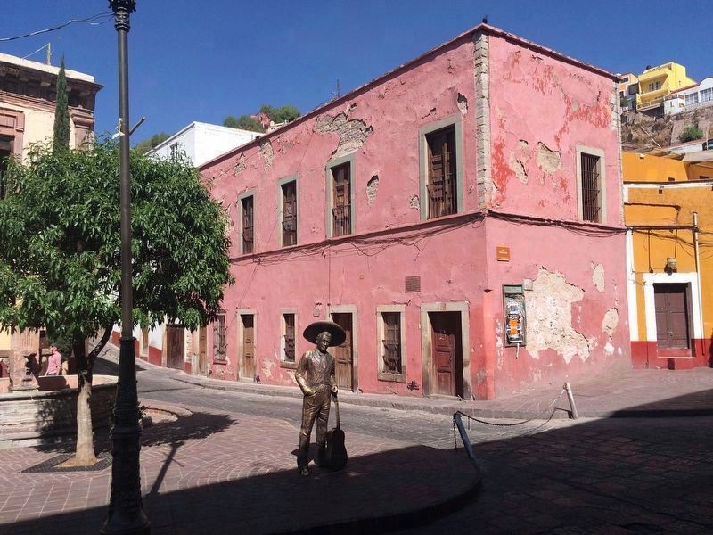
5. Nearby house and statue of Jorge Negrete
Some meters to the east of the marker is this statue and the birth house of one of Mexico's most famous singers, Jorge Negrete. The markers at the base of the statue and on the house read, respectively:
Jorge Negrete
“El Charro Cantor”
Fundacion Amigos del
Artista Guanajuatense, A.C.
1911-1953
English translation:
Jorge Negrete
“The Singing Charro”
Friends of the Artists of Guanajuato Foundation
1911-1953
La Asociacion
Nacional de Actores
a la memoria de su
inolvidable compañero
Jorge Negrete
30 de Nov. de 1911 – 5 de Dic. De 1953.
5 de diciembre de 1959.
English translation:
The National Actors Association
to the memory of our unforgettable friend
Jorge Negrete
November 30, 1911 – December 5, 1953.
December 3, 1959.
“El Charro Cantor”
Fundacion Amigos del
Artista Guanajuatense, A.C.
1911-1953
English translation:
Jorge Negrete
“The Singing Charro”
Friends of the Artists of Guanajuato Foundation
1911-1953
Nacional de Actores
a la memoria de su
inolvidable compañero
Jorge Negrete
30 de Nov. de 1911 – 5 de Dic. De 1953.
5 de diciembre de 1959.
The National Actors Association
to the memory of our unforgettable friend
Jorge Negrete
November 30, 1911 – December 5, 1953.
December 3, 1959.
Credits. This page was last revised on June 28, 2017. It was originally submitted on June 27, 2017, by J. Makali Bruton of Accra, Ghana. This page has been viewed 165 times since then and 14 times this year. Photos: 1, 2, 3, 4. submitted on June 27, 2017, by J. Makali Bruton of Accra, Ghana. 5. submitted on June 28, 2017, by J. Makali Bruton of Accra, Ghana.
