Paducah in Cottle County, Texas — The American South (West South Central)
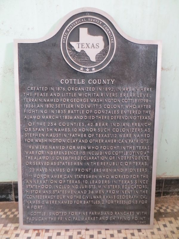
Cottle County
Of the 254 counties, 42 bear Indian, French or Spanish names. 10 honor such colonizers as Stephen F. Austin, "Father of Texas." 12 were named for Washington, Clay and other American patriots.
96 were named for men who fought in the Texas War for Independence (15, including Cottle, dying at the Alamo), signed the Declaration of Independence or served as statesmen in the Republic of Texas.
23 have names of frontiersmen and pioneers. 11 honor American Statesmen who worked for the annexation of Texas; 10 leaders in Texas since statehood, including jurists, ministers, educators, historians, statesman; and 36 men prominent in the Confederacy during the Civil War. 8 have geographical names. 2 were named for battles, 2 for trees, one for a fort.
Cottle is noted for fine farms and ranches, with Paducah the principal market and shipping point.
Erected 1964 by State Historical Survey Committee. (Marker Number 1074.)
Topics. This historical marker is listed in this topic list: Settlements & Settlers. A significant historical date for this entry is March 1, 1836.
Location. Marker has been reported missing. It was located near 34° 0.761′ N, 100° 18.102′ W. Marker was in Paducah, Texas, in Cottle County. Touch for map. Marker was in this post office area: Paducah TX 79248, United States of America. Touch for directions.
Other nearby markers. At least 7 other markers are within 11 miles of this location, measured as the crow flies. Cottle County Courthouse (about 400 feet away, measured in a direct line); The Gray and The Blue (about 500 feet away); Quanah Parker Trail (about 700 feet away); Gober-Barron-Williford House (approx. 0.3 miles away); Emmett Martin (approx. 0.6 miles away); Garden of Memories Cemetery (approx. 0.7 miles away); Chalk (approx. 10.3 miles away).
More about this marker. Marker should be on the NW corner of Highways 70 & 62, or 9th & Easley Streets, Paducah. But, it is in the basement storage room at the Cottle County Courthouse.
Credits. This page was last revised on June 30, 2017. It was originally submitted on June 30, 2017, by Bill Kirchner of Tucson, Arizona. This page has been viewed 345 times since then and 16 times this year. Photos: 1, 2. submitted on June 30, 2017, by Bill Kirchner of Tucson, Arizona.

