Pine Grove in Amador County, California — The American West (Pacific Coastal)
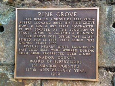
Pine Grove
Pine Grove post office was established July 12, 1856. First school was opened about 1853.
Several nearby mines, located in East Gold Belt, were worked during Gold Rush, prospected ever since.
Amador County Board of Supervisors in Amador County’s 125th anniversary year, 1979.
Erected 1979 by Amador County Board of Supervisors. (Marker Number 38.)
Topics and series. This historical marker is listed in this topic list: Settlements & Settlers. In addition, it is included in the California Historical Landmarks series list. A significant historical date for this entry is July 12, 1856.
Location. 38° 24.793′ N, 120° 39.51′ W. Marker is in Pine Grove, California, in Amador County. Marker is on State Highway 88 east of Irishtown Road, on the right when traveling east. Touch for map. Marker is at or near this postal address: 19840 State Highway 88, Pine Grove CA 95665, United States of America. Touch for directions.
Other nearby markers. At least 8 other markers are within 3 miles of this marker, measured as the crow flies. Hun'ge (approx. 1.1 miles away); Chaw'se (approx. 1.2 miles away); Petroglyphs (Rock Carvings) (approx. 1.2 miles away); Chaw Sé Roundhouse (approx. 1.2 miles away); Volcano Masonic Cave (approx. 2.4 miles away); Moose Milk (approx. 2½ miles away); St. George Hotel (approx. 2½ miles away); General Store (approx. 2½ miles away). Touch for a list and map of all markers in Pine Grove.
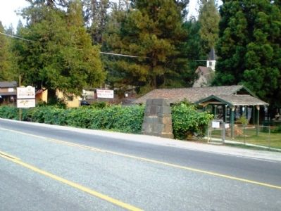
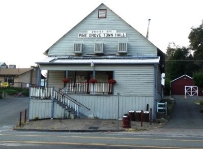
More about this marker. The monument/marker is next to the community park, and across the street from the town hall.
Regarding Pine Grove. In 1932 this site was designated California Historical Landmark No. 38 - Irishtown. This was an important stopping place for emigrants on their way to the southern mines. The first white settlers on this spot found it a 'city of wigwams,' and hundreds of mortars in the rocks testify that this was a favorite Indian camping ground.
Also see . . . Pine Grove Information. (Submitted on August 20, 2008, by Kevin W. of Stafford, Virginia.)
Credits. This page was last revised on January 22, 2024. It was originally submitted on August 20, 2008, by Andrew Ruppenstein of Lamorinda, California. This page has been viewed 1,913 times since then and 54 times this year. Photos: 1, 2, 3. submitted on August 20, 2008, by Andrew Ruppenstein of Lamorinda, California. • Kevin W. was the editor who published this page.


