Orchard Lake in Oakland County, Michigan — The American Midwest (Great Lakes)
Waiting Room and the "Wye"
at the Michigan Military Academy
To change directions, trolleys had to turn around.
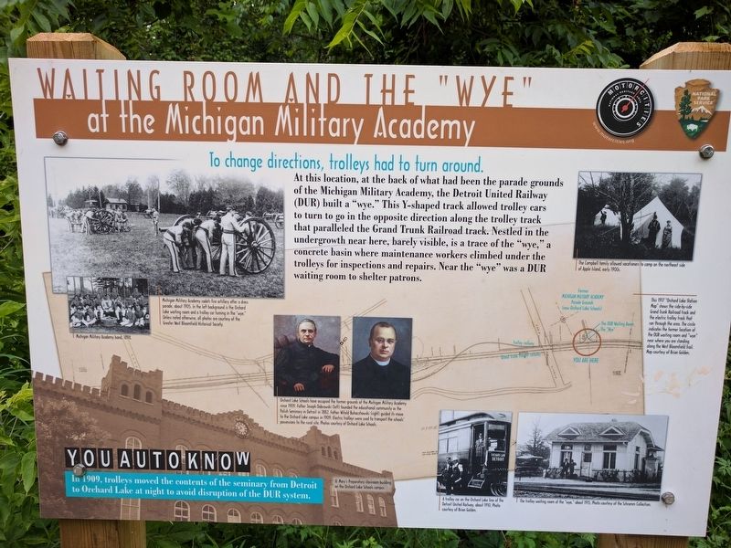
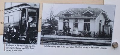
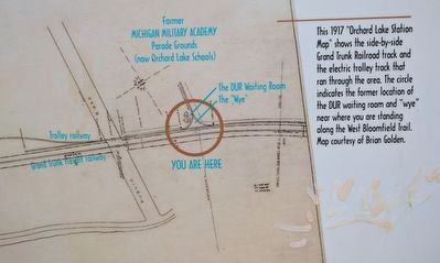
At this location, at the back of what had been the parade grounds of the Michigan Military Academy, the Detroit United Railway (DUR) built a "wye." This Y-shaped track allowed trolley cars to turn to go in the opposite direction along the trolley track that paralleled the Grand Trunk Railroad track. Nestled in the undergrowth near here, barely visible, is a trace of the "wye," a concrete basin where maintenance workers climbed under the trolleys for inspections and repairs. Near the "wye" was a DUR waiting room to shelter patrons.
You Auto Know
In 1909, trolleys moved the contents of the seminary from Detroit to Orchard Lake at night to avoid disruption of the DUR system.
Erected by MotorCities National Heritage Area, National Park Service.
Topics and series. This historical marker is listed in these topic lists: Education • Railroads & Streetcars. In addition, it is included in the MotorCities National Heritage Area series list. A significant historical year for this entry is 1909.
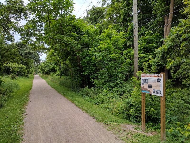
Location. 42° 35.635′ N, 83° 21.116′ W. Marker is in Orchard Lake, Michigan, in Oakland County. Marker is on the West Bloomfield Trail, a bicycling/hiking trail, about 445 feet north of Seminary Road and about 0.2 mile south of Orchard Lake Road Crossing #3. Touch for map. Marker is in this post office area: West Bloomfield MI 48324, United States of America. Touch for directions.
Other nearby markers. At least 8 other markers are within walking distance of this marker. Lakes and Attractions (about 500 feet away, measured in a direct line); Tracks Over Tracks (approx. 0.2 miles away); Orchard Lake Schools / Joseph Tarr Copeland (approx. 0.3 miles away); A Lake and a Trolley (approx. 0.4 miles away); Gateway to Nature (approx. half a mile away); In Good Company (approx. 0.6 miles away); Apple Island (approx. 0.6 miles away); "Motoring" to Pine Lake (approx. ¾ mile away). Touch for a list and map of all markers in Orchard Lake.
Also see . . . Michigan Military Academy. Wikipedia article about the Michigan Military Academy. (Submitted on July 7, 2017, by Joel Seewald of Madison Heights, Michigan.)
Photographed By Joel Seewald, July 2, 2017
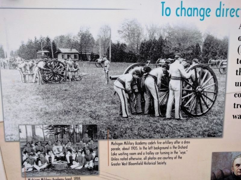
2. Upper Left and Middle Left Images
Upper left image: Michigan Military Academy cadets fire artillery after a dress parade, about 1905. In the left background is the Orchard Lake waiting room and a trolley car turning in the "wye." Unless noted otherwise, all photos are courtesy of the Greater West Bloomfield Historical Society. Middle left image: Michigan Military Academy band, 1898.
Photographed By Joel Seewald, July 2, 2017
4. Middle Images
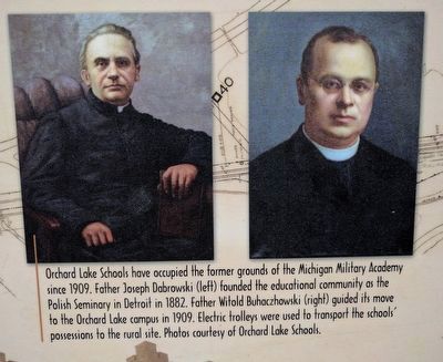
Orchard Lake Schools have occupied the former grounds of the Michigan Military Academy since 1909. Father Joseph Dabrowski (left) founded the educational community as the Polish Seminary in Detroit in 1882. Father Witold Buhaczhowski (right) guided its move to the Orchard Lake campus in 1909. Electric trolleys were used to transport the schools' possessions to the rural site. Photos courtesy of Orchard Lake Schools.
Photographed By Joel Seewald, July 2, 2017
6. Map (detail)
The 1917 "Orchard Lake Station Map" shows the side-by-side Grand Trunk Railroad track and the electric trolley track that ran through the area. The circle indicates the former location of the DUR waiting room and "wye" near where you are standing along the West Bloomgfield Trail. Map courtesy of Brian Golden.
Credits. This page was last revised on September 6, 2020. It was originally submitted on July 7, 2017, by Joel Seewald of Madison Heights, Michigan. This page has been viewed 265 times since then and 19 times this year. Photos: 1, 2, 3, 4, 5, 6, 7, 8. submitted on July 7, 2017, by Joel Seewald of Madison Heights, Michigan.
