Soda Springs in Nevada County, California — The American West (Pacific Coastal)
Soda Springs Hotel
Hwy 40 Scenic Bypass
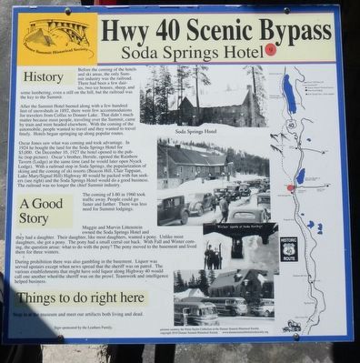
Inscription.
Before the coming of the hotels and ski areas, the only Summit industry was the railroad. There had been a few dairies, two ice houses, sheep and some lumbering, even a still on the hill, but the railroad was key to the Summit.
After the Summit Hotel burned along with a few hundred feet of snow sheds in 1892, there were few accommodations for travelers from Colfax to Donner Lake. That didn't much mater because most people, traveling over the Summit, came by train and were headed elsewhere. With the coming of the automobile, people wanted to travel and they wanted to travel freely. Hotels began springing up along popular routes.
Oscar Jones saw what was coming and took advantage. In 1924 he bought the land for the Soda Springs Hotel for $5,000. On December 10, 1927 the hotel opened to the public (top picture). Oscar's brother, Herstle, opened the Rainbow Tavern (Lodge) at the same time (and he would later open Nyack Lodge). With a railroad stop at Soda Springs, the popularization of skiing and the coming of ski resorts (Beacon Hill, Clair Tappaan, Lake Mary/Signal Hill) Highway 40 would be packed with fun seekers (see right) and the Soda Springs Hotel would do a good business. The railroad was no longer the chief Summit industry.
The coming of I-80 in 1960 took traffic away. People could go faster and farther. There was less need for Summit lodging.
Maggie and Marvin Littenstein owned the Soda Springs Hotel and they had a daughter. Their daughter, like most daughters, wanted a pony. Unlike most daughters, she got a pony. The pony had a small corral out back, With Fall and Winter coming, the question arose: what to do with the pony? The pony moved to the basement and live there for three winters.
During prohibition there was also gambling in the basement. Liquor was served upstairs except when news spread that the sheriff was on patrol. The various establishments that might have sold liquor along Highway 40 would call one another when the sheriff was on the prowl. Teamwork and intelligence helped business.
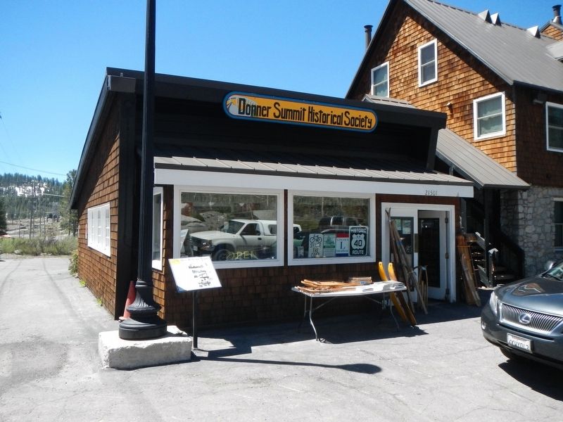
Stop in at the museum and meet our artifacts both living and dead.
Erected by Donner Summit Historical Society. (Marker Number 9.)
Topics and series. This historical marker is listed in these topic lists: Industry & Commerce • Roads & Vehicles. In addition, it is included in the Donner Summit Historical Society series list. A significant historical date for this entry is December 10, 1927.
Location. 39° 19.4′ N, 120° 22.766′ W. Marker is in Soda Springs, California, in Nevada County. Marker is on Donner Pass Road near Soda Springs Road, on the right when traveling east. Touch for map. Marker is at or near this postal address: 21501 Donner Pass Road, Soda Springs CA 95728, United States of America. Touch for directions.
Other nearby markers. At least 8 other markers are within one mile of this marker, measured as the crow flies. Lake Van Norden Dam (approx. 0.2 miles away); Soda Springs Store (approx. ¼ mile away); Summit Valley Native American Mortars (approx. half a mile away); Donner Summit Lodge (approx. 0.6 miles away); Central Sierra Snow Lab (approx. 0.6 miles away); Truckee Trail - Leaving Summit Valley (approx. 0.7 miles away); Emigrant Wagon Route (approx. ¾ mile away); Dutch Flat Donner Lake Wagon Road (approx. 1.1 miles away). Touch for a list and map of all markers in Soda Springs.
Credits. This page was last revised on December 4, 2021. It was originally submitted on July 8, 2017, by Barry Swackhamer of Brentwood, California. This page has been viewed 736 times since then and 70 times this year. Photos: 1, 2. submitted on July 8, 2017, by Barry Swackhamer of Brentwood, California.

