Orchard Lake in Oakland County, Michigan — The American Midwest (Great Lakes)
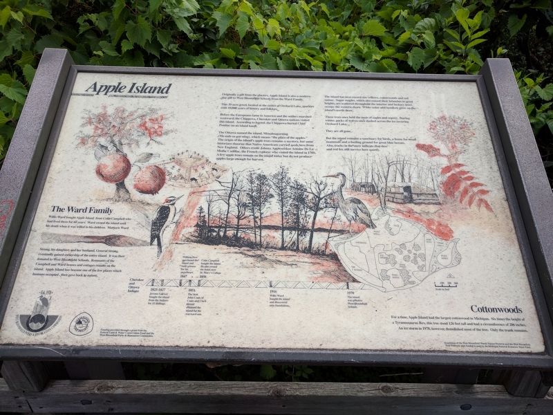
Apple Island
Originally a gift from the glaciers, Apple Island is also a modern-day gift to West Bloomfield Schools from the Ward Family.
This 35-acre-jewel, located at the center of Orchard Lake, sparkles with 10,000 years of history and folklore.
Before the Europeans came to America and the settlers marched westward, the Chippewa, Cherokee and Ottawa nations visited this island. According to legend, the Chippewa buried Chief Pontiac on an island knoll.
The Ottawa named the island, Menahsagorning (Me-nah-sa-gor-ning), which means "the place of the apples." The origin of the island's apple trees remains a mystery, but some historians theorize that Native Americans carried seeds here from New England. Others credit Johnny Appleseed or Antoine De La Mothe Cadillac, the French explorer who visited the island in 1701. A few apple trees remain on the island today but do not produce apples large enough for harvest.
The island has near-record size willows, cottonwoods and red sumac. Sugar maples, which also extend their branches to great heights, are scattered throughout the interior and hickory trees occupy the western shore. White cedar and hemlock grow on the island's north shore.
These trees once held the nests of eagles and osprey. During winter, packs of wolves once dashed across the ice covering Orchard Lake.
They are all gone.
But the island remains a sanctuary for birds, a home for small mammals and a feeding ground for great blue herons. Also, tracks in the snow indicate that deer and red fox still survive here quietly.
The Ward Family
Willis Ward bought Apple Island from Colin Campbell who had lived there for 60 years. Ward owned the island until his death when it was willed to his children. Marjorie Ward Strong, his daughter, and her husband, General Strong, eventually gained ownership of the entire island. It was then donated to West Bloomfield Schools. Remnants of the Campbell and Ward houses and cottages remain on the island. Apple Island has become one of the few places which humans occupied , then gave back to nature.
Cottonwoods
For a time, Apple Island had the largest cottonwood in Michigan. Six times the height of a Tyrannosaurus Rex, this tree stood 126-feet tall and had a circumference of 206 inches. An ice storm in 1978, however, demolished most of the tree. Only the trunk remains.
Cherokee and Ottawa Indians
1825-1827 Jerome Galway bought the island from the Indians for 11 shillings.
1847 William Dow purchased the island and built a house for his sweetheart.
1851 The Scot John Coats
of Coats and Clark thread obtained the island for his wayward son.
1856 Colin Campbell bought the island. He also owned the hotel, now St. Mary's College
1916 Willis Ward bought the island and discovered nine foundations.
1970 The island was gifted to West Bloomfield Schools.
Funding provided through a grant from the Federal Land & Water Conservation Fund and the West Bloomfield Parks & Recreation Commission.
Acquisition of the West Bloomfield Woods Nature Preserve and the West Bloomfield Trail Network were funded in part by the Michigan Natural Resources Trust Fund.
Erected by West Bloomfield Parks & Recreation Commission.
Topics. This historical marker is listed in these topic lists: Environment • Native Americans • Settlements & Settlers. A significant historical year for this entry is 1701.
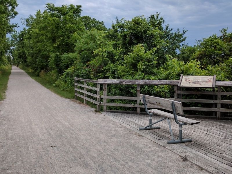
Location. 42° 35.149′ N, 83° 21.37′ W. Marker is in Orchard Lake, Michigan, in Oakland County. Marker can be reached from Orchard Lake Road when traveling north. Marker is on the West Bloomfield Trail, a bicycling/hiking trail, about 275 feet south of Orchard Lake Road crossing #2. Orchard Lake Crossing #2 is about 230 feet east of the intersection of Indian Trail and Orchard Lake Road. Touch for map. Marker is in this post office area: West Bloomfield MI 48323, United States of America. Touch for directions.
Other nearby markers. At least 8 other markers are within walking distance of this marker. Gateway to Nature (about 400 feet away, measured in a direct line); Waiting for the Trolleys (approx. ¼ mile away); The Orchard Lake Museum (approx. ¼ mile away); a different marker also named Apple Island (approx. ¼ mile away); Conglomerate Boulder (approx. ¼ mile away); Green School Bell (approx. ¼ mile away); Drawn by Water (approx. ¼ mile away); Tracks Over Tracks (approx. 0.4 miles away). Touch for a list and map of all markers in Orchard Lake.
Related marker. Click here for another marker that is related to this marker. Another marker titled Apple Island.
Credits. This page was last revised on June 29, 2021. It was originally submitted on July 9, 2017, by Joel Seewald of Madison Heights, Michigan. This page has been viewed 746 times since then and 113 times this year. Last updated on May 28, 2021, by J.T. Lambrou of New Boston, Michigan. Photos: 1, 2. submitted on July 9, 2017, by Joel Seewald of Madison Heights, Michigan. • Mark Hilton was the editor who published this page.

