Near Park Valley in Box Elder County, Utah — The American Mountains (Southwest)
Watercress
Inscription.
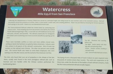
Following the abandonment of Terrace, Watercress served as a principle freight and siding for area ranchers early in the twentieth century. Railroad documents record the existence of corrals, a barn, a stock pond, a water tank, and a loading platform. Water was provided by rerouting the Terrace aqueduct from springs to the north. Watercress was abandoned around 1940.
The Transcontinental Railroad unified the United States by connecting east coast and west. Tracks heading east from Sacramento were laid by the Central Pacific Railroad beginning in 1863. It was built not with bulldozers but by men with picks, shovels, and dynamite. The railroad created jobs for immigrants and settlers and would bring even more economic benefits by opening up the west.
There were inevitable conflicts as more and more settlers moved west, settling on lands that had been occupied by Native Americans. Cultures came into contact in all aspects of the railroad's construction. Nine of every ten workers on the railroad were Chinese. The other ten percent were usually Irish. The Central Pacific also relied on some black employees who were seeking a new life after slavery and the turmoil of the American Civil War.
The Irish, who faced their own set of prejudices in the climate of the late 1800s, usually were found in the more prestigious railroad jobs such as foreman, and iron handler while the Chinese workers preformed the backbreaking labor.
The laying of over a thousand miles of track in about six years required many thousands of workers (more than 10,000). The work and cooperation of all these men, under the direction of the leaders of each railroad company, made the first transcontinental railroad actually happen.
Erected by Department of the Interior, Bureau of Land Management.
Topics and series. This historical marker is listed in these topic lists: Asian Americans • Railroads & Streetcars. In addition, it is included in the Transcontinental Railroad series list.
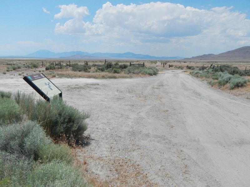
Location. 41° 29.25′ N, 113° 33.48′ W. Marker is near Park Valley, Utah, in Box Elder County. Marker is on Transcontinental Railroad Back Country Byway, on the left when traveling west. Touch for map. Marker is in this post office area: Park Valley UT 84329, United States of America. Touch for directions.
Other nearby markers. At least 7 other markers are within 12 miles of this marker, measured as the crow flies. Terrace (approx. 2.4 miles away); Walden Siding (approx. 2˝ miles away); Terrace Cemetery (approx. 3 miles away); Old Terrace (approx. 3.6 miles away); Red Dome Siding (approx. 6.7 miles away); Bovine (approx. 8.2 miles away); Matlin (approx. 11.4 miles away).
More about this marker. The Transcontinental Railroad Back Country Byway is a 90 mile dirt/gravel track on top of or beside the old Central Pacific Rail Road grade between Old Lucin and Promontory Summit. Other than markers designating old station and sidings there are few, if any, road signs identifying any of the side roads. Any other road names or numbers use on this marker page have been taken Google Maps which identifies the Byway variously as Golden Spike Loop Road, Old Railroad Grade Road, Salt Wells Road, etc. Neither are there any mileage posts, though one could do the arithmetic using the "Mile ... from San Francisco" on the markers to determine distances. Nor is there any mail delivery, so no street addresses either.
Credits. This page was last revised on July 13, 2017. It was originally submitted on July 13, 2017, by Barry Swackhamer of Brentwood, California. This page has been viewed 300 times since then and 18 times this year. Photos: 1, 2. submitted on July 13, 2017, by Barry Swackhamer of Brentwood, California.

