Flower Mound in Denton County, Texas — The American South (West South Central)
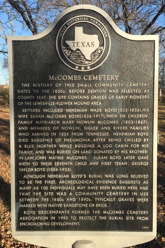
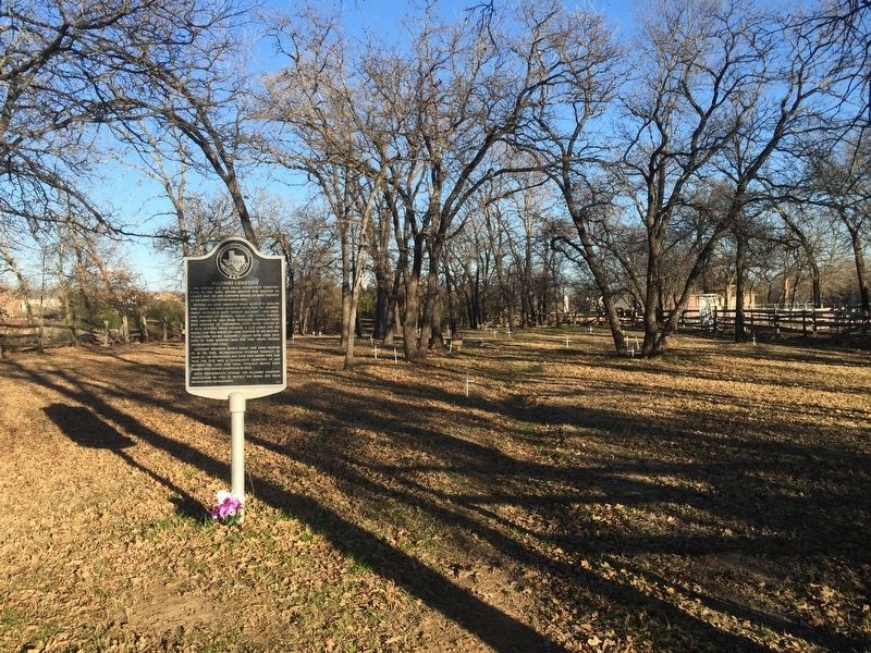
McCombs Cemetery
Settlers included Nehemiah Wade Boyd (1823-1856), his wife Susan McCombs Boyd (1824-1917), their six children, family matriarch Mary Nowlin McCombs (1803-1867), and members of Nowlin, Sigler and Rivers families who arrived in 1855 from Tennessee. Nehemiah Boyd died suddenly of pneumonia after being chilled by a blue norther while building a log cabin for his family, and was buried on land donated by his brother-in-law, John Mathis McCombs. Susan Boyd later gave birth to their seventh child and first Texan, George Taylor Boyd (1856-1933).
Although Nehemiah Boyd's burial was long believed to be the first, archeological evidence suggests as many as 100 individuals may have been buried here and that the site was a community cemetery in use between the 1850s and 1890s. Typically graves were marked with native sandstone or brick.
Boyd descendants formed the McCombs Cemetery Association in 1990 to protect the burial site from encroaching development.
Erected 1997 by Texas Historical Commission. (Marker Number 11846.)
Topics. This historical marker is listed in these topic lists: Cemeteries & Burial Sites • Settlements & Settlers.
Location. 33° 1.725′ N, 97° 2.23′ W. Marker is in Flower Mound, Texas, in Denton County. Marker is on Wager Road south of St Gallen Lane, on the right when traveling north. Touch for map. Marker is in this post office area: Flower Mound TX 75028, United States of America. Touch for directions.
Other nearby markers. At least 8 other markers are within 4 miles of this marker, measured as the crow flies. The Peters Colony (approx. 1.3 miles away); Flower Mound Presbyterian Church (approx. 1.4 miles away); Flower Mound (approx. 2 miles away); McCurley Cemetery (approx. 2˝ miles away); Bethel Community (approx. 2.6 miles away); Lane Chapel C.M.E. Church (approx. 2.8 miles away); Smith Cemetery (approx. 3.3 miles away); Lewisville Prehistoric Site (approx. 3.8 miles away). Touch for a list and map of all markers in Flower Mound.
Credits. This page was last revised on July 17, 2017. It was originally submitted on July 15, 2017, by QuesterMark of Fort Worth, Texas. This page has been viewed 555 times since then and 71 times this year. Photos: 1, 2. submitted on July 15, 2017, by QuesterMark of Fort Worth, Texas. • Bernard Fisher was the editor who published this page.

