Near Downey in Bannock County, Idaho — The American West (Mountains)
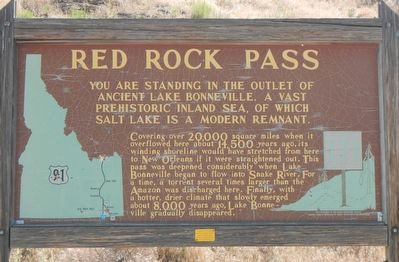
Red Rock Pass
Covering over 20,000 square miles when it overflowed here about 14,500 years ago, its winding shoreline would have stretched from here to New Orleans if it were straightened out. This pass was deepened considerably when Lake Bonneville began to flow into Snake River. For a time, a torrent several times larger than the Amazon was discharged here. Finally, with a hotter drier climate that slowly emerged about 8,000 years ago, Lake Bonneville gradually disappeared.
Erected by Idaho Department of Transportation. (Marker Number 171.)
Topics and series. This historical marker is listed in these topic lists: Natural Features • Paleontology • Waterways & Vessels. In addition, it is included in the Idaho State Historical Society series list.
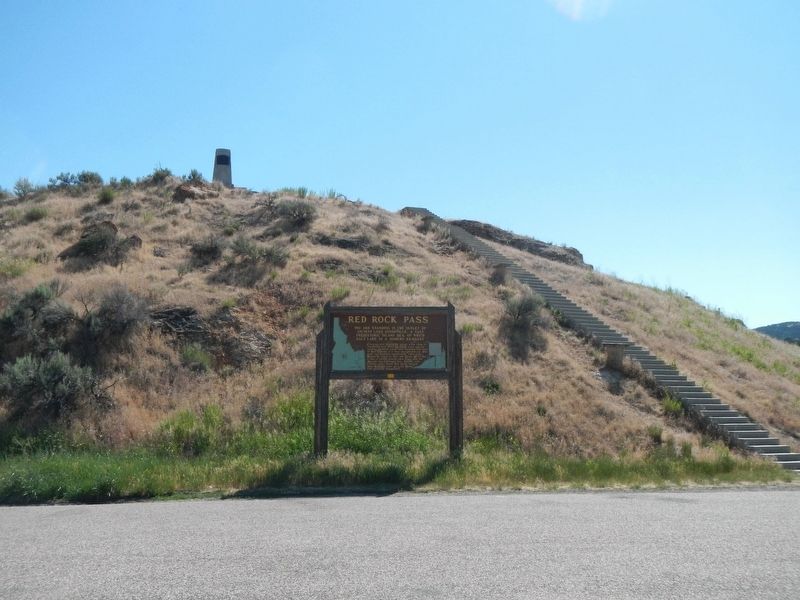
Location. 42° 21.258′ N, 112° 2.964′ W. Marker is near Downey, Idaho, in Bannock County. Marker is on U.S. 91 at milepost 30.2 near South Old Oxford Highway, on the right when traveling north. Touch for map. Marker is at or near this postal address: 28136 US Highway 91, Downey ID 83234, United States of America. Touch for directions.
Other nearby markers. At least 8 other markers are within 16 miles of this marker, measured as the crow flies. Captain Jefferson Hunt, Soldier, Pioneer, Churchman (within shouting distance of this marker); Pioneer Cabin (approx. 6˝ miles away); Settlement of Oxford (approx. 6.8 miles away); Stage Coach Station (approx. 11 miles away); Bidwell/Bartleson Trail - Small Brook (approx. 12.6 miles away); The Shoshone (approx. 15.7 miles away); The Earth Will Remember (approx. 15.7 miles away); A Battle Becomes a Massacre (approx. 15.7 miles away). Touch for a list and map of all markers in Downey.
Also see . . . The Lake Bonneville Flood -- Idaho State University. Lake Bonneville was the precursor of the Great Salt Lake. The shorelines of this ancient lake can be seen on the higher slopes of the Wasatch Mountains, more than 984 feet above the present level of the Great Salt Lake. Before the catastrophic Bonneville flood, Lake Bonneville covered an area of more than 19,691 square miles. (Submitted on July 19, 2017, by Barry Swackhamer of Brentwood, California.)

Photographed By Barry Swackhamer, June 21, 2017
3. Red Rock Pass Geological Site plaque
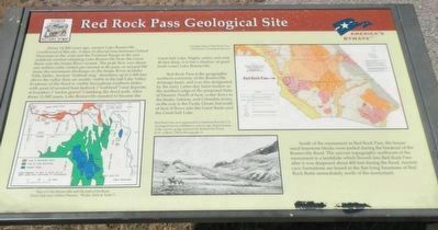
About 14,500 years ago, ancient Lake Bonneville overflowed at this site. A dam of alluvial fans between Oxford Mountain to the west and the Portneuf Range to the east suddenly eroded releasing Lake Bonneville from the Great Basin into the Snake River system. The peak flow was about one million cubic meters per second at the pass, or around 500 times the maximum discharge on the Snake River at Idaho Falls, Idaho. Ancient "bathtub ring" shorelines up to 1,000 feet above the valley floor are readily visible in the Salt Lake Valley. Evidence of the flood is visible throughout southern Idaho with areas of scoured bare bedrock ("scabland") and deposits of boulders ("melon gravel") marking the flood path. After about 11,000 years, Lake Bonneville receded to become the Great Salt Lake. Highly saline and only 40 feet deep, it is but a shadow of giant fresh-water Lake Bonneville.
Red Rock Pass is the geographic northern extremity of the Bonneville drainage basin, and was also designated by the early Latter-day Saints leaders as the northern edge of the proposed State of Deseret. North of here, water flows to the Snake, Salmon, and Columbia rivers, on the way to the Pacific Ocean, but south of here it flows into the Great Basin and the Great Salt Lake.
South of the monument in Red Rock Pass, the house-sized limestone blocks were jostled during the breakout of the Bonneville flood. The uneven topography northwest of the monument is a landslide with flowed into Red Rock Pass after it was deepened about 400 feet during the flood. Ancient cave formations are found in the flat-lying limestone of Red Rock Butte immediately north of the monument.
Captions: (bottom left) Map of Lake Bonneville and the path of its flood.; (bottom center) Red Roak Pass as it appeared in a woodcut that the U.S. Geological Survey published a century ago. Rapid erosion of the narrow gorge released the Bonneville Flood.; (upper right) Geological Map of the Red Rock Pass area.
Credits. This page was last revised on July 19, 2017. It was originally submitted on July 19, 2017, by Barry Swackhamer of Brentwood, California. This page has been viewed 804 times since then and 162 times this year. Photos: 1, 2, 3. submitted on July 19, 2017, by Barry Swackhamer of Brentwood, California.

