Near Wayan in Caribou County, Idaho — The American West (Mountains)
Tincup Creek
Inscription.
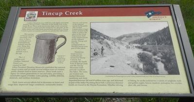
Caribou Mountain rises 9,800 feet with alpine snowfields feeding Tincup Creek, a tributary to the South Fork of the Snake River. Placer gold discoveries high on the mountain in 1871 led to a gold rush that lasted for two decades. In the 1880s sheep and cattle herds passed back and forth in Tincup Creek to graze on summer pasture and activity that still occurs.
The naming of Tincup Creek is uncertain. One story is that a young girl was kidnapped by Indians and the only thing they wanted in trade back to her parents was a tin cup.
The 1.1 million-acre Caribou National Forest was created in 1907 when President Theodore Roosevelt established the national forest system and set aside several million acres of western public domain land as forest reserves. The lands were a legacy for future generations to use and enjoy, providing a sustainable supply of timber, water, grazing, wildlife, fisheries, minerals, and outdoor recreation.
Early forest service efforts led to decreases in forest and range fires, improved range conditions, sustainable timber harvest, and access to the national forests for the public. The Civilian Conservation Corps (CCC), formed in the 1930s to relieve the effects of the Great Depression, built many improvements on the national forests. Tincup and Pine Bar campgrounds in Tincup Canyon were part of this effort.
Numerous forest service trailheads are located in Tincup Canyon. For example, the South Fork of Tincup Creek and the Tincup Mountain trails provide excellent day hikes. The rocks are twisted and faulted Mesozoic sandstone and shale deposits between 260 and 65 million years ago, and deformed as part of the Idaho-Wyoming thrust belt. Cretaceous dinosaur fossils are found in the Wayan Formation. Whether driving or hiking, be on the lookout for a variety of songbirds, bald and golden eagles, beaver, muskrat, porcupine, fox, coyotes, deer, elk, and moose.
Topics and series. This historical marker is listed in this topic list: Environment. In addition, it is included in the Civilian Conservation Corps (CCC), and the Former U.S. Presidents: #26 Theodore Roosevelt series lists. A significant historical year for this entry is 1871.
Location. 42° 58.464′ N, 111° 11.292′ W. Marker is near Wayan, Idaho, in Caribou County. Marker is on State Highway 34 near Tincup Road, on the left when traveling west. Touch for map. Marker is in this post office area: Wayan ID 83285, United States of America. Touch for directions.
Other nearby markers. At least 8 other markers are within 12 miles of this marker, measured as the crow flies. Pioneer Historic Byway (approx. 5.9 miles away); Grays Lake Valley (approx. 9.6 miles away); Cariboo Mountain (approx. 9.6 miles away); John Grey (approx. 9.6 miles away); The Baker Cabin (approx. 9.7 miles away in Wyoming); First Post Office (approx. 10.1 miles away in Wyoming); Agriculture under the Stars (approx. 11.6 miles away in Wyoming); Wyoming's Wildlife (approx. 11.6 miles away in Wyoming). Touch for a list and map of all markers in Wayan.
Credits. This page was last revised on August 1, 2020. It was originally submitted on July 23, 2017, by Barry Swackhamer of Brentwood, California. This page has been viewed 479 times since then and 31 times this year. Photos: 1, 2. submitted on July 23, 2017, by Barry Swackhamer of Brentwood, California.

