Near Cullman in Cullman County, Alabama — The American South (East South Central)
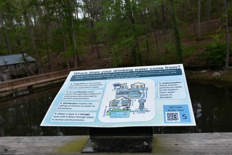
Where does your drinking water come from?
At Clarkson Covered Bridge, your drinking water comes from Lake Catoma. Following a drop of water from the source through the treatment process and eventually to the faucet.
1. Coagulation is the process that removes dirt and particles that are suspended in water.
2. Sedimentation allows heavier particles to settle to the bottom. Clear water moves to filtration.
3. During filtration water passes through filters (layers of sand, gravel and charcoal) to remove small particles.
4. Disinfection involves the adding of chlorine to water to kill bacteria.
5. Water is kept in a storage tank until if flows through pipes to homes and business.
Topics. This historical marker is listed in these topic lists: Environment • Waterways & Vessels.
Location. 34° 12.448′ N, 86° 59.452′ W. Marker is near Cullman, Alabama, in Cullman County. Marker is on County Road 1043. Located in Clarkson Covered Bridge Park. Touch for map. Marker is at or near this postal address: 1240 Co Rd 1043, Cullman AL 35057, United States of America. Touch for directions.
Other nearby markers. At least 8 other markers are within 2 miles of this marker, measured as the crow flies. Birds of Alabama (here, next to this marker); Alabama's Aquatic Biodiversity (here, next to this marker); What happens to my wastewater? (here, next to this marker); Alabama's Physical Diversity (within shouting distance of this marker); Land-Use and Water Quality (within shouting distance of this marker); Clarkson Covered Bridge (within shouting distance of this marker); Streight’s Raid (approx. 1.9 miles away); a different marker also named Streight’s Raid (approx. 1.9 miles away). Touch for a list and map of all markers in Cullman.
Also see . . . Clarkson Covered Bridge Park. One of Cullman's most well known attractions and historically rich sites, Clarkson Covered Bridge, originally built in 1904, and was once used regularly by farmers and travelers to cross Crooked Creek, the weatherworn bridge is now closed to traffic, the centerpiece of a park built in period fashion to showcase the bridge and its historical significance. (Submitted on July 25, 2017, by Sandra Hughes Tidwell of Killen, Alabama, USA.)
Credits. This page was last revised on December 24, 2021. It was originally submitted on July 25, 2017, by Sandra Hughes Tidwell of Killen, Alabama, USA. This page has been viewed 328 times since then and 42 times this year. Photo 1. submitted on July 25, 2017, by Sandra Hughes Tidwell of Killen, Alabama, USA. • Bill Pfingsten was the editor who published this page.
