Sumpter in Baker County, Oregon — The American West (Northwest)
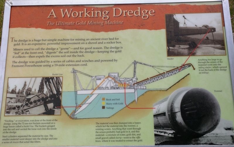
A Working Dredge
The Ultimate Gold Mining Machine
Inscription.
The dredge is a huge but simple machine for mining an ancient river bed for gold. It is an expensive, powerful improvement on the shovel and rocker box.
Miners used to call the dredge a "goose"---and for good reason. The dredge is "fed" at the front end, "digests" the soil inside the dredge---keeping the gold it collects- then expelling the excess soil out the back.
The dredge was guided by a series of cables and winches and powered by Fremont Powerhouse using a 19-mile extension cord.
"Feeding," or excavation was done at the front end of the dredge using 72 one ton buckets mounted on a huge boom, called a bucket line. The buckets gouged into the soil and carried the loose rock into the inside of the dredge.
Steel cylinders separated the material by size. The smaller material went deeper into the dredge, and into a series of sluices that acted like filters.
The material was then dumped into a hopper, which fed the material into a trommel, a rotating screen. Anything that went through the screen probably had gold in it, and this material---a mixture of water, gold, dirt, and small gravel called slurry---went to the riffle boxes, where it was treated to extract the gold.
Anything too large to go through the screen of the trommel went into the tailing stacker, which spewed it out of the back of the dredge as tailings.
Erected by Oregon State Parks.
Topics. This historical marker is listed in this topic list: Industry & Commerce. A significant historical year for this entry is 1930.
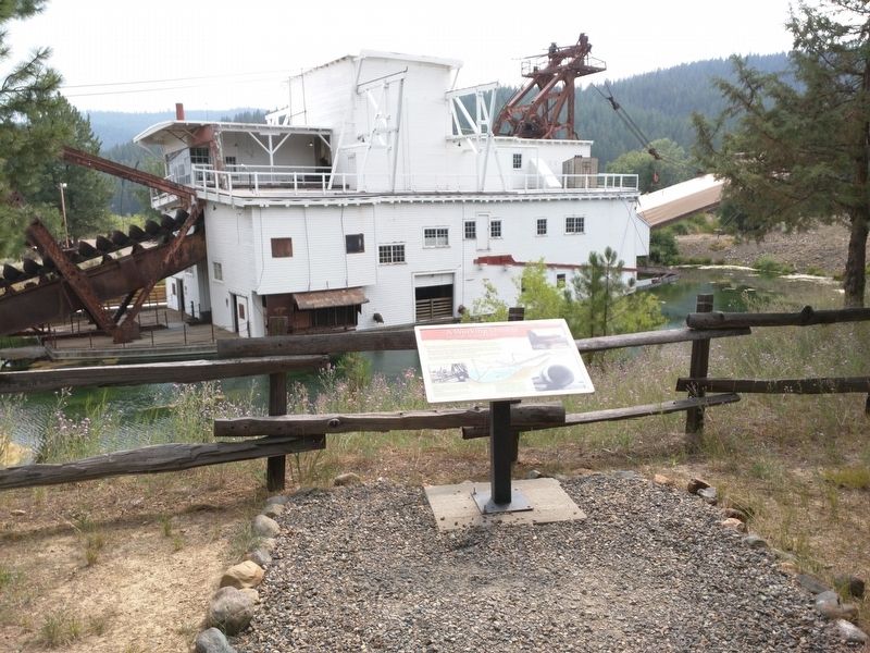
Location. 44° 44.572′ N, 118° 12.239′ W. Marker is in Sumpter, Oregon, in Baker County. Marker can be reached from Austin Street. The marker and dredge are located at the Sumpter Valley Dredge State Heritage Area. This marker is located along the short interpretive trail that circles the dredge. Touch for map. Marker is in this post office area: Sumpter OR 97877, United States of America. Touch for directions.
Other nearby markers. At least 6 other markers are within walking distance of this marker. Floating in its own pond (within shouting distance of this marker); Anchoring the Dredge (within shouting distance of this marker); A Tale of the Tailings (about 300 feet away, measured in a direct line); A Golden History (about 400 feet away); Site of Bank of Sumpter (approx. 0.3 miles away); Sumpter, Oregon (approx. 0.4 miles away).
More about this marker. There are several additional markers and interpretive signs along the trails surrounding the dredge and inside the dredge itself.

Photographed By Don Hann, August 7, 2017
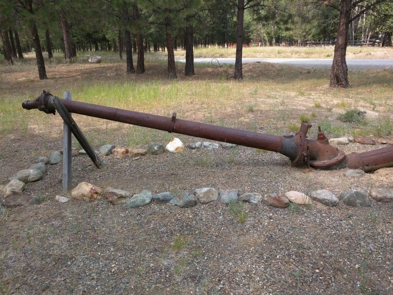
3. Hydraulic Giant
Other historic mining equipment is on display in the park. This is a hydraulic giant used like a giant garden hose to blast away hillsides of gold bearing alluvial deposits. Using hydraulic giants was the most efficient way of mining free gold in alluvial deposits before the development of the dredge around 1900.
Credits. This page was last revised on August 25, 2017. It was originally submitted on August 12, 2017, by Don Hann of Canyon City, Oregon. This page has been viewed 159 times since then and 13 times this year. Photos: 1, 2, 3. submitted on August 12, 2017, by Don Hann of Canyon City, Oregon. • Syd Whittle was the editor who published this page.

