History of St. Catherine Street
Natchez Trails
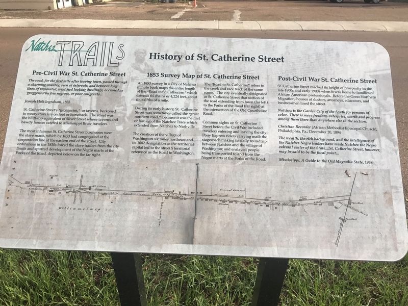
The road, for the first mile, after leaving town, passed through a charming country, seen at intervals, and between long lines of unpainted, wretched looking dwellings, occupied as 'groggeries' by free negroes, or poor emigrants...
Joseph Holt Ingraham, 1835
St. Catherine Street's "groggeries," or taverns, beckoned to weary travelers on foot or horseback. The street was the bluff-top equivalent of Silver Street whose taverns and bawdy houses catered to Mississippi River travelers.
The most infamous St. Catherine Street businesses were the slave marts, which by 1853 had congregated at the corporation line at the eastern end of the street. City ordinances in the 1830s forced the slave traders from the city limits and spurred the development of the Negro marts at the Forks of the Road, depicted below on the far right.
An 1853 survey in a City of Natchez minute book maps the entire length of the "Road to St. Catherine," which extends 64 chains or 4,224 feet, about four-fifths of a mile.
During its early history, St. Catherine Street was sometimes called "great northern road," because it was the first or last leg of the Natchez Trace which extended from Natchez to Nashville.
The
creation of the village of Washington six miles northeast and its 1802 designation as the territorial capital led to the street's territorial references as the Road to Washington.The "Road to St. Catherine" refers to the creek and race track of the same name. The city eventually designated as St. Catherine Street that section of the road extending from town (far left) to the Forks of the Road (far right) at the intersection of the Old Courthouse Road.
Common sights on St. Catherine Street before the Civil War included travelers entering and leaving the city; Pony Express riders carrying mail; the stagecoach making its daily roundtrip between Natchez and the village of Washington; and enslaved people being transported to and from the Negro marts at the Forks of the Road
St. Catherine Street reached its height of prosperity in the late 1800s and early 1900s when it was home to families of African American professionals. Before the Great Northern Migration, houses of doctors, attorneys, educators and businessmen lined the street.
Natchez is the Garden City of the South for persons of color. There is more freedom, enterprise, worth and progress among them there than anywhere else in the section.
Christian Recorder[African Methodist Episcopal Church], Philadelphia, Pa., December 20, 1894
The wealth, the rich background, and the intelligence of Natchez Negro leaders have made Natchez the Negro cultural center of the State.... St. Catherine Street, however, may be said to be the focal point....
Mississippi, A Guide to the Old Magnolia State, 1938
Erected by City Of Natchez.
Topics and series. This historical marker is listed in these topic lists: Roads & Vehicles • Settlements & Settlers. In addition, it is included in the African Methodist Episcopal (AME) Church, and the Mississippi - Natchez Trails series lists.
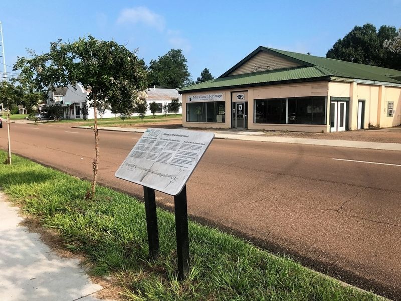
Location. 31° 33.366′ N, 91° 23.105′ W. Marker is in Natchez, Mississippi, in Adams County. Marker is on St. Catherine Street west of Liberty Road, on the left when traveling west. Touch for map. Marker is in this post office area: Natchez MS 39120, United States of America. Touch for directions.
Other nearby markers. At least 8 other markers are within walking distance of this marker. America's Domestic "Slave" Trading Routes To The Deep South (a few steps from this marker); Forks of the Road (within shouting distance of this marker); a different marker also named Forks of the Road (about 300 feet away, measured in a direct line); Ex-"Slaves" as U.S. Civil War Soldiers in the Mississippi Valley Campaign (about 400 feet away); Forks of the Road Historical Site
Credits. This page was last revised on January 26, 2024. It was originally submitted on August 13, 2017, by Cajun Scrambler of Assumption, Louisiana. This page has been viewed 836 times since then and 111 times this year. Photos: 1, 2. submitted on August 13, 2017.

