Poolesville in Montgomery County, Maryland — The American Northeast (Mid-Atlantic)
The Old Bank Building
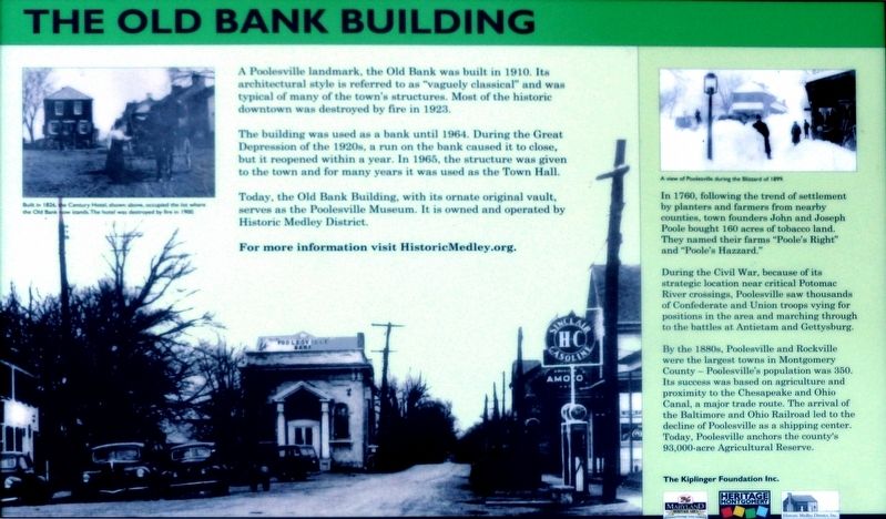
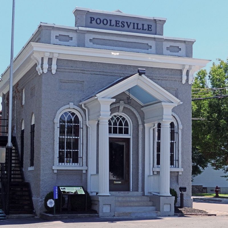
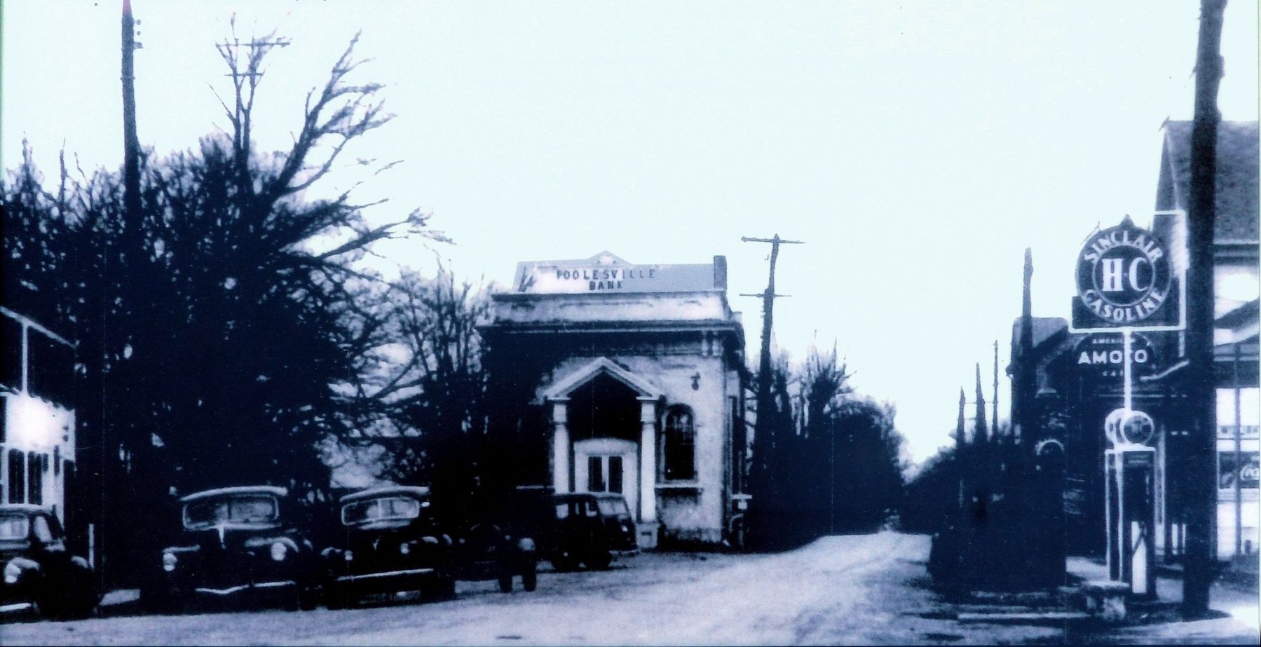
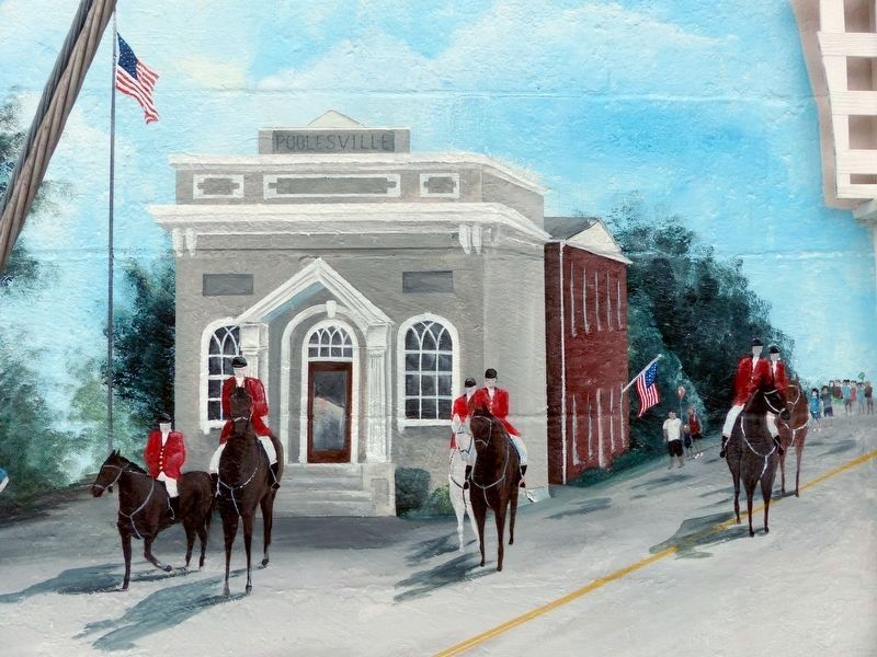
The Building was used as a bank until 1964. During the Great Depression of the 1920s, a run on the bank caused it to close, but it reopened within a year. In 1965, the structure was given to the town and for many years it was used as the Town Hall.
Today, the Old Bank Building, with its ornate original vault, serves as the Poolesville Museum. It is owned and operated by Historic Medley District.
For more information visit HistoricMedley.org.
In 1760, following the trend of settlement by planters and farmers from nearby counties, town founders John and Joseph Poole bought 160 acres of tabacco land. They named their farms “Poole's Right” and “Poole's Hazzard.”
During the Civil War, because of its strategic location near critical Potomac River crossings, Poolesville saw thousands of Confederate and Union troops vying for positions in the area and marching through to the battles of Antietam and Gettysburg.
By the 1880s, Poolesville and Rockville were the largest towns in Montgomery County — Poolesville's population was 350. Its success was based on agriculture and proximity to the Chesapeake and Ohio Canal, a major trade route. The arrival of the Baltimore and Ohio Railroad led to the decline of Poolesville as a shipping center. Today, Poolesville anchors the county's 93,000-acre Agricultural Reserve.
Topics. This historical marker is listed in this topic list: Industry & Commerce. A significant historical year for this entry is 1910.
Location. 39° 8.757′ N, 77° 24.959′ W. Marker is in Poolesville, Maryland, in Montgomery County. Marker can be reached from Fisher Avenue. Touch for map. Marker is at or near this postal address: 19933 Fisher Avenue, Poolesville MD 20837, United States of America. Touch for directions.
Other nearby markers. At least 8 other markers are within walking distance of this marker. Poolesville (within shouting distance of this marker); a different marker also named Poolesville (within shouting distance of this marker); Welcome to Poolesville (within shouting distance of this marker); Lynching of George W. Peck / Lynching in Maryland (about 300 feet away, measured in a direct line); The Civil War at Poolesville (about 600 feet away); Historic Poolesville (about 700 feet away); St. Peter's Church (approx. 0.2 miles away); 20101 Fisher Avenue (approx. 0.2 miles away). Touch for a list and map of all markers in Poolesville.
Credits. This page was last revised on July 11, 2019. It was originally submitted on August 14, 2017, by Allen C. Browne of Silver Spring, Maryland. This page has been viewed 374 times since then and 13 times this year. Photos: 1, 2, 3, 4, 5. submitted on August 14, 2017, by Allen C. Browne of Silver Spring, Maryland. 6. submitted on June 26, 2019, by Allen C. Browne of Silver Spring, Maryland. • Bill Pfingsten was the editor who published this page.
