Logan Square in Philadelphia in Philadelphia County, Pennsylvania — The American Northeast (Mid-Atlantic)
Power And Politics
Parkway Museums District
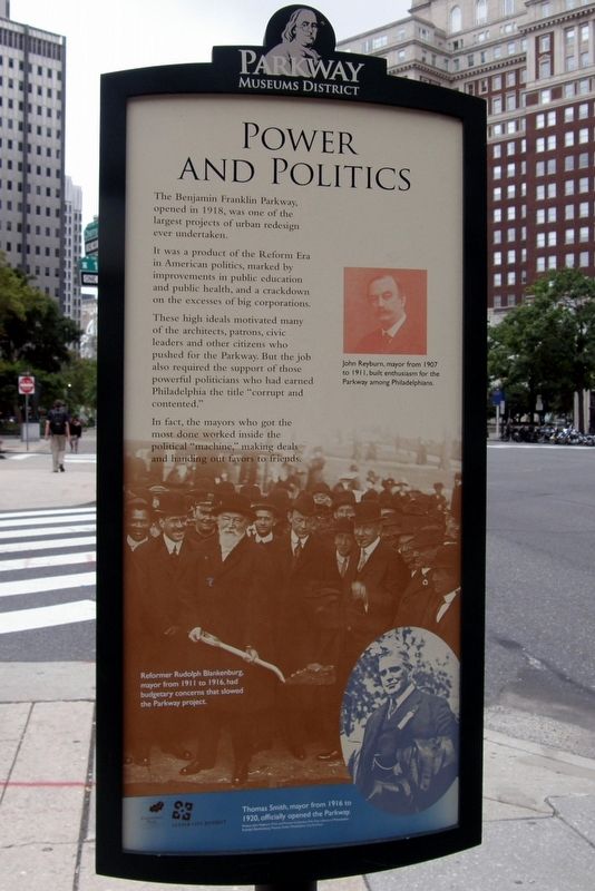
The Benjamin Franklin Parkway, opened in 1918, was one of the largest projects of urban redesign ever undertaken.
It was a product of the Reform Era in American politics, marked by improvements in public education and public health, and a crackdown on the excesses of big corporations.
These high ideals motivated many of the architects, patrons, civic leaders, and other citizens who pushed for the Parkway. But the job also required the support of those powerful politicians who had earned Philadelphia the title “corrupt and contented.”
In fact, the mayors who got the most done worked inside the political “machine”, making deals and handing out favors to friends.
[Captions:]
John Reyburn, mayor from 1907 to 1911, built enthusiasm for the Parkway among Philadelphians.
Reformer Rudolph Blankenburg, mayor from 1911 to 1916, had budgetary concerns that slowed the Parkway project.
Thomas Smith, mayor from 1916 to 1920, officially opened the Parkway.
Erected by Fairmount Park, Philadelphia's Park System; Center City District.
Topics. This historical marker is listed in these topic lists: Arts, Letters, Music • Charity & Public Work • Parks & Recreational Areas • Roads & Vehicles. A significant historical year for this entry is 1918.
Location. 39° 57.367′ N, 75° 10.071′ W. Marker is in Philadelphia, Pennsylvania, in Philadelphia County. It is in Logan Square. Marker is at the intersection of Benjamin Franklin Parkway and N 17th Street, on the right when traveling west on Benjamin Franklin Parkway. Touch for map. Marker is at or near this postal address: 136 N 17th St, Philadelphia PA 19103, United States of America. Touch for directions.
Other nearby markers. At least 8 other markers are within walking distance of this marker. Friends Select School (a few steps from this marker); A Grand Plan / Parkway Museums District (within shouting distance of this marker); Three Disks, One Lacking (within shouting distance of this marker); Rock Form (Porthcurno) (within shouting distance of this marker); Three-Way Piece Number 1: Points (within shouting distance of this marker); Train Tracks from Treblinka (about 300 feet away, measured in a direct line); Kopernik (about 400 feet away); Theresienstadt Tree (about 400 feet away). Touch for a list and map of all markers in Philadelphia.
Credits. This page was last revised on February 2, 2023. It was originally submitted on August 14, 2017, by Larry Gertner of New York, New York. This page has been viewed 177 times since then and 6 times this year. Photos: 1. submitted on August 14, 2017, by Larry Gertner of New York, New York. 2, 3. submitted on December 21, 2022, by Devry Becker Jones of Washington, District of Columbia. • Bill Pfingsten was the editor who published this page.

![Power And Politics Marker [Reverse]. Click for full size. Power And Politics Marker [Reverse] image. Click for full size.](Photos6/696/Photo696575.jpg?1221202230700PM)
