Near Spotsylvania Courthouse in Spotsylvania County, Virginia — The American South (Mid-Atlantic)
Chancellorsville
The Battle of Chancellorsville
— Fredericksburg and Spotsylvania National Military Park —
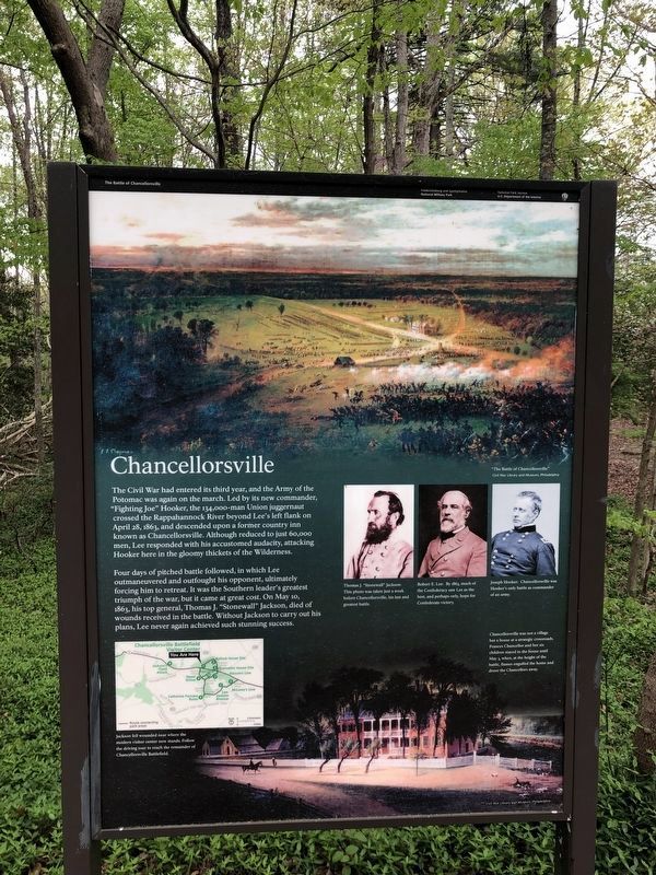
The Civil War had entered its third year, and the Army of the Potomac was again on the march. Led by its new commander, "Fighting Joe" Hooker, the 134,000-man Union juggernaut crossed the Rappahannock River beyond Lee's left flank on April 28, 1863, and descended upon a former country inn known as Chancellorsville. Although reduced to just 60,000 men, Lee responded with his accustomed audacity, attacking Hooker here in the gloomy thickets of the Wilderness.
Four days of pitched battle followed, in which Lee outmaneuvered and outfought his opponent, ultimately forcing him to retreat. It was the Southern leader's greatest triumph of the war, but it came at great cost. On May 10, 1863, his top general, Thomas J. "Stonewall" Jackson, died of wounds received in the battle. Without Jackson to carry out his plans, Lee never again achieved such stunning success.
Erected 2008 by National Park Service, U.S. Department of the Interior.
Topics. This historical marker is listed in this topic list: War, US Civil. A significant historical month for this entry is April 1857.
Location. 38° 18.687′ N, 77° 38.954′ W. Marker is near Spotsylvania Courthouse, Virginia, in Spotsylvania County. Marker can be reached from Plank Road / Germania Highway (State Highway 3), on the right when traveling west. Located in front of the entrance to the Chancellorsville Visitors Center to the Fredericksburg & Spotsylvania National Military Park. Touch for map. Marker is at or near this postal address: 9001 Plank Road, Spotsylvania VA 22553, United States of America. Touch for directions.
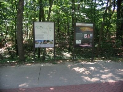
Other nearby markers. At least 8 other markers are within walking distance of this marker. Chancellorsville Campaign (here, next to this marker); Fredericksburg and Spotsylvania National Military Park (a few steps from this marker); a different marker also named Chancellorsville Campaign (within shouting distance of this marker); A Fatal Reconnaissance (within shouting distance of this marker); Confederate Catastrophe (within shouting distance of this marker); a different marker also named Chancellorsville Campaign (within shouting distance of this marker); The Battle of Chancellorsville (within shouting distance of this marker); a different marker also named Chancellorsville Campaign (about 300 feet away, measured in a direct line). Touch for a list and map of all markers in Spotsylvania Courthouse.
More about this marker. In the upper part of the marker is a painting of The Battle of Chancellorsville. To the right of the text are portraits of the Generals mentioned in the text - Jackson, Lee, and Hooker. Jackson's portrait was taken just a week before Chancellorsville, his last and greatest battle. Lee's portrait is captioned, by 1863, much of the Confederacy saw Lee as the best, and perhaps only, hope for Confederate victory. Hooker's portrait notes that Chancellorsville was Hooker's only battle as a commander of an army.
The lower part of the marker is a painting depicting the Chancellor Inn and surrounding area. Chancellorsville was not a village but a tavern at a strategic crossroads. Frances Chancellor and her six children stayed in the house until May 3, when, at the height of the battle, flames engulfed the house and drove the Chancellors away.
A small inset map shows the tour stops on the battlefield, Jackson fell wounded near where the modern visitor center now stands. Follow the driving tour to reach the remainder of Chancellorsville Battlefield.
Also see . . . Old Chancellorville Campaign Marker. This marker replaced a 1950’s era marker that stood here until early 2008. Click on this link to see the old marker. (Submitted on August 25, 2008.)

Photographed By Craig Swain, October 18, 2008
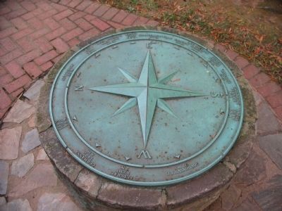
3. Compass at the Chancellorsville Visitor Center
As at many locations on the Fredericksburg - Spotsylvania Battlefields, a compass points out the distance and direction to related locations. Working from the north, clockwise: Gettysburg - 115 miles, U.S. Ford - 3.8 miles, Apex Hooker's Last Line - 0.9 miles, Bank's Ford - 6.7 miles, Chancellorsville - 0.9 miles, Fairview - 0.5 miles, Lee-Jackson Bivouac - 1.8 miles, Guinea Station - 18 miles, Richmond - 55 miles, Catharine Furnace - 1.5 miles, Hazel Grove - 0.8 miles, Gordonsville - 32 miles, Federal Right - 2 miles, Germanna Ford - 8 miles, and Ely's Ford - 3.8 miles.
Credits. This page was last revised on July 9, 2021. It was originally submitted on August 24, 2008. This page has been viewed 3,012 times since then and 32 times this year. Last updated on September 3, 2020, by Bradley Owen of Morgantown, West Virginia. Photos: 1. submitted on April 20, 2021, by Devry Becker Jones of Washington, District of Columbia. 2. submitted on August 24, 2008, by Craig Swain of Leesburg, Virginia. 3. submitted on October 22, 2008, by Craig Swain of Leesburg, Virginia. 4. submitted on July 25, 2015, by Brandon Fletcher of Chattanooga, Tennessee. • J. Makali Bruton was the editor who published this page.


