Near Maribel in Manitowoc County, Wisconsin — The American Midwest (Great Lakes)
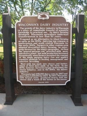
Wisconsin's Dairy Industry
Proposed as an alternative to wheat farming as early as the 1850s, dairying was common in southeastern and south central Wisconsin by the early 1860s. Farmers in other regions soon adopted diversified dairy farming, an enterprise favored by the state's geography. At first the "general purpose cow" provided milk, meat, and motive power, but milk production increased dramatically when farmers accepted the concept of the single purpose dairy cow and applied scientific methods to feeding, management, and selective breeding.
Most milk was made into cheese and butter, which at first were made on the farm. In the 1870s, however, factories began dominating the cheese industry, and in the 1890s, the butter industry.
Wisconsin had 245,000 dairy cows by 1867 and more than 2,000,000 by 1925. By 1907, Wisconsin, 13th largest state, produced nearly half the cheese and a tenth of the butter in the nation.
Erected 1980 by the Wisconsin Historical Society. (Marker Number 263.)
Topics and series. This historical marker is listed in these topic lists: Agriculture • Animals • Industry & Commerce • Science & Medicine. In addition, it is included in the Wisconsin Historical Society series list. A significant historical year for this entry is 1867.
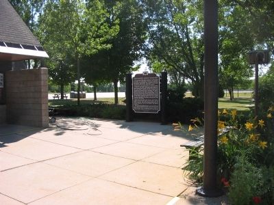
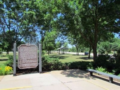
Location. 44° 19.092′ N, 87° 48.966′ W. Marker is near Maribel, Wisconsin, in Manitowoc County. Marker can be reached from Interstate 43 at milepost 168,, 2˝ miles south of Shirley Road (State Highway 96), on the right when traveling south. Marker is south of Denmark, at southbound Rest Area 51. Touch for map. Marker is in this post office area: Maribel WI 54227, United States of America. Touch for directions.
Other nearby markers. At least 8 other markers are within 16 miles of this marker, measured as the crow flies. Wisconsin's Maritime Industries (approx. 0.3 miles away); Rock Mill (approx. 2.4 miles away); Rogation Shrines (approx. 9.3 miles away); Tisch Mills (approx. 9.7 miles away); Na-Ya-to-Shingh "Chief Mishicott" Potawatomi Leader (approx. 10.1 miles away); George Halada Farmstead (approx. 10.9 miles away); Bellevue Park (approx. 15.3 miles away); Riverside Ballroom (approx. 15.4 miles away).
Also see . . . Wisconsin: America's Dairyland. (Submitted on August 24, 2008.)
Credits. This page was last revised on June 16, 2016. It was originally submitted on August 24, 2008, by Keith L of Wisconsin Rapids, Wisconsin. This page has been viewed 1,393 times since then and 23 times this year. Photos: 1, 2. submitted on August 24, 2008, by Keith L of Wisconsin Rapids, Wisconsin. 3. submitted on June 18, 2012, by Bob (peach) Weber of Dewey, Arizona. • Craig Swain was the editor who published this page.


