Norfolk Botanical Gardens , Virginia — The American South (Mid-Atlantic)
Norfolk International Airport
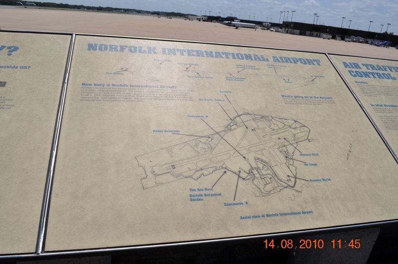
Norfolk International Airport has grown from a small municipal airport in the 1940's to a major international airport. The present passenger terminal carrier completed in 1974 and the airport began handling international passenger travel in 1976. After the metropolitan Washington airports, Norfolk International Airpot is the most visited in Virginia. The airport is home to numerous passenger airlines as well as a number of cargo carriers.
What' s Going on at the Airport?
Norfolk International Airport is typical of most large international airports. Can you identify all of these buildings and activities on the field?
(caption)
Aerial view of Norfolk International Airport
Topics. This historical marker is listed in this topic list: Air & Space. A significant historical year for this entry is 1974.
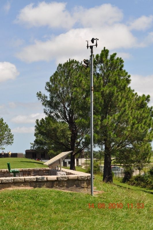
Location. 36° 54.042′ N, 76° 12.007′ W. Marker is in Norfolk, Virginia. It is in Norfolk Botanical Gardens. Marker can be reached from Botanical Gardens Access Road, 0.6 miles east of Azalea Garden Road (Route 192), on the right when traveling east. Marker is in the Norfolk Botanical Gardens overlooking the Norfolk Airport. Touch for map. Marker is at or near this postal address: 6700 Azalea Garden Rd, Norfolk VA 23518, United States of America. Touch for directions.
Other nearby markers. At least 8 other markers are within 3 miles of this marker, measured as the crow flies. How do Planes Fly? (here, next to this marker); Air Traffic Control (here, next to this marker); Norfolk Botanical Gardens (about 600 feet away, measured in a direct line); U.S.N. Armed Guard of World War II Memorial (approx. 1.1 miles away); Col. John Thorowgood Jr. (approx. 2 miles away); City Beach (approx. 2.2 miles away); Bataan Corregidor Memorial (approx. 2.7 miles away); Pearl Harbor Memorial (approx. 2.7 miles away). Touch for a list and map of all markers in Norfolk.
Also see . . .
1. Norfolk International Airport. (Submitted on August 22, 2017.)
2. Norfolk Botanical Garden. (Submitted on August 22, 2017.)
Credits. This page was last revised on February 1, 2023. It was originally submitted on August 17, 2017, by Sandra Hughes Tidwell of Killen, Alabama, USA. This page has been viewed 239 times since then and 14 times this year. Photos: 1, 2, 3, 4. submitted on August 17, 2017, by Sandra Hughes Tidwell of Killen, Alabama, USA. • Bernard Fisher was the editor who published this page.


