Sandys in Sandys Parish, Bermuda, British Overseas Territories — North Atlantic Ocean (Sargasso Sea)
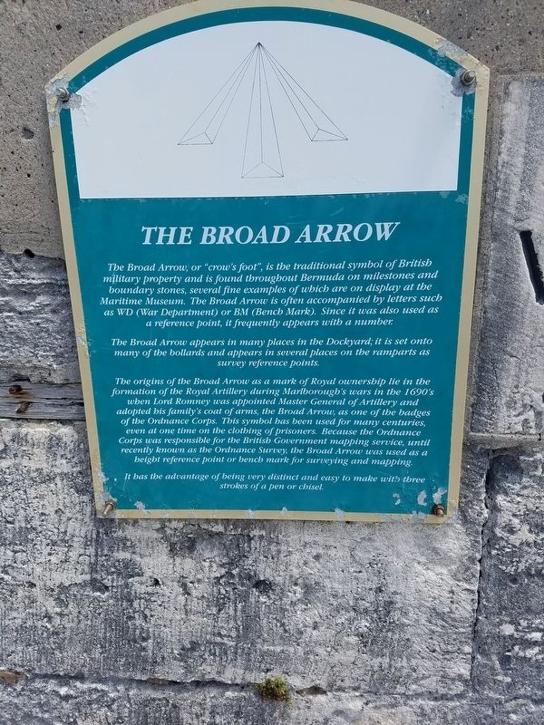
The Broad Arrow
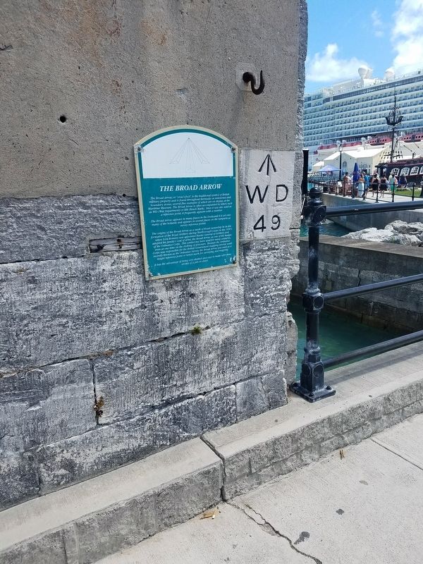
The Broad Arrow, or "crow's foot", is the traditional symbol of British military property and is found throughout Bermuda on milestones and boundary stones, several fine examples of which are on display at the Maritime Museum. The Broad Arrow is often accompanied by letters such as WD (War Department) or BM (Bench Mark). Since it was also used as a reference point, it frequently appears with a number.
The Broad Arrow appears in many places in the Dockyard; it is set onto many of the bollards and appears in several places on the ramparts as survey reference points.
The origins of the Broad Arrow as a mark of Royal ownership lie in the formation of the Royal Artillery during Marlborough's wars in the 1690's when Lord Romney was appointed Master General of Artillery and adopted his family's coat of arms, the Broad Arrow, as one of the badges of Ordnance Corps. The symbol has been used for many centuries, even at one time on the clothing of prisoners. Because the Ordnance Corps was responsible for the British Government mapping service, until recently known as the Ordnance Survey, the Broad Arrow was used as a height reference point or bench mark for surveying and mapping.
It has the advantage of being very distinct and easy to make with three strokes of a pen or chisel.
Topics. This historical marker is listed in this topic list: Military.
Location. 32° 19.607′ N, 64° 49.958′ W. Marker is in Sandys, Bermuda, in Sandys Parish. Marker is on North Arm, on the right when traveling north. The marker is located on a rampart near the entrance to the Royal Naval Dockyard. Touch for map. Marker is at or near this postal address: North Arm 4, Sandys, Bermuda MA 01, British Overseas Territories. Touch for directions.
Other nearby markers. At least 8 other markers are within 16 kilometers of this marker, measured as the crow flies. Victualling Yard (about 150 meters away, measured in a direct line); North Rock Beacon (about 240 meters away); The Great Western Storehouse (approx. 0.3 kilometers away); Pilot Darrell's House (approx. 15.7 kilometers away); John Till (approx. 15.8 kilometers away); First Government House (approx. 15.8 kilometers away); Midshipman Richard Sutherland Dale (approx. 15.8 kilometers away); American Prisoners of the War of 1812 who died in Bermuda (approx. 15.9 kilometers away).
Credits. This page was last revised on February 25, 2024. It was originally submitted on August 21, 2017, by Bill Coughlin of Woodland Park, New Jersey. This page has been viewed 967 times since then and 151 times this year. Last updated on February 23, 2024, by Carl Gordon Moore Jr. of North East, Maryland. Photos: 1, 2. submitted on August 21, 2017, by Bill Coughlin of Woodland Park, New Jersey. • J. Makali Bruton was the editor who published this page.

