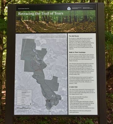
Retracing the Trail of Tears
The Bell Route
On October 11, 1838, 660 Cherokee led by John Adair Bell left from Fort Cass (present day Charleston, Tennessee) to begin an arduous 700-mile journey. Weak and miserable from being held in removal camps, the people in the Bell detachment who passed through here banded together, staying close to family members for the long trek.
Walk in Their Footsteps
You are invited to walk along the same path the Cherokee traveled on the Trail of Tears in 1838. It was a cold and wet November as they trudged by, not even half way to their destination to Indian Territory.
The Cherokee that passed through here left their homes in North Carolina, Alabama, Georgia, and Tennessee with 56 wagons and 318 horses. The journey had already been a trying one, as they were faced with terrible road conditions that slowed their progress. Imagine how the numbers of people and wagons would have mired an already muddy road.
The Bell detachment that traveled through here lost 23 of its members along the route due to exhaustion and illness before the group of weary travelers arrived in Evansville, Arkansas, on January 7, 1839.
A Safe Visit
The Trail of Tears interpretive retracement trail is just over 2.5 miles long one way. As you hike the trail, you will see signs indicating when you are
For a safe and enjoyable visit, please:
• Pay attention to trail signs
• Stay on the trail
• Share your hiking plans with friends or family
• Wear appropriate shoes and clothes for hiking
• Be aware of ticks, poison ivy, and snakes
• Carry a bottle of water and snacks
• Help keep the trail litter free and leave no trace
Please help preserve the traces of the past for future generations.
Legend
Main Road through Park
Trail of Tears National Historic Trail - Retracement Trail
Overlook Trail
Shoals Creek Trail/Waterfall Trail
Connector Trails
Bike Trail
Fitness Trail
Cabin Trail
Wayside Exhibit
Erected by David Crockett State Park, Trail of Tears National Historic Trail, National Park Service, National Park Foundation, MTSU Center for Historic Preservation.
Topics and series. This historical marker is listed in this topic list: Native Americans. In addition, it is included in the Trail of Tears series list. A significant historical date for this entry is October 11, 1838.
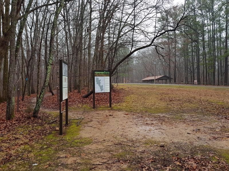
Location. 35° 14.879′ N, 87° 21.171′ W. Marker is in Lawrenceburg, Tennessee, in Lawrence County. Marker is on David Crockett State Park Road. Marker is just south of Campground #1.
Other nearby markers. At least 8 other markers are within 2 miles of this marker, measured as the crow flies. They Passed This Way (here, next to this marker); Pioneers in Textiles (approx. 0.4 miles away); Museum Honoring David Crockett (approx. one mile away); Courthouse - Lawrence County Tennessee (approx. 1.1 miles away); Skirmish at Lawrenceburg (approx. 1.1 miles away); Mexican War Monument (approx. 1.1 miles away); Lawrence County War Memorial (approx. 1.1 miles away); Col. David Crockett (approx. 1.1 miles away). Touch for a list and map of all markers in Lawrenceburg.
Credits. This page was last revised on June 7, 2020. It was originally submitted on August 25, 2017, by Sandra Hughes Tidwell of Killen, Alabama, USA. This page has been viewed 406 times since then and 26 times this year. Last updated on September 11, 2017, by Byron Hooks of Sandy Springs, Georgia. Photos: 1. submitted on August 25, 2017, by Sandra Hughes Tidwell of Killen, Alabama, USA. 2. submitted on February 21, 2018, by J. Makali Bruton of Accra, Ghana. • Bill Pfingsten was the editor who published this page.

