Near Nokesville in Prince William County, Virginia — The American South (Mid-Atlantic)
Battle of Kettle Run
Ewell's Flawless Retreat
— Second Manassas Campaign —
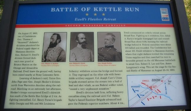
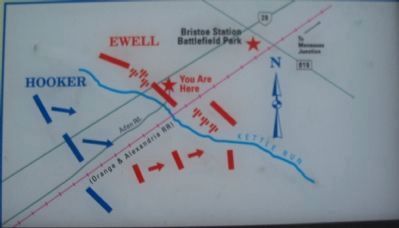
Learning of Jackson's raid, Union Gen. John Pope sent Gen. Joseph Hooker's division north from Warrenton Junction along the railroad. Marching on an extremely hot afternoon, Hooker's troops encountered Ewell's skirmish line south of the Kettle Run bridge at 2 p.m. As fighting intensified, Col. Henry Forno's brigade (60th Georgia and 6th and 8th Louisiana Infantry) withdrew across the bridge and burned it. They regrouped on the other side with formidable artillery support. Col. Joseph Carr's Union brigade stormed across the stream into a hail of lead and shot which, as one Federal soldier noted, "caused a very unpleasant sensation."
Ewell's division held firm, inflicting heavy casualties along the railroad until Col. Nelson Taylor's famed Excelsior Brigade advanced and gave the Federals superior numbers. About 4 p.m., Ewell commenced an orderly retreat across Broad Run. Fighting as it withdrew, Gen. Jubal A. Early's brigade disengaged last and crossed Broad Run about 6:00, burning the railroad bridge behind it. Federal casualties were about 300 killed and wounded. The Confederates lost about 150. Ewell withdrew to Manassas Junction, where that night Jackson torched the remaining Union supplies and then marched his men to favorable ground on the old Manassas battlefield to await Gen. Robert E. Lee and Gen. James Longstreet's wing. This set the stage for the Second Battle of Manassas on August 28-30, 1862.
Erected 2008 by Virginia Civil War Trails.
Topics and series. This historical marker is listed in this topic list: War, US Civil. In addition, it is included in the Virginia Civil War Trails series list. A significant historical year for this entry is 1862.
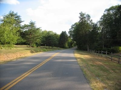
Location. Marker has been reported missing. It was located near 38° 42.962′ N, 77° 33.666′ W. Marker was near Nokesville, Virginia, in Prince William County. Marker was at the intersection of Nokesville Road (State Highway 28) and Aden Road (County Route 646), on the right when traveling north on Nokesville Road. Touch for map. Marker was in this post office area: Nokesville VA 20181, United States of America. Touch for directions.
Other nearby markers. At least 8 other markers are within one mile of this location, measured as the crow flies. A Narrow Escape (approx. 0.6 miles away); Early & Gordon at Bristoe Station (approx. 0.6 miles away); Preparing for Battle (approx. one mile
away); Confederates in Bristoe (approx. one mile away); Battle Along the Railroad (approx. one mile away); Alabama Cemetery (approx. one mile away); Here Lie Men from the State of Alabama (approx. one mile away); Cemeteries (approx. one mile away). Touch for a list and map of all markers in Nokesville.
More about this marker. In the upper center of the marker are portraits of Gens. Jackson, Ewell, and Hooker. On the lower right is a map illustrating the tactical movements described in the text.
Additional commentary.
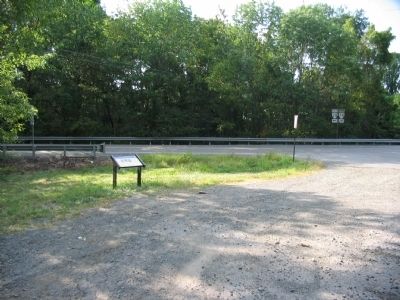
1. Kettle Run Marker
The Civil War Trails Marker is missing form this spot. You will only find the Civil War Trails sign but no marker. It has been removed. Note To Editor only visible by Contributor and editor
— Submitted December 5, 2015, by Jorge A. Torres of Springfield, Virginia.
Photographed By Craig Swain, August 24, 2008
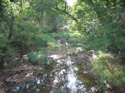
5. Federal Advance
Looking southwest from the Aden Road bridge. The Federals advanced into the low ground on the west bank of Kettle Run, pressing the outnumbered Confederates back toward Bristoe Station. Most of the action occurred to the south of this point, along the railroad. The site is on private property.
Credits. This page was last revised on June 16, 2016. It was originally submitted on August 26, 2008, by Craig Swain of Leesburg, Virginia. This page has been viewed 5,625 times since then and 65 times this year. Photos: 1, 2, 3, 4, 5. submitted on August 26, 2008, by Craig Swain of Leesburg, Virginia.
