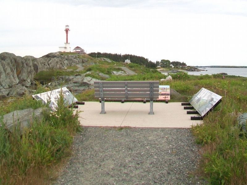
Cheboque
Cheboque
The name "Cheboque" comes from the Mi'kmaw word for "big marshes", a very accurate name for this area. Beginning at Arcadia, the Cheboque salt marsh sprawls 343 hectares (837 acres) alongside the Cheboque River.
According to a 1607 map drawn by Samuel de Champlain, there may have been homes along the Cheboque River as early as 1607, which would make it the third oldest European settlement in Canada after Saint-Croix (1604) and Port Royal (1605). Cheboque was a major Acadian settlement until 1755-58 when the community was destroyed and many of its inhabitants deported by the British. In 1761 New England Planters settled the former Acadian lands and built a community based on fishing, farming, lumbering and shipping.
[Photo captions read]
• Chebogue has been a farming and fishing community for over three hundred years.
• Gathering hay at Chebogue, c.1900. Note the oxen team hitched to the wagon.
A Diverse Landscape
Chebogue's extensive salt marsh makes it a very important ecological area that has contributed to Chebogue's fishing and farming industries for centuries.
With each tidal cycle, the salt marsh and mudflats trap floating debris such as seaweed. The seaweed decomposes and provides nutrients for millions of tiny organisms that are, in turn, consumed by larger
ocean species such as fish. Clams are harvested from Chebogue's mudflats, while the wharf near Town Point, is a lobster fishing port.Salt marshes also protect farmland by removing sediments and toxins, from the water, and acting as a buffer from tidal invasions such as storm surges. For many years, Chebogue's rich agricultural land supported local farms, as well as a thriving dairy industry. Cook's Dairy Farm, once a family-owned operation, is a local provider of milk and milk products.
[Photo captions read]
• The Chebogue River system and its surrounding marshlands provide a haven for wildlife, including migratory and native shorebirds.
• Dairy still cows [sic - cows still] graze the lush meadowlands overlooking the Chebogue River.
Boating on the Chebogue
Bordered by salt marshes, the winding Chebogue River is part of an estuary system that is home to a wide array of wildlife, including fish and numerous species of birds.
This tranquil, tidal river is also a haven for human recreation. The Chebogue River Aquatic Club attracts boating and kayaking enthusiasts from all over Atlantic Canada and North America. Established in 1967-68, the Club is open to all, and has a public slipway for non-members. It also provides boaters and paddlers with unique access to both the Chebogue River and the sea. On an interesting note, the Chebogue river
[Photo captions read]
Boaters, from across North America, enjoy the tranquility and scenery of the Chebogue River.
What can you see from here?
The long strip of land, to your right, is Chebogue Point, part of the historic fishing and farming community of Chebogue.
Cheboque is an important ecological area with a diverse and scenic landscape.
The scenic Cheboque River attracts recreational boaters from across North America.
Erected by Municipality of the District of Yarmouth.
Topics and series. This historical marker is listed in these topic lists: Agriculture • Environment • Waterways & Vessels. In addition, it is included in the Acadian History series list. A significant historical year for this entry is 1607.
Location. 43° 47.534′ N, 66° 9.307′ W. Marker is in Cape Forchu, Nova Scotia, in Yarmouth County. Marker is along Cape Forchu Lightstation's Leif Ericson Trail. Touch for map. Marker is at or near this postal address: 1856 Nova Scotia Route 304, Cape Forchu NS B5A 4A7, Canada. Touch for directions.
Other nearby markers. At least 8 other markers are within walking distance of this marker. Harbour of Deception (here, next to this marker); Explosive Geology (within shouting distance of this marker); The Tusket Islands (within
Also see . . .
1. Cheboque River. Mapcata entry (Submitted on August 30, 2017, by William Fischer, Jr. of Scranton, Pennsylvania.)
2. Cape Forchu: A Light Like No Other. Lighthouse Website (Submitted on August 30, 2017, by William Fischer, Jr. of Scranton, Pennsylvania.)
Credits. This page was last revised on December 9, 2021. It was originally submitted on August 30, 2017, by William Fischer, Jr. of Scranton, Pennsylvania. This page has been viewed 241 times since then and 16 times this year. Photos: 1, 2, 3. submitted on August 30, 2017, by William Fischer, Jr. of Scranton, Pennsylvania.


