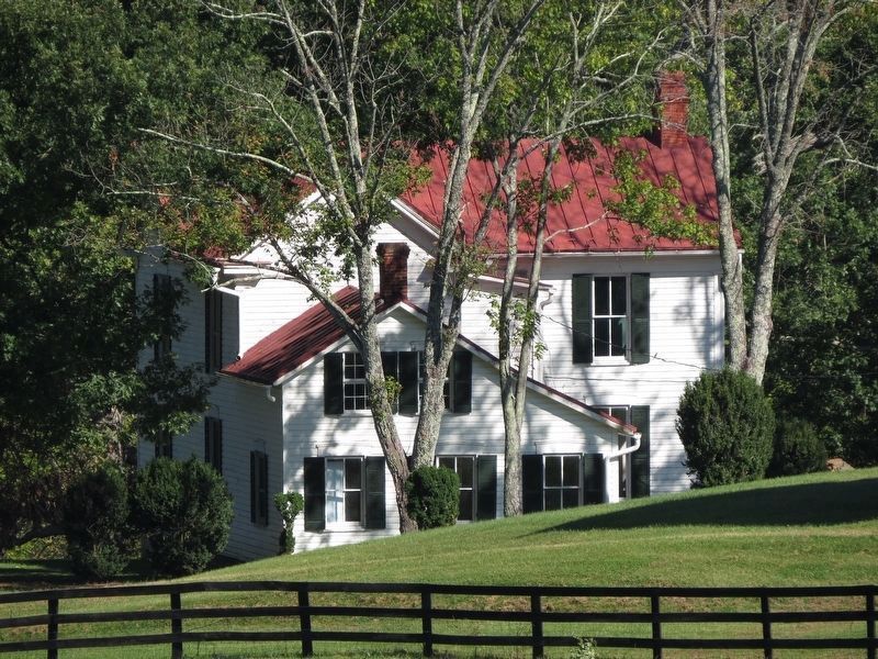
Near Aldie in Loudoun County, Virginia — The American South (Mid-Atlantic)
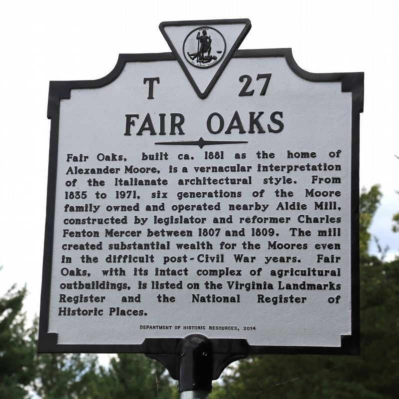
Fair Oaks
Erected 2014 by Department of Historic Resources. (Marker Number T-24.)
Topics and series. This historical marker is listed in these topic lists: Architecture • Industry & Commerce • Settlements & Settlers. In addition, it is included in the Virginia Department of Historic Resources (DHR) series list. A significant historical year for this entry is 1881.
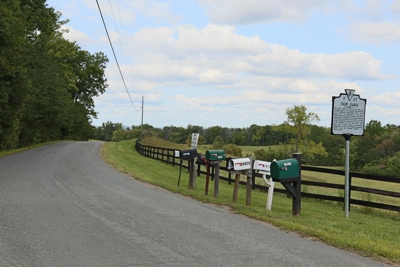
Location. 38° 57.722′ N, 77° 38.196′ W. Marker is near Aldie, Virginia, in Loudoun County. Marker is on New Mountain Road (Virginia Route 631) 0.8 miles south of Lee-Jackson Memorial Highway (U.S. 50), on the left when traveling south. Touch for map. Marker is at or near this postal address: 23718 New Mountain Rd, Aldie VA 20105, United States of America. Touch for directions.
Other nearby markers. At least 8 other markers are within walking distance of this marker. The Milling Complex (approx. 0.9 miles away); Waterpower System (approx. 0.9 miles away); A Freedom Seeker from Aldie: The Story of Daniel Dangerfield (approx. one mile away); Battle of Aldie (approx. one mile away); Lee Moves North Again (approx. one mile away); Aldie Mill (approx. one mile away); a different marker also named The Aldie Mill (approx. one mile away); Slashing Sabers (approx. one mile away). Touch for a list and map of all markers in Aldie.
Also see . . . 2014 National Register of Historic Places Nomination Form. Form prepared by Lori Kimball and Jane Covington.
Historic Context. Charles Fenton Mercer inherited approximately 300 acres of Bull Run land from his father in the late 1700s. After coming to Loudoun County in 1804, Mercer sold his original inheritance and a year later bought 768 acres from his father’s estate. By this time the Joseph Moore family was established on the east side of Bull Run Mountain. In 1801 he was named overseer of a portion of the east/west road that came to be called Braddock Road.
Two main roads provided a vital transportation link at the time. The Carolina Road [today’s U.S. 15] ran north-south along the eastern edge of the Bull Run Mountain range into Prince William County. ‘The primary east-west road in southern Loudoun County followed the line of the present Braddock Road [ the predecessor to today’s U.S. 50] from the Fairfax County line westward to the gap in the Bull Run Mountains formed by the Little River. From this point the road continued westward through the town of Middleburg to Ashby’s Gap in the Blue Run Mountains.’ Other roads used by the local citizenry ran over the Bull Run Mountain, connecting their lands and providing access to the Carolina Road and Braddock Road. Known today as Old Braddock Road, the abandoned road bed runs along the eastern edge of Fair Oaks Farm.
At the time Mercer came to Loudoun, the ‘Little River Turnpike [today’s U.S. 50 through here] was being built from his land at the gap in Bull Run Mountain to the commercial port of Alexandria along the Potomac River. The property was also connected to the west by two existing roads that would become the Ashby’s Gap Turnpike and the Snickersville Turnpike.’ The transportation network and ‘abundant supply of water from the Little River encouraged Mercer to partner with William Cooke to construct and operate a water-powered grist mill on this [Mercer’s] property in 1807.’ Construction of the mill was finished in 1809. Mercer called it Aldie Mill, supposedly named for Aldie Castle in Scotland, which is believed to be the family’s ancestral home. During this period, his home, Aldie Manor, was built across the turnpike from the mill. 4 Both the house and mill remain today.
In 1809 Mercer petitioned the Virginia Assembly to establish a town on his property at the western end of the Little River Turnpike. The Town of Aldie was incorporated in 1810 with Mercer as one of the trustees. The town was to have lots laid out and streets created. That same year Mercer ran for and was elected to the Virginia House of Delegates. During the War of 1812 he was a major in a Virginia militia and served in Norfolk in 1814. The next year he sold the available lots in Aldie to one of the town trustees, William Noland. In 1817 Mercer was “elected to the U.S. House of Representatives for Loudoun, Fairfax and Prince William Counties.”
The Moore family’s connection to the Aldie Mill started during Mercer’s ownership when John Moore leased the mill. In 1835 Moore purchased the mill and the miller’s house from Mercer. Four years later John Moore purchased a 57-acre parcel, with no buildings on it, from Ruth Lacey. One of its boundaries was, and still is, the old Braddock Road.
After a long and distinguished career, Mercer retired from politics in 1839 and moved to Tallahassee, Florida, where he worked at a bank. He began to sell the rest of his lands in Aldie. In 1842 Augustus Zerega (alternately spelled Zerga, Zaraga, and diZerega) acquired the remainder of Mercer’s lands in Aldie. The purchase included Aldie Manor, tracts along the Little River Turnpike in the village, and undeveloped land on Bull Run Mountain. Born to parents of Italian descent who resided in the West Indies, Zerega was a Master Mariner whose main place of residence was in Westchester, New York. It is not known how Zerega learned of the Aldie lands or why he bought them but family lore says he met Mercer in Florida. Being in the shipping business, Zerega could have been at a Florida port and been introduced to Mercer. As for why he bought the property, it could simply have been an investment, as he purchased land in Prince William County also. Timber from the wooded land would have been used locally for residential and commercial fuel. A 20th-century chancery case provides another clue. Descendants were involved in a lawsuit to determine the value of the lands and apportionment to family members. Depositions throughout the case refer to mineral rights on the property and the possibility of iron ore. Although no witnesses attest to seeing iron ore, they mention hearsay about it being on the lands. Perhaps the reason for Augustus’s initial purchase was speculation of minerals on the property. Whatever the intention, census records and Augustus’s obituary indicate he never lived on his Aldie land. After the Civil War, his son, Alfred, came to Loudoun and settled at Aldie Manor.
John Moore expanded his Bull Run Mountain
lands in 1851 with the purchase of 95 acres
adjacent to the 57-acre acquisition made in 1839. Land tax records show no buildings on either
parcel. He also bought the brick tavern lot in Aldie.
Prior to the Civil War, Loudoun was one of Virginia’s top producing agricultural counties and the Aldie Mill was one of the top producing mills3 John Moore’s primary occupation was miller, ranking fifth in the county in 1850 production. The Agricultural Census for that year reflects his small scale farming operation with 55 acres of improved land, valued at $3,500. He owned one horse, four milk cows, and fifty-five swine. This livestock was valued at $365. The farm produced 50 bushels of wheat, 50 bushels of oats, 25 bushels of Irish potatoes, 300 pounds of butter, and 20 tons of hay. Although an anti-secessionist, Moore owned 11 enslaved African Americans prior to the start of the Civil War, demonstrating the paradox of this time. Six of Moore’s slaves were of working age and two males might have helped at the mill.
The Moores are an example of a family with differing opinions about seceding from the Union. On May 23, 1861, when Virginians voted on a secession referendum, John Moore voted to remain in the Union. His 23 year-old son, Robert L. Moore, voted to secede. Why the father sided with Unionists is not known. As a business owner, perhaps he anticipated the toll war would have on his mill and the economy. Perhaps he worried about his sons becoming soldiers. His son, Alexander B. Moore, who would later construct the buildings on Fair Oaks Farm, served on the Confederate side in the local 8th Virginia regiment. He achieved the rank of adjutant. During the War, John Moore’s Unionist sentiment might have spared his mill during the Burning Raid in November of 1864. Part of Major General Wesley Merritt’s order was to burn all barns, mills and their contents with the Bull Run Mountains as the eastern boundary and the Shenandoah River as its western. The Aldie Mill is located within those boundaries. The order also stipulated that no dwellings were to be burned. Perhaps John Moore’s house, known as the Miller’s House, was too close to the mill. Fortunately for the Town of Aldie, the mill survived. Captain Moore reportedly allowed Federal troops to hide in the mill’s grain bins. His son, Alexander, allegedly allowed Mosby’s Rangers into the mill to capture the flour-covered Union soldiers.
A few years after the Civil War, Alfred L.B. Zerega came to Loudoun County and settled on his father’s lands. He and his family lived at Aldie Manor. During the Reconstruction Era, the mill was operated by Captain Moore and his eldest son, Alexander B. Moore, with Captain Moore’s grandson, J. E. Douglass, acting as apprentice. Douglass took over in 1881 after his grandfather’s death.
An 1874 legal case shows the importance of the road network on the mountain. Alfred Zerega, John Moore, and other citizens petitioned the county court for a road starting on the Little River Turnpike and running over the mountain through the lands of Zerega, John Moore, and others to intersect an existing roadbed that lead to the Carolina Road. The petitioners stated that the “…road is a prime necessity to us in bad weather when Little River and the Deep Hollow Road are full [of] ice, it is the only road that we can get to Aldie on. At present we have to go through the fields of Augustus Zerega to get to Aldie in bad weather.” The court approved the new roadbed and it came to be known as New Mountain Road. This road borders Fair Oaks on the west.
John Moore, the man whose mill was the centerpiece of Aldie, died in 1879. He left vast land holdings in five different states. His heirs were involved in a chancery case to establish value and divide the lands. One of the parcels was referred to as the Graveyard Tract and came to be owned by John’s son, Alexander B. The family cemetery is located on the easternmost edge, near an old roadbed referred to in deeds as “the old turnpike road.” There are 14 documented gravesites. Of the surviving, decipherable stones, the earliest burial date is January 26, 1844, for 4 year-old Rosanna Moore, probably the daughter of John Moore. The cemetery contains field stones, possibly indicating burials of the enslaved, and stones with worn, unreadable markings, possibly indicating burials older than 1844.
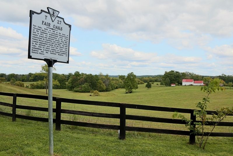
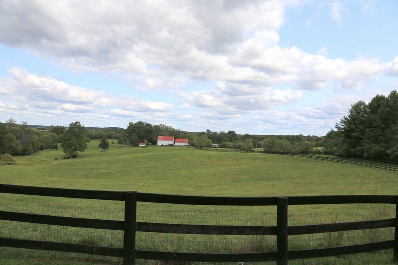
It was under Alexander B. Moore’s ownership that the extant house and its supporting outbuildings were constructed on the property. The 1882 Loudoun County Land Tax records show buildings valued at $800. The buildings represent construction at a time when Loudoun County was still recovering from the Civil War and few structures were being built. The house, barn, and other outbuildings are an intact, little-altered farm complex from that period.
In 1922, the heirs of Alexander B. Moore sold the property to the Carter Gibson family. Mr. Gibson’s son, Dr. James “Jimmy” Gibson was the Middleburg physician who in July 1955 was first to the scene to treat the then-Senator Lyndon Johnson when he suffered a near fatal heart attack while visiting the Brown brothers at Huntland Farm. The Senator was transported to Washington hospitals after being successfully stabilized by Dr. Gibson.
The Gibson family sold the farm in 2005 to the Frank Foundation Child Assistance Program, a Washington, D.C., based child adoption agency coordinating adoptions between Russia and the United States. Following the construction of Dulles Airport, Loudoun’s population was exploding and migrating westward and, by early 2000, there was enormous development pressure on the ‘Gilbert’s Crossroads’ area, once a sleepy rural intersection between Route 15 and Route 50. A fight between preservation-minded organizations such as the Piedmont Environmental Council (PEC) and developers ensued. By 2006, the 91 acres associated with Fair Oaks were slated for development and the farmstead was scheduled to be demolished. With the 2008 collapse of the real estate market, the land development project was put on hold and in 2010, the Peter Basser and Georgia Ravitz Trust purchased the 91 acres. The farm has been placed into perpetual conservation easement. The farm buildings have been stabilized, with recent exterior envelope restorations. (Submitted on September 10, 2017.)
Credits. This page was last revised on October 8, 2022. It was originally submitted on September 10, 2017, by J. J. Prats of Powell, Ohio. This page has been viewed 730 times since then and 50 times this year. Photos: 1, 2, 3, 4. submitted on September 10, 2017, by J. J. Prats of Powell, Ohio. 5. submitted on September 26, 2017, by Samuel Paik of Gainesville, Virginia.
Editor’s want-list for this marker. Photos of Fair Oaks • Can you help?
