Kit Carson in Amador County, California — The American West (Pacific Coastal)
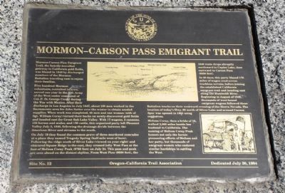
Mormon-Carson Pass Emigrant Trail
Five hundred Mormon volunteers, recruited in Iowa, served one year in the Army of the West under command of Col. P. St. George Cooke during the war with Mexico. After their discharge in Los Angeles in July 1847, about 100 men worked in the Sacramento area for John Sutter over the winter to obtain needed supplies. When work was completed, 45 men and one woman (wife of Sgt. William Coray) turned their backs on newly-discovered gold fields and headed east for Great Salt Lake Valley. With 17 wagons, 2 cannons, 150 horses and mules, and 150 cattle, this organized party left Pleasant Valley July 3, 1848, following the drainage divide between the American River and streams to the south.
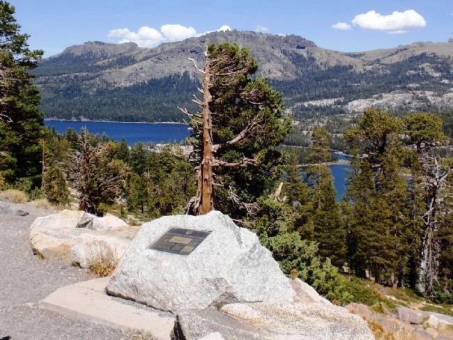
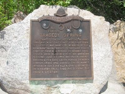
On July 19 they found the common grave of three murdered comrades at a place they named Tragedy Spring (half-mile west of here). Following the ridge south of Silver Lake (viewed on your right) and obscured Squaw Ridge to the east, they crossed lofty West Pass at the foot of Melissa Coray Peak (9763 feet) on July 24. This pass and peak are seen ahead on the distant skyline. From West Pass (9550 feet), the 1848 route drops abruptly northward to Caples Lake, then eastward to Carson Pass (8550 feet).
In 40 days, this party blazed 170 miles of wagon road across trackless terrain, before joining the established California emigrant trail and heading east along the Humboldt River. Beginning in August of 1848, thousands of west-bound followed these Battalion track on their westward crossing of the Sierra Nevada. The location of today’s Hwy. 88 north of Silver Lake and north of Carson Spur was opened with explosives.
Melissa Coray, then a bride of 18, walked beside her husband to California. The naming of Melissa Coray Peak honors not only the heroic pioneering efforts of Melissa and her party, but thousands of emigrant women who endured similar hardships in settling the West.
Site No. 52 Oregon-California Trail Association Dedicated July 30, 1994
Erected 1994 by Oregon-California Trail Association.
Topics and series. This historical marker is listed in this topic list: Roads & Vehicles. In addition, it is included in the California Trail series list. A significant historical month for this entry is July 1847.
Location. 38° 38.5′ N, 120° 8.179′ W. Marker is in Kit Carson, California, in Amador County. Marker is on Carson Pass Highway (State Highway 88), on the right when traveling east. Marker is on the right side of the road
when driving east, just as Silver Lake comes into view. Touch for map. Marker is in this post office area: Kit Carson CA 95644, United States of America. Touch for directions.
Other nearby markers. At least 8 other markers are within 7 miles of this marker, measured as the crow flies. Old Emigrant Road (approx. half a mile away); Tragedy Spring (approx. 0.6 miles away); Plasse Resort (approx. 0.6 miles away); Plasse’s Trading Post (approx. 0.6 miles away); Maiden's Grave (approx. 2 miles away); Kirkwood's (approx. 5˝ miles away); Carson Trail - Leek Springs (approx. 5.6 miles away); Caples Lake (approx. 6.1 miles away). Touch for a list and map of all markers in Kit Carson.
Also see . . . The Oregon-California Trail Association Home Page. This is the home page of the association that put up the marker. They have a history section on the pioneer trails in the western part of the US. (Submitted on August 29, 2008.)
Credits. This page was last revised on July 26, 2018. It was originally submitted on August 29, 2008, by Andrew Ruppenstein of Lamorinda, California. This page has been viewed 8,752 times since then and 96 times this year. Photos: 1, 2. submitted on August 29, 2008, by Andrew Ruppenstein of Lamorinda, California. 3. submitted on July 31, 2009, by Syd Whittle of Mesa, Arizona. • Kevin W. was the editor who published this page.


