Tyrone Township near York Springs in Adams County, Pennsylvania — The American Northeast (Mid-Atlantic)
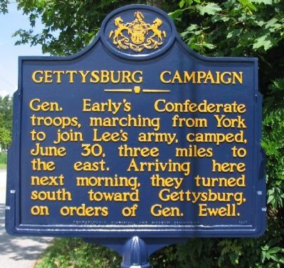
Gettysburg Campaign
Erected 1947 by Pennsylvania Historical and Museum Commission.
Topics and series. This historical marker is listed in this topic list: War, US Civil. In addition, it is included in the Gettysburg Campaign, and the Pennsylvania Historical and Museum Commission series lists. A significant historical date for this entry is June 30, 1781.
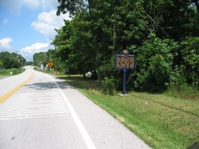
Location. 39° 56.828′ N, 77° 8.84′ W. Marker is near York Springs, Pennsylvania, in Adams County. It is in Tyrone Township. Marker is at the intersection of Old Harrisburg Road (County Route 3001) and Heidlersburg Road (Pennsylvania Route 234), on the right when traveling north on Old Harrisburg Road. Located on Old U.S. Highway 15. Touch for map. Marker is at or near this postal address: 5005 Old US Rte 15, York Springs PA 17372, United States of America. Touch for directions.
Other nearby markers. At least 8 other markers are within 5 miles of this marker, measured as the crow flies. A different marker also named Gettysburg Campaign (approx. half a mile away); Rock Chapel (approx. one mile away); Original Studebaker Wagon Shop (approx. 2.1 miles away); Great Conewago Presbyterian Church (approx. 4.2 miles away); Civil War Soldiers in the Great Conewago Cemetery (approx. 4.2 miles away); Revolutionary Soldiers in Great Conewago Cemetery (approx. 4.2 miles away); Presbyterian Church Cemetery (approx. 4.3 miles away); Wirt's Tavern (approx. 4˝ miles away). Touch for a list and map of all markers in York Springs.

Photographed By Craig Swain, July 24, 2008
3. Heidlersburg
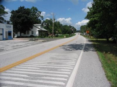
Looking north from the marker location toward the small village of Heidlersburg. According to John Schildt in Roads to Gettysburg, Confederate Generals Ewell, Early, Trimble, and Rodes had a conference just outside of Heidlersburg on June 30, 1863. Ewell, the corps commander, had just received orders from Confederate General Robert E. Lee indicating the far flung army should now consolidate near a town called Gettysburg to the south.
Credits. This page was last revised on February 7, 2023. It was originally submitted on August 29, 2008, by Craig Swain of Leesburg, Virginia. This page has been viewed 1,798 times since then and 24 times this year. Photos: 1, 2, 3. submitted on August 29, 2008, by Craig Swain of Leesburg, Virginia.

