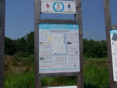
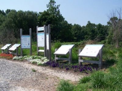
Near Newark in New Castle County, Delaware — The American Northeast (Mid-Atlantic)
Your Gateway to Pencader Heritage
Exploring the Past
Welsh Tract Church
William Penn granted a 30,000 acre tract of land to three Welshmen, (David Evans, William Davis, and William Willis) in 1701. They and their followers had left southern Wales in search of religious freedom. In encouraging settlement of this portion of "the lower three counties", William Penn was defending his charter against possible incursion of settlers from the adjacent Calvert Charter which established Maryland.
The Welsh were an Old School Primitive Baptist congregation. They built their first church, a log structure, in 1703 at the site of the current church on Welsh Tract Road. It was the first Baptist church in Delaware. It was replace by the current brick building in 1746. The church continues to hold services from its beginnings to the present day. The settlement was an example of religious freedom combined with formal deeding of property ownership which established the format for the development of Delaware and Pennsylvania.
Separating two religious doctrines (Catholic and Anglican) by ownership of deeded land.
Milling
The Native Americans were the first millers in the Pencader area, dating back as far as 5,000 B.C. The first grain to be milled was maize (known today as corn). This milling process used a crude mortise and pestle. Improvements began in 1638 when the Swedes and Finns came to this country. They connected a set of millstones to a primitive water wheel for power. New varieties of grain were introduced as well as domesticated animals and improved farming methods.
In 1701 the Welsh Tract land grant by William Penn established land titles and water rights which encouraged the development of mills along the Christiana River. Several mills were constructed. As the population continued to grow, increasing the need for cornmeal and flour, dams had to be built to accommodate larger wheels and millstones for these mills.
The Battle of Cooch's Bridge in 1777 brought the destruction of all the mills and millstones along the Christiana River with the exception of Fisher's Mill (of which only the miller's house remains standing today. The British used this mill to supply the needs of their troops.
The great period of milling in Pencader began in 1794 when William Cooch financed and build a new mill. Benjamin Latrobe was brought in by Cooch to assist in this project as a hydro-engineer and was responsible for raising the elevation of dams and constructing millraces. The third man involved in the construction of mills in Pencader Hundred was Oliver Evans of nearby Newport. He was commissioned to design and erect a second mill. As a customer of Evans, George Washington became influential in the new process of drying and preparing grain for milling that Evans was developing. Mr. Evans was able to get a patent for his flour equipment. The resulting flour was unique and became known as the "Kings Flour". This flour was exported to England, and the Christiana Watershed became the milling capital of the world for over 100 years.
Many mills were built in the Pencader area. Only the Cooch-Dayett complex remains today. The original walls of the mill were built in the mid 1830's. In 1890 equipment was updated and roller mills replaced the millstones. The yield of flour increased and byproducts of the brand and middling were used in manufacturing of feed. Milling ceased in 1996 when the property was purchased by the State of Delaware and is today administrated by the Department of Historic and Cultural Affairs. The ultimate plan is that the Cooch-Dayett mill will be restored as a working mill.
First industries in Pencader were waterpowered mills used to process grains into feed and flour.
Development of Roads
Roads in Pencader did not develop until the early part of the eighteenth century. Early settlements and mills were located on or near streams and rivers which provided the only reliable means of transportation. the road construction supported by the colonial government was used to connect Christina Bridge to the head of the Elk River. Known as the "Old Post Road" it followed the route used today by Old Baltimore Pike. In 1766, another east-west roadway was constructed between Gilpin's Mill on the Big Elk River and Christina Bridge. It was called "Welsh Tract Road". Passing through Ogle's Town, its route is followed today by Welsh Tract Road, Route 4 and the portion of Route 273 from Ogletown to Christiana. In 1768 a north-south road was built from Cooch's Bridge to the Buck Tavern (originally located in present day Summit). Passing through Aiken's Tavern (current day Glasgow) it followed a path represented today by Old Cooch's Bridge and Route 896. This road was utilized by British General Howe's army as they marched from the Head of Elk toward Newark encountering the American militia in the Battle of Cooch's Bridge nine years later.
The first turnpike in Pencader was chartered in 1809 connecting New Castle to Frenchtown. Completed in 1813 and known as the "New Castle and Frenchtown Turnpike" it operated until 1827 following the route of present day Route 273 from New Castle to Hare's Corner and then along Route 40 and Frenchtown Road to Elkton. The other turnpike built through Pencader Hundred was completed in 1817. Called the "Elk and Christiana Turnpike", it followed the path of the Old Post Road. With toll gates at Cooch's Bridge and near present day Salem Church Road, it operated until 1838 when it reverted to a public road. Both turnpikes served travelers and commercial shippers moving north and south between the colonies by connecting ports served by sailing ships and steam packets at New Castle and Elkton.
Connecting ports and mills and providing cross peninsular transit for passengers and goods.
Iron Production
Iron ore was first discovered on Iron and Chestnut Hills by early Swedish settlers in the early 17th Century. The first commercial use of the ore was made by Lord William Keith. Lt. Governor of Pennsylvania (and "the lower three counties" which became Delaware) who purchased a large tract of land along west bank of the Christina River north of present day Cooch's Bridge and built a forge and bloomery at Keithsboro. His business was not successful and the forge ceased operation in 1726.
A group of Philadelphia businessmen formed the Abington Partnership in 1727 in order to build a forge. When they were not able to put the forge into operation, the organization dissolved in 1735. It is interesting that both forges were built on top of hematite hills which also contained a quantity of limestone, the flux needed in iron smelting. Yet neither forge was able to capitalize on these excellent resources and become successful. The Principio Company in adjacent Cecil County did succeed and made extensive use of the ore from Pencader for many years.
Early Iron industry has roots in Pencader Hundred
New Castle and Frenchtown Railroad
Begun in 1831, the New Castle and Frenchtown Railroad began carrying passengers on Feb. 28, 1932. Following a route paralleling and just south of the New Castle and Frenchtown Turnpike. It provided a higher level of service than the canal which froze in winter and the Turnpike which was difficult to maintain in wet weather. It was an immediate success and a second track was added in 1837 permitting uninterrupted two way train travel. Business continued to prosper and over 100,000 passengers were carried in that year. A new railroad, the Philadelphia, Wilmington and Baltimore Railroad, was built through Newark in 1838 and the competition proved too severe for the NC&F, which was taken over by its rival in 1843.
The third passenger railroad opened in America
Topics. This historical marker is listed in these topic lists: Churches & Religion • Colonial Era • Industry & Commerce. A significant historical date for this entry is February 28, 1932.
Location. 39° 38.461′ N, 75° 43.944′ W. Marker is near Newark, Delaware, in New Castle County. Marker is on Dayett Mills Road near Old Baltimore Pike, on the right when traveling south. Touch for map. Marker is in this post office area: Newark DE 19702, United States of America. Touch for directions.
Other nearby markers. At least 8 other markers are within walking distance of this marker. Delaware's Field of Valor (here, next to this marker); Mason Dixon Line & the Boundaries of Delaware (here, next to this marker); Enjoy the Pencader Area Today (here, next to this marker); Geology (here, next to this marker); Milling in Pencader Hundred (here, next to this marker); Pencader Heritage Museum (here, next to this marker); The Hundreds of Delaware (here, next to this marker); The Battle of Cooch’s Bridge (here, next to this marker). Touch for a list and map of all markers in Newark.
More about this marker. Written 26 September 2020: Could not find this marker at this location, but it might occur elsewhere.
Credits. This page was last revised on December 31, 2023. It was originally submitted on August 30, 2008, by Bill Pfingsten of Bel Air, Maryland. This page has been viewed 3,381 times since then and 32 times this year. Last updated on September 29, 2020, by Carl Gordon Moore Jr. of North East, Maryland. Photos: 1, 2. submitted on August 30, 2008, by Bill Pfingsten of Bel Air, Maryland.

