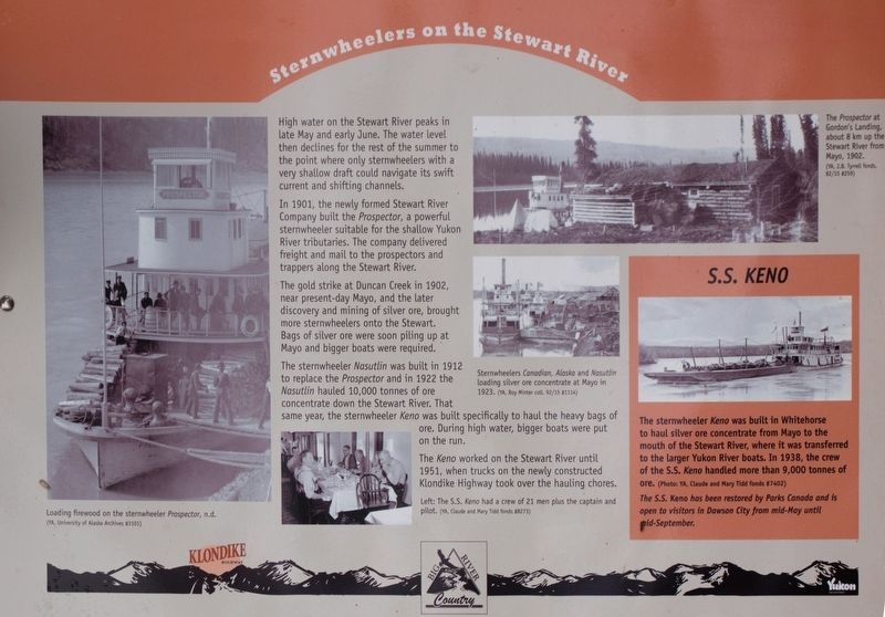
Sternwheelers on the Stewart River
In 1901, the newly formed Stewart River Company built the Prospector, a powerful sternwheeler suitable for the shallow Yukon River tributaries. The company delivered freight and mail to the prospectors and trappers along the Stewart River.
The gold strike in 1902, near present-day Mayo, and the later discovery and mining of silver ore were soon piling up at Mayo and bigger boats were required.
The sternwheeler Nasutlin was built in 1912 to replace the Prospector and in 1922 the Nasutlin hauled 10,000 tonnes of ore concentrate down the Stewart River. That same year, the sternwheeler Keno was built specifically to haul the heavy bags of ore. During high water, bigger boats were put on the run.
The Keno worked on the Stewart River until 1951, when trucks on the newly constructed Klondike Highway took over the hauling chores.
[see photo for additional caption and photo credit text]
Erected by Yukon Government.
Topics. This historical marker is listed in these topic lists: Industry & Commerce
Location. 63° 27.251′ N, 136° 56.438′ W. Marker is in Stewart Crossing, Yukon. Marker is on Klondike Highway (Provincial Highway 2 at milepost 551),, on the left when traveling west. Marker is at Km 551, in a pullout overlooking the Stewart River. Touch for map. Marker is in this post office area: Stewart Crossing YT Y0B 1M0, Canada. Touch for directions.
Additional keywords. mining
Credits. This page was last revised on February 21, 2018. It was originally submitted on September 29, 2017, by Christopher Earle of Olympia, Washington. This page has been viewed 234 times since then and 7 times this year. Photo 1. submitted on September 29, 2017, by Christopher Earle of Olympia, Washington. • Andrew Ruppenstein was the editor who published this page.
Editor’s want-list for this marker. Wide shot of the marker and its surroundings. • Can you help?
